Viking Way ban after motorcycles 'damage' trail

Sections of the route had suffered "significant surface deterioration" in recent years due to "recreational" motor vehicle use, officials said
- Published
Damage to parts of a long-distance trail – allegedly caused by 4x4s and motorcycles – has prompted a council to impose vehicle restrictions.
Lincolnshire County Council voted unanimously in favour of introducing a traffic regulation order (TRO) at a meeting on Monday.
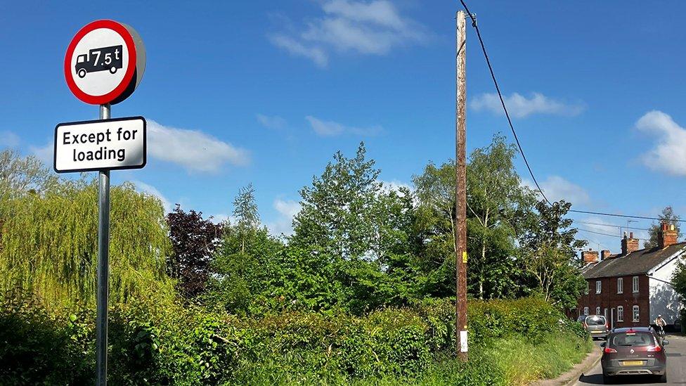
It will restrict motor vehicle access to parts of Sewstern Lane and The Drift, near Grantham, which form part of the Viking Way.
The move would prevent further damage and help to protect the environment, officials said.
'Significant deterioration'
The Viking Way, external, which opened in 1976, is a 149-mile walking route through Lincolnshire, Leicestershire and Rutland.
Councillor Richard Davies, executive member for highways at the authority, said: “As key parts of the Viking Way long-distance walking route, these unsurfaced public highways are of both cultural and environmental importance.
The lanes were "vital recreational areas" for walkers, cyclists, horse riders, and local communities, he added.
However, parts of the route had suffered "significant surface deterioration" in recent years due to "recreational" use of motor vehicles – particularly 4x4s and motorcycles.
“The resulting ruts – some up to a metre deep – have rendered sections of these roads impassable for pedestrians and other non-motorised users, especially during the wet winter months," Mr Davies said.
The proposals attracted more than 50 objections.
Some suggested the damage was most likely caused by agricultural vehicles, while others said the restrictions would disadvantage motor users and their enjoyment of the countryside.
However, Councillor Ian Fleetwood, who chairs the planning committee, said the measures would protect the historic paths for future generations.
He said the decision had been widely supported by local residents, walking groups and environmental organisations.
The four sections covered by the order are:
Thackson’s Well Farm at Long Bennington southwards to the A52 west of Sedgebrook village
Mill Farm in the parish of Sedgebrook to Woolsthorpe Lane near Stenwith
Saltby Airfield to Sproxton Road to the west of Skillington
Sproxton Road to Buckminster Lane to the west of Skillington
Access for essential maintenance, agricultural and emergency vehicles would be maintained, the authority said.
Follow BBC Lincolnshire on Facebook, X (formerly Twitter), external, and Instagram. Send your story ideas to eastyorkslincs.news@bbc.co.uk, external
Related topics
- Published27 May 2023
- Published4 June 2024
- Published15 July 2024