'Threatening' cloud spotted on horizon explained

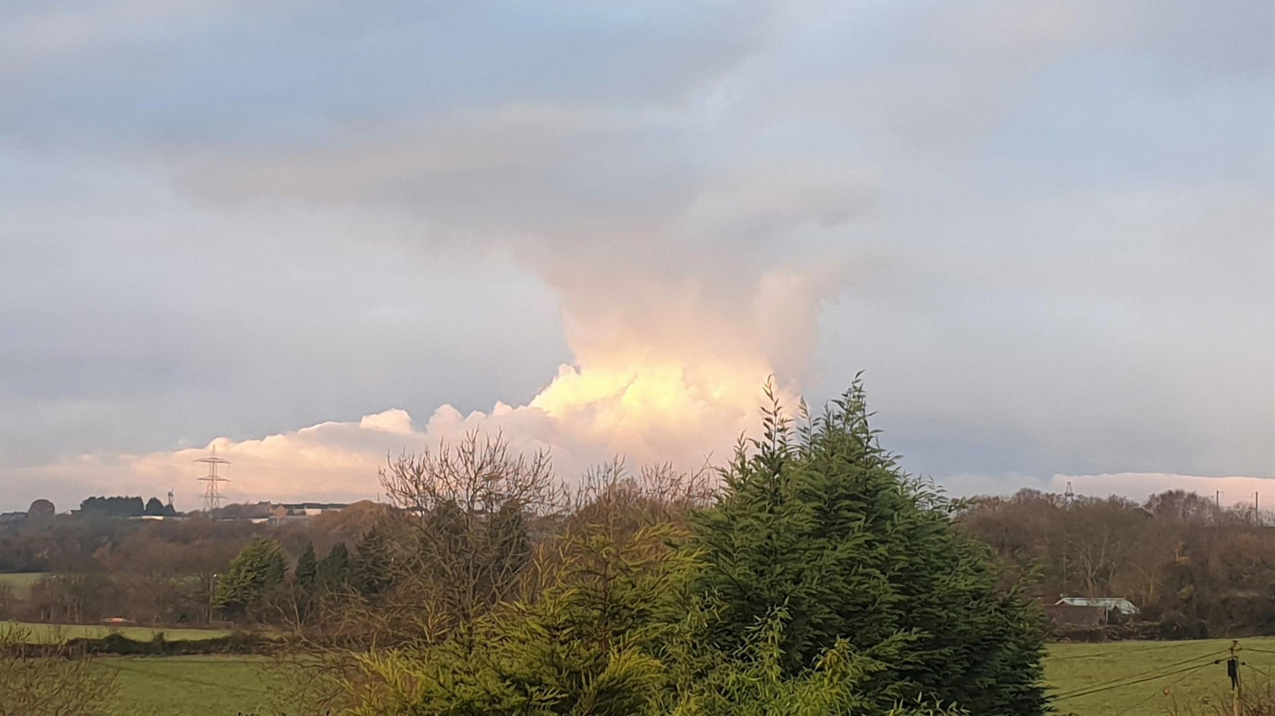
This dramatic cloud was photographed by BBC Weather Watcher Heidi-Eye from Winterbourne, South Gloucestershire, on Tuesday morning
- Published
Photographs taken by BBC Weather Watchers of a threatening-looking cloud looming on the horizon have prompted curiosity as to what might have caused it.
Tuesday has given a dramatic view of this phenomenon, which is one familiar to local people during calmer, colder days of autumn and winter especially, and always rooted above the very same spot.
It's a towering mass of cloud, rising skyward as if associated with a thunderstorm, or huge fire, or indeed something else of more sinister nature.
But the real cause is far more benign.

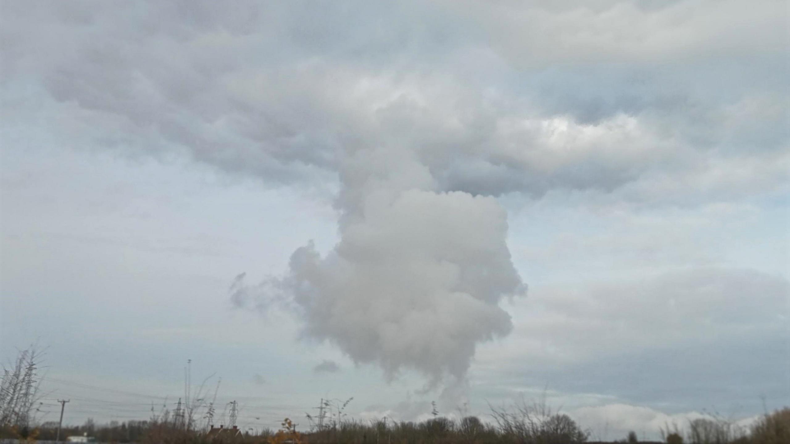
BBC Weather Watcher Hanley Bear took this shot from Hallen, South Gloucestershire, on Tuesday morning. Note how the cloud reaches at certain height, then flattens
It is a question regularly asked of me at this time of the year and the answer is that this cloud formation in entirely anthropogenic, in other words it is effectively man-made.
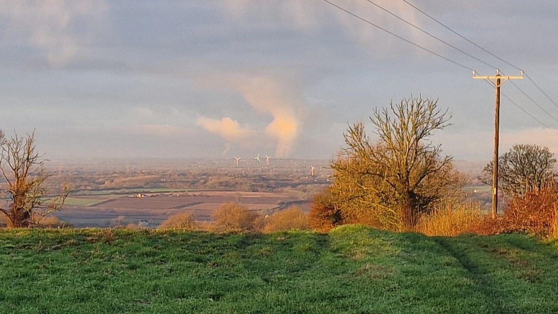
Often visible from dozens of miles away under clear, calm conditions, it forms directly above the industrial complex of Avonmouth, on Bristol's shoreline of the mouth of the River Severn.
But why?
Rising warm, moist air from outflow stacks and chimneys at Avonmouth soars up into the cold air above.
In doing so, it readily condenses and forms a plume of cloud - this sometimes towering up to a considerable size and height.
This happens generally under conditions of calmer, colder weather, as a ridge of high pressure, external establishes temporarily across us.
Usually, the plume of warm air would continue rising higher into the ever-colder atmosphere above. But that's not the case on Tuesday.

Weather Watcher Rispo's shot, looking towards Bristol from Hawkesbury Upton shows the 'Avonmouth Plume' on the horizon
Instead, the cloud reaches a point (at about 6,000ft in this case) where the air actually starts to both suddenly warm and dry out - meteorologists call this a temperature inversion, external.
Photos of Tuesday's 'Avonmouth Plume' clearly show how the cloud reaches a certain height but then flattens-out - a clear sign of an inversion 'capping' its upward growth.
Under high pressure in winter, these inversions are a common feature and the reason, for example, why fog sometimes gets locked in and can persist without ever rising and clearing.
In particularly cold weather and very specific conditions, these types of man-made clouds can even deliver very light snow, as used to be noticed from the Didcot Power Station, external in Oxfordshire.
It will be interesting to see if we get further spectacular examples of the 'Avonmouth Plume' over the coming weeks of winter.
Get in touch
Tell us which stories we should cover in Bristol
Follow BBC Bristol on Facebook, external, X, external and Instagram, external. Send your story ideas to us on email or via WhatsApp on 0800 313 4630.
More weather explainers
- Attribution
- Published29 November 2024

- Attribution
- Published2 December 2024

- Attribution
- Published29 July 2024

Related internet links
- Attribution