New detailed images of island available to view

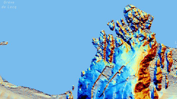
The colours and the 3D parts of the photo are artificially added by a mapping program using different angles of ‘sunlight’ to show lumps and bumps in the ground
At a glance
Images are now available which show maps of Jersey in detail previously unavailable
The images can be viewed on Jersey's historic environment's newly-relaunched website
A spokesperson for Jersey Heritage said the photos "detect small changes in the ground surface"
- Published
New images of Jersey showing the landscape in increased detail are now available to view and research for free.
Light detection and ranging (LiDAR) is a remote sensing method of looking at the landscape of the island and creates a 3D image of the nearby environment.
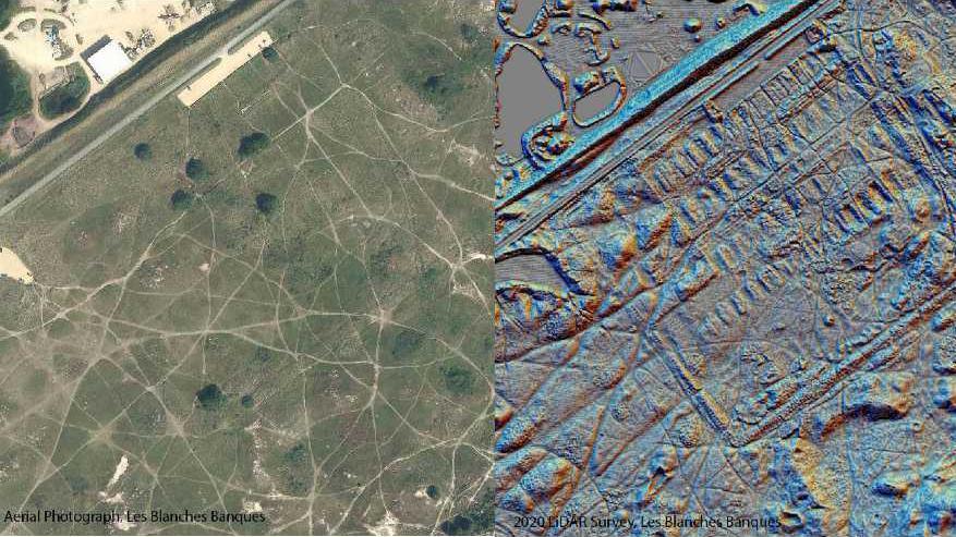
One of the maps shows the site of a World War One camp erected at Blanches Banques for German prisoners of war, with the LiDAR image showing much more detail than a standard aerial photo.
Jersey Heritage's Susan Freebrey said it is an important step as it gives "extra information about monuments without having to dig them up".

The photo on the left shows the site of the camp at Blaches Banques, and the image on the right is shown using LiDAR.
Susan Freebrey, of Jersey Heritage, said: "Looking at the aerial photo you can just about make out a few of the remains of the camp and we can compare that with photos as it is a ‘modern’ site.
"However the LiDAR shows much more of the site showing many, if not all, of the buildings."
She added: "The LiDAR is important as it’s a non invasive tool that can reveal new heritage sites and add extra detail to existing heritage sites.
"This means we can get important extra information about monuments without having to dig them up which, though recorded in detail, would destroy them."
A spokesperson for Jersey Heritage said: "LiDAR doesn’t look underneath the ground, so it doesn’t show where there are coin hoards or any other buried artefacts, and it can’t see through water.
"However, it does detect small changes in the ground surface and the 3D representation of Jersey created by our survey shows all sorts of things that you wouldn’t be able to see if you were outside just looking at a field."
Follow BBC Jersey on Twitter, external and Facebook, external. Send your story ideas to channel.islands@bbc.co.uk, external.