Low-flying plane returns to Cornwall for surveys

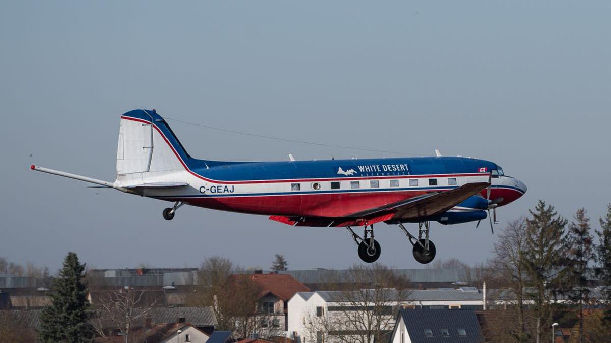
The company said it had returned to the area to complete work that was started in 2021
- Published
A low-flying plane will be starting survey work over Cornwall this month.
Bell Geospace, an Edinburgh-based airborne geophysical surveying company, is collecting information to create geological maps.
The company said it had returned to the area to complete work started in 2021.
It said the flights would take place during daylight hours, with take-offs from Cornwall Airport Newquay "just after sunrise".
'Passive technique'
The Basler BT-67 aircraft being used for the survey, which looks similar to a DC3 or Dakota aircraft, has two propeller engines and "a strong track record of reliability", Bell Geospace said.
It added: "The survey will involve a plane flying in straight lines at an average height of 200m (656ft) to collect geophysical information on the properties of rocks below the ground.
"The information being collected creates geological maps. These maps may be used for planning geothermal resources in the area or by domestic mining companies tasked with future-proofing the supply of critical minerals needed to build net-zero economies."
The information gathered may be used to evaluate the geothermal energy and lithium potential in the Cornwall area, those involved in the project said.
The company estimated the survey would take two to three weeks to complete, with about eight days of flying.
The sensitive measuring equipment in the aircraft was a "totally passive technique which does not involved sending out any signals or soundwaves," it added.
It said flights typically lasted four to five hours and parishes, farms and equine centres in the fly zone would be notified.
Follow BBC Cornwall on X, external, Facebook, external and Instagram, external. Send your story ideas to spotlight@bbc.co.uk, external.
- Published18 December 2021

- Published18 October 2024

- Published7 October 2024

- Published7 October 2024
