Flood warnings in parts of England as rain relents

People wade through floodwater surrounding mobile homes in Cogenhoe, Northamptonshire, after the River Nene burst its banks
- Published
Flooding caused by heavy downpours and thunderstorms has continued to cause disruption across parts of central and southern England.
While Tuesday did not bring any further rain, some schools and roads have remained closed.
On Tuesday evening there were more than 20 flood warnings, meaning flooding is expected, and more than 50 flood alerts, meaning flooding is possible, in place from the Environment Agency.
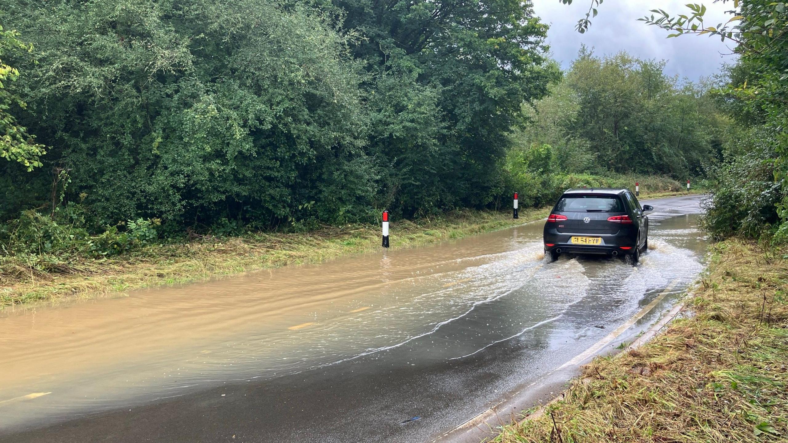
Some areas experienced more than a month's worth of rain in a matter of hours over the weekend and Monday. A yellow weather warning for rain on Thursday in northern parts of England has also been issued.
Watch: A421 submerged by flood water in Bedfordshire
Areas affected include parts of Northampton, Somerset, Buckinghamshire, and Worcestershire stretching down to Newport just across the border with Wales.
The Environment Agency also said it was closely monitoring river levels.
The River Nene in Northampton burst its banks, while areas surrounding the River Great Ouse, in Cambridgeshire, have also been largely affected.
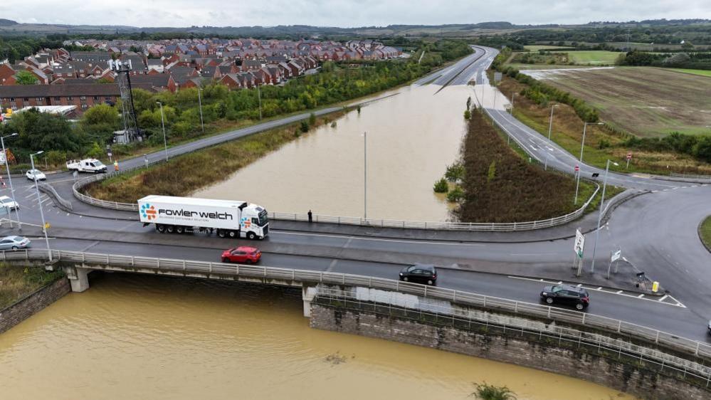
Flooding in Bedfordshire is among the most severe and the A421 road remains closed with no timescale for its reopening. Local people have dubbed the road "Bedfordshire's new river."
One lane of the A5 at Milton Keynes was also closed.
BBC Weather's Matt Taylor said "the good news" is that the worst of the rainfall is now over, but "the impacts of the recent torrential rain will continue to be felt for a while yet".
He said given the amount of rainfall, it will take a while for some of that to soak into the ground and work through the river system, meaning "some areas could see rivers continue to rise over the next couple of days".
Wimbledon pump 100,000 litres of water from ground
- Attribution
- Published24 September 2024
Parts of Bedfordshire, Oxfordshire, Warwickshire and Northamptonshire saw more than 100mm of rain (4 ins) in the last 48 hours with Woburn in Bedfordshire seeing 132mm (5.2 ins) recorded.
After the River Nene burst its banks, the Cogenhoe Mill Holiday Park in Northamptonshire was submerged, with murky brown water coming up to knee-level.
On the river, people on boats were rescued by the fire service.
Saphire Blurton, 32, and Lee Mills, 53, moved into a boat on Monday, and were awoken by emergency services after rising water levels.
"[It was] a bit ironic being rescued from a boat to a boat but it was OK", Mr Mills said, adding the fire service "were really on it" because a number of boats had already sunk that morning.
Disruption to train services has now ended between Rugby and Milton Keynes Central due to earlier flooding, Avanti West Coast trains has told passengers.

People are calling the flooding on the A421 in Bedfordshire, a river

Flooding in Bedfordshire is among the most severe and the A421 road remains closed with no timescale for its reopening
Train services in Kent and Sussex are still facing disruption as Network Rail engineers were unable to complete full repairs to part of the signalling system following flooding on the line.
Chiltern Railways said trains between Banbury and Bicester North were expected to run at reduced speed on all lines until the end of Tuesday due to heavy rain flooding the railway.
BBC Weather said Tuesday and early Wednesday will be much drier, with sunny spells, before another area of rain sweeps across the country later on Wednesday and into Thursday.
A yellow weather warning for rain on Thursday is in place across parts of northern England and the north Midlands. The heaviest rainfall is likely to be across the Pennines and North York Moors.

A drone captured fields submerged in water near Bicester

A yellow weather warning for rain over the weekend in Staffordshire left a field in Kings Bromley flooded
These downpours are not expected "to be as impactful as recent rain", then much cooler weather "will grab the attention of most of us later in the week, as northerly winds drop the temperature more widely across the UK."
Highs of around 16C are forecast for southern England.
"As the system that we have had moves its way off towards the east, we start to get a bit more of a northerly flow so we're bringing in those cooler northerly winds," the Met Office said.
A gradual decline in temperatures will continue through Wednesday and Thursday but it is unlikely any frost will develop with plenty of cloud around.
Get in touch
How is the weather affecting you today?
Related topics
- Published23 September 2024
- Published23 September 2024
- Published23 September 2024