Equipment to be installed to monitor landslip

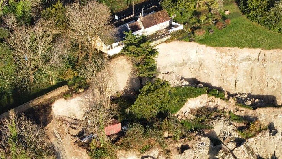
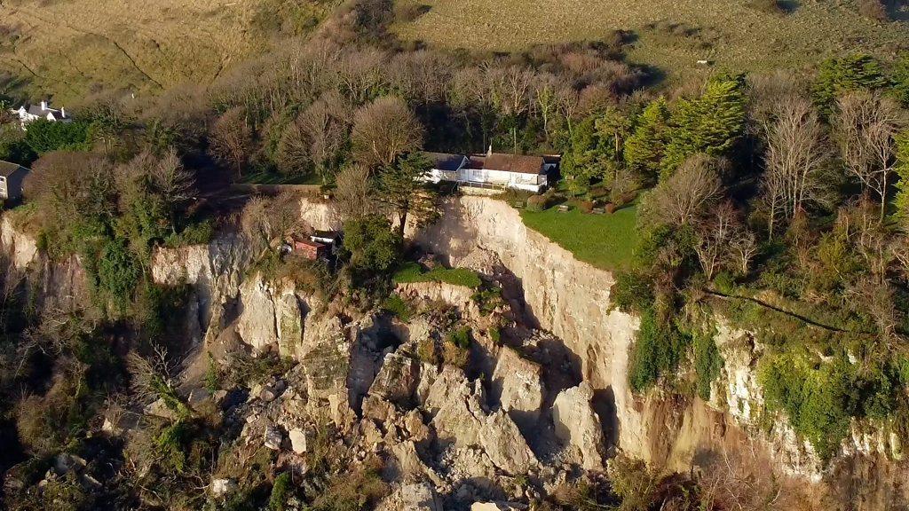
Huge chunks of the cliffs came away in a landslip at Ventnor on 10 December
- Published
Specialist equipment will be installed to monitor land movement in an area near a major landslip.
Isle of Wight Council are preparing to install the devices next week around Leeson Road after part of the cliff collapsed in December 2023.
It includes three extensometers to measure and record changes to visible cracking, 22 tiltmeters to record lateral ground movement and three global navigation satellite sensors which monitor vertical and horizontal land movement.
Natasha Dix, service director for waste, environment and planning said we need to “understand more about the risk of further movement.”
Leeson Road, the A3055 between Shanklin to Ventnor, has remained closed since the landslip in December which forced residents to leave 20 properties.
16 hectares - 14 million cubic metres of land was displaced in what was one of the largest landslides recorded on the South Coast of England.
Ms Dix told residents at the public meeting in Ventnor last month, “because of the catastrophic nature of the landslip and the ongoing heavy and prolonged rainfall, we need to understand more about the risk of further movement before we can make an informed decision.”
She continued: “This equipment will be a crucial part of that process. While we cannot second-guess what that data will be, we can assure the community that we will continue to keep residents and businesses informed along the way.”
The equipment can be installed – subject to no further movement, favourable weather and necessary permissions have been given as the equipment will be on private land.
The type of equipment as well as the locations where it will be placed has been decided in consultation with industry experts.
Follow BBC South on Facebook, external, X (Twitter), external, or Instagram, external. Send your story ideas to south.newsonline@bbc.co.uk, external or via WhatsApp on 0808 100 2240, external.
Related topics
- Published1 March 2024
- Published11 December 2023