Eroding riverside road to be strengthened

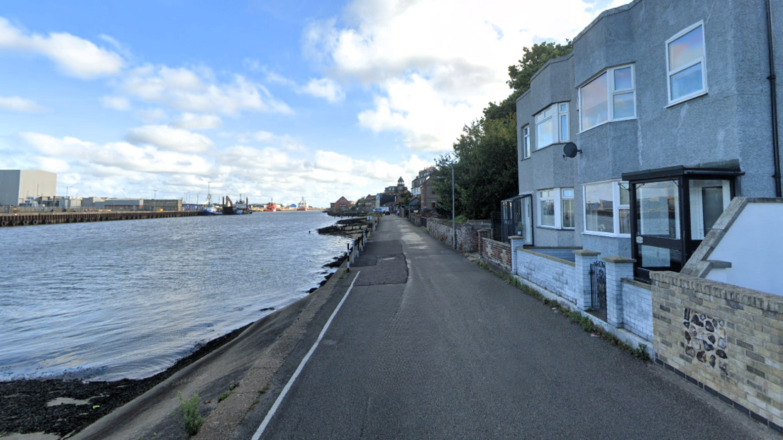
The work will extend along Riverside Road, just south of the Fishermen's Quay slipway
- Published
A vulnerable section of road that has partially collapsed next to a waterway is to be strengthened in a £1.3m project to build a new river wall.
Part of Riverside Road in Gorleston-on-Sea was closed to traffic in 2020 after erosion undermined part of the surface and it reopened after temporary repairs by Norfolk County Council.
Sheet piling will be installed one metre out into the River Yare from the existing wall along a 140-metre (155 yards) section of the embankment, which will allow the road to be widened.
When meeting Graham Plant, council portfolio holder for transport and infrastructure, our reporter discovered a sinkhole which the councillor then reported to the highways team.
"They need to come and put a cone around it or find out exactly what the depth of the hole is and how far back it goes. It's an emergency hole that's going to have to be repaired," said Plant.

Graham Plant said the £1.3m investment would end decades of "patching and fixing" Riverside Road
The planning documents, external give no detail of the duration of embankment repairs but Plant said the work would start in January.
He thanked local people in advance for their patience during diversions saying it was impossible to say how long the project would take owing to a series of unknown issues beneath the road surface.
A capping beam and hand rail would create a physical barrier between the road and river, replacing vertical steel poles that currently mark the hazard.

In July 2020, temporary measures were put in place, including concrete cylinders filled with ballast to shore up the man-made river bank

By October 2025, those same concrete pipe sections are empty as tides have washed the material out of the cylinders
Plant added that the road was "going to collapse and we don't want that to happen".
"You can see all the houses that depend on the road and it's really important we spend this money and make it right. Historically we've spent a lot of time patching and trying to make it good and safe," he said.
"Now we've finally got the money to do it."

Our reporter discovered a small hole in the road, about the size of a fist, but closer inspection showed there is little material underneath to support a wider area of the road surface, creating a danger to road users

The hole was 12in (30cm) deep and a larger area had been hollowed out inside by the water
Describing the narrowness of the road as a game of "chicken" where cars risk hitting a wall or going into the water, Plant said the fix would address that issue through widening.
"Passing another car on this road, you're frightened to do so," he said.
"But what we want to do is change that... and make it wider, so it's going to be easier for traffic to pass each other."

A cone had been placed over the sinkhole and the road was still open to traffic in October 2025
Get in touch
Do you have a story suggestion for Norfolk?
Follow Norfolk news on BBC Sounds, Facebook, external, Instagram, external and X, external.
Related topics
More stories of interest
- Published9 December 2024
- Published22 September