Landslide coal tip noted as concern months before
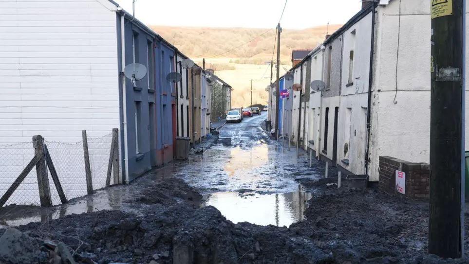
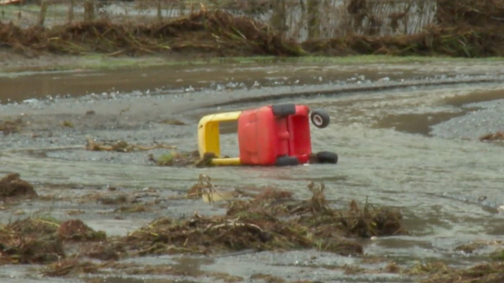
This is how Woodland Terrace in Cwmtillery looked after the coal tip landslide
- Published
A former coal tip which collapsed and forced families to evacuate their homes in November had been designated as a potential problem earlier this year, it has been revealed.
An inspection report for the Cwmtillery tip in Blaenau Gwent - a Category D site with the highest potential impact to public safety - had found several "features causing concern" in August.
Late last month residents in the village saw a landslide of deep slurry and debris running down its streets after torrential rain during Storm Bert.
Blaenau Gwent Council, who own the tip and are responsible for its maintenance, said mitigation measures had been introduced and the drainage system was working well.
River of boulders and trees from collapsed coal tip
- Published25 November 2024
'I could have lost my grandchildren in landslide'
- Published25 November 2024
About 40 homes were evacuated late on 24 November following a landslide at the disused coal tip, with residents told they could return to their houses by the council five days later.
The council has since said the slip was caused by a water issue - or spring - which had developed during Storm Bert and had saturated an area of the tip, dislodging material and sending it towards the homes below.
It said that the "immediate risk" had been removed following works after the slip, but that the tip would be inspected twice daily during heavy rainfall.
A twice-yearly inspection was carried out at the Cwmtillery tip by the Mining Remediation Authority - formerly the Coal Authority - in August, on behalf of the Welsh government which highlighted no major issues.
Its report, seen by the BBC, highlighted "saturated ground associated with minor seepages located on the upper tip plateau", along with "distortion of juvenile trees along the lower south west facing flank" which was identified as a "potential indicator of shallow creep".
However, the inspection also found that was "a longstanding feature of the site" and that "no evidence of recent ground movement" had been observed.
In addition, fly tipped waste had been found "within close proximity to the large diameter culvert close at the north western section of the lower tip plateau".
Aerial footage shows extent of damage caused by Cwmtillery coal tip slide
The report also stated that the examination was carried out "without the benefit of a detailed site plan", whilst certain areas were overgrown to the extent that visual inspection was not possible.
Regarding drainage, the report found there were no new changes, other than a new "clean stone land drain located along the crest of the lower lateau".
The report did not identify changes in the structures within the body of the tip and there were no changes to seepage within.
However there were changes to seepage "above the tip", the report stating a "minor, ochreous seepage located adjacent to the flow path of issues which enter the site from just off the eastern perimeter where minor saturation [was] observed".
The report also identified changes in surface erosion, "the previously bare lower tip plateau" having "re-vegetated well since prior maintenance works", along with minor excavation works from "a series of small bike ramps having been constructed adjacent to the concrete canvas channel along its rear".
Blaenau Gwent Council confirmed the landslip was a "singular wash-out of a former coal tip in the area".
A spokesperson added that "mitigation measures for the seepage introduced earlier in the year", along with "an enhanced drainage system" were "working well".
The council said that the minor seepage referred to in the report was from the main section of the tip and not the section of the tip where the landslide occurred - which was at the edge of a separate section.
They added that the fly tipping problem had been addressed, with stones put in place to stop off-roaders from accessing the site and the rubbish removed.
Responding to overgrown vegetation hampering inspection, the council said this was a "disclaimer" put in the majority of inspection reports and reflected most coal tips lack of records, along with the fact many are wooded to the degree that access can be limited.
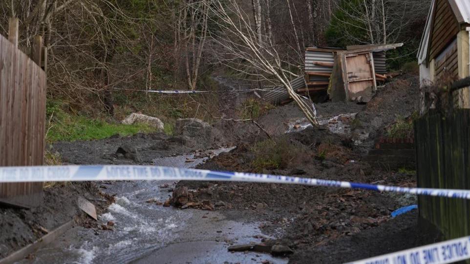
The council said the site would continue to be closely monitored
With severe weather warnings in place, the council confirmed that it would continue "to monitor the site closely".
The Mining Remediation Authority have also agreed to inspect the site weekly, the council added.
The council said that reprofiling works had taken place following the landslip with the slopes being covered by geojute matting.
The council added it was seeking "an independent assessment into the work carried out so far to provide further reassurance" and would be working with the Welsh government to access additional funding "to secure the long-term stability of the tip" to protect communities.
The Welsh government had previously said it was "fully committed to ensuring our coal tip communities are safe, both now and in the future".
"The highest risk coal tips (category C and D) are regularly inspected by the Coal Authority and we will continue to work with our statutory partners throughout Wales to inspect and evaluate the highest rates tips in Wales."
Related topics
- Published25 November 2024
- Published25 November 2024
- Published24 November 2024
