Wednesday on BBC Verify Livepublished at 17:48 BST 25 June
 Anthony Reuben
BBC Verify senior journalist
That’s almost it for BBC Verify Live but there’s plenty more to come from the team.
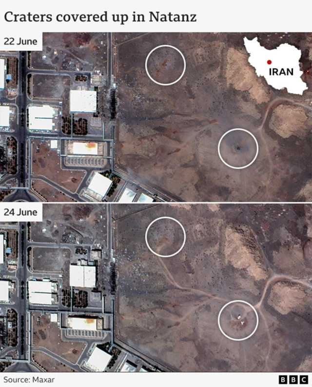
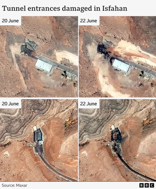
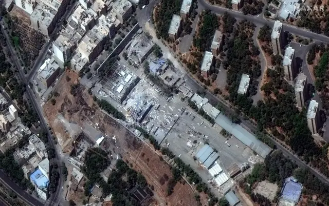
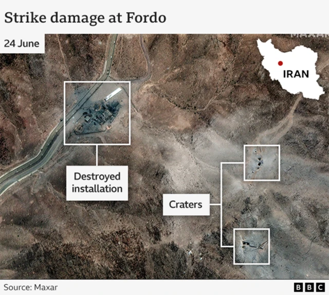
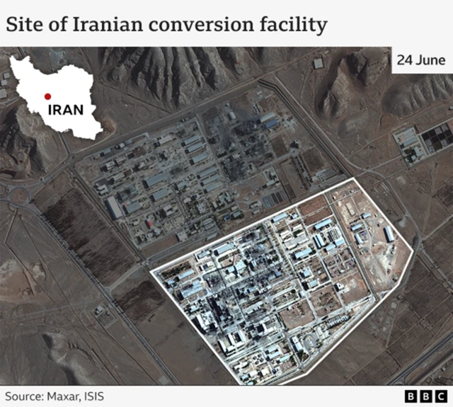
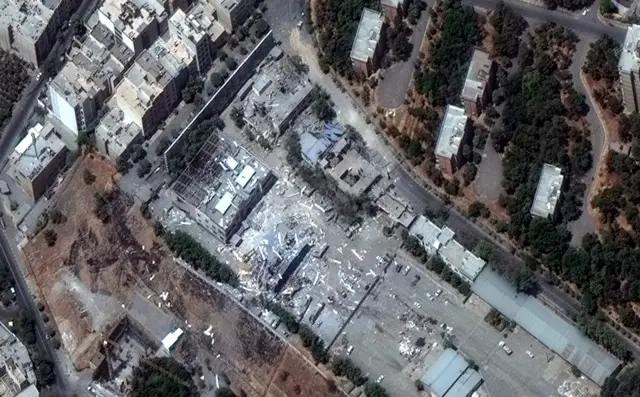
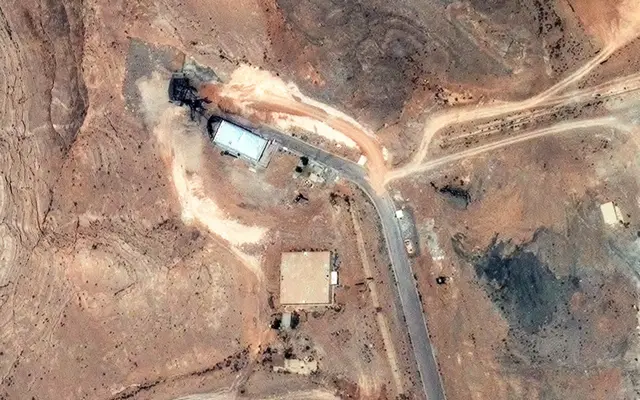
We’ve spent much of the day analysing and assessing satellite images showing damage to three of Iran’s main nuclear sites following Israeli and US air raids.
We’ve put all the images - and what we’ve learned from them - into one piece which you can read here.
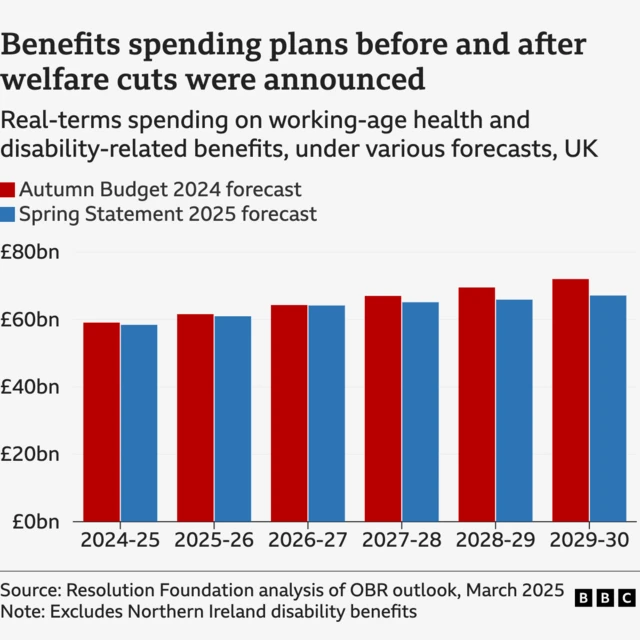
We’ll also be keeping an eye on the growing rebellion among Labour MPs over UK welfare spending - which we’ve also been looking at here on the live page.
You can always get in touch with us by filling out our contact form and you can catch up with our videos, investigations and fact-checks here.