Adventures in No Man's Land
- Published
What exactly is No Man's Land? It may be the space on a battlefield between two opposing front lines, a buffer zone between two countries or a parcel of land unclaimed and ungoverned by local authorities. The notion has never been fully defined so two men are travelling across Europe to a puzzling area on the Egypt-Sudan border in order to understand it better.
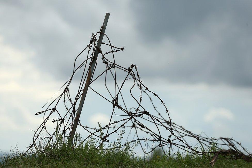
The term "No Man's Land" may conjure up images of shell-holed battlefields, mud, barbed wire and shredded tree trunks, but it goes back much further than the trenches of World War One.
"I think people fail to realise that the term 'No Man's Land' has a 1,000-year history," says Alasdair Pinkerton, an expert in human geography at the Royal Holloway University of London.
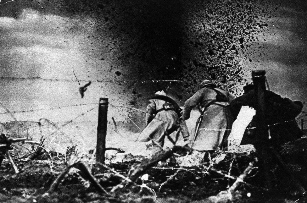
French soldiers attack across No Man's Land during Word War One

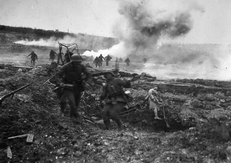
German soldiers advance across No Man's Land during World War One
"It first appears in the Domesday Book in the late 1000s to describe parcels of land that lie just beyond the London city walls," he says. "And in the UK there are several places called No Man's Land - extra-parochial spaces that were beyond the rule of the church, beyond the rule of different fiefdoms that were handed out by the king… ribbons of land between these different regimes of power."
So when Pinkerton set off with fellow researcher Noam Leshem of Durham University on a tour of No Man's Lands across Europe to North Africa their first stop was a field in Hertfordshire in southern England called Nomansland Common. It historically fell between two church parishes, which could not decide which of them should cover it. It became a hang-out for "brigands and cattle rustlers and highway men, and indeed highway women," says Pinkerton, beyond the reach of any authority.
When somebody died on the common in the 18th Century the two parishes saw an opportunity to extend their reach, and competed to take responsibility for the corpse. But the status of the land remained unresolved until 1899, when a new law brought it under public ownership.
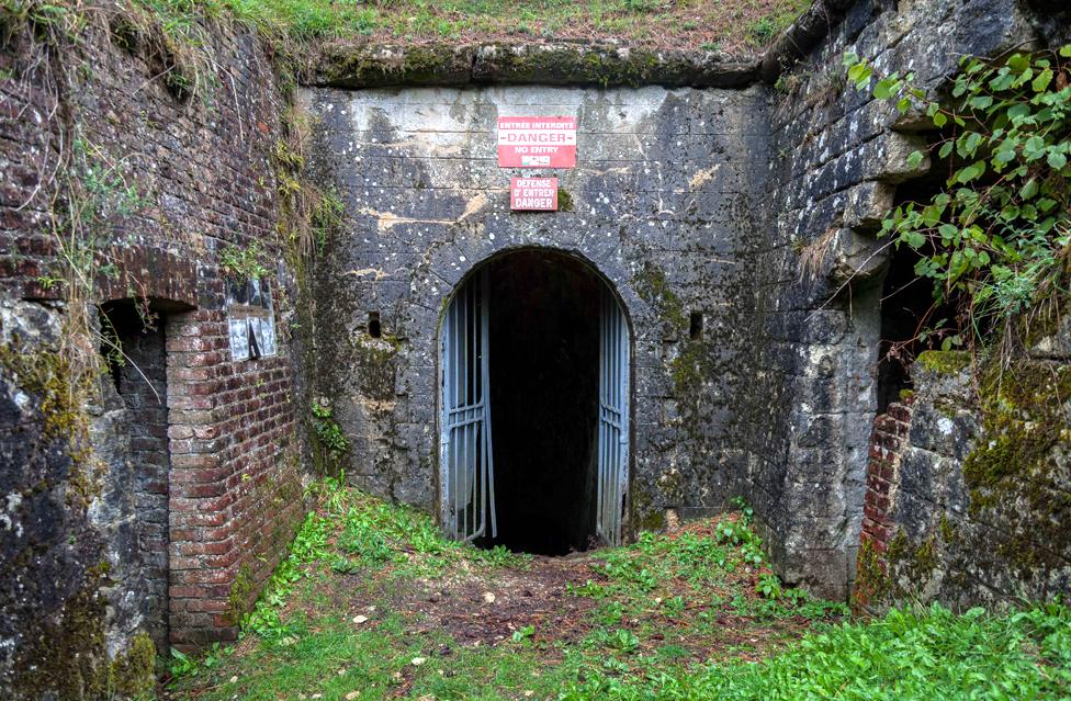
An overgrown World War One fortification in Verdun
Leshem and Pinkerton's journey to other No Man's Lands is expected to last a month and is taking them through 19 countries.
"We use the term today - at least colloquially - to refer to anywhere from derelict inner city areas to spaces between borders, and even tax havens. It's not just confined to military history," says Pinkerton. "Our interest is to explore other aspects - from the ecology of these sites, to their relationships to the vulnerability of human individuals and communities."
Leshem regards the essence of No Man's Land as "a place where there has been an intentional withdrawal of state power and sovereignty".
"At the same time that space has been delineated - there is a very clear sense of what is in it, and what is considered to be outside of it.
"So you have these two forces - on the one hand this intentional pulling back, and at the same time this setting apart."
The researchers use the words "abandonment" and "enclosure" to encapsulate these ideas, and point out that they apply logically to areas left too poisoned for human habitation by weapons testing or mining, or weapons of war.

The itinerary
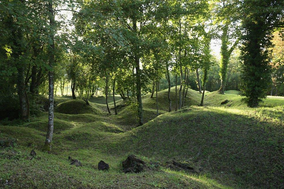
Overgrown shell craters in Verdun
September
Nomansland in Hertfordshire, Plague Burial Pit at Farringdon in London, Calais, Ypres, Verdun, Basel, Venice, Ljubljana, Sarajevo, Mitrovica, Thessaloniki, Athens, Lanoka, Kato Pyrgos and Nicosia
October
Famagusta, Cairo, Nile Valley, Aswan, Al Alaqi, Bir Tawil, Red Sea Coast

At Verdun in France, which witnessed horrific fighting during World War One, Pinkerton and Leshem visited the Zone Rouge - an area deemed too dangerous for civilians to return to.
After the war nine villages in the zone were sealed off completely - rendered death traps by unexploded ordnance, and poisoned beyond habitation by the arsenic, chlorine and phosgene the opposing armies aimed at each other.
"The area is still considered to be very poisoned," says Pinkerton, "so the French government planted an enormous forest of black pines, like a living sarcophagus." He compares the zone to the nuclear disaster site at Chernobyl, which is encased in a "concrete sarcophagus".
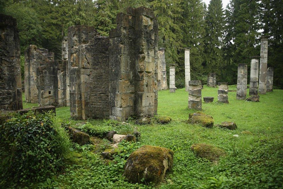
The remains Ornes village near Verdun
He points out that nature has also overtaken other prohibited areas. Like the Western Front of World War One, nuclear test sites in the United States were left so toxic that they had to be abandoned. Already fenced off to civilians, government decrees enclosed them legally too, turning vast tracts of land into wildlife reservations.
These sites could not be built on or cultivated for agriculture, resulting in a "kind of rediscovery of the Wild West", says Leshem, with the return of bison herds and birds of prey. It is a "return to a kind of natural state" through "an entirely unnatural process", says Pinkerton.
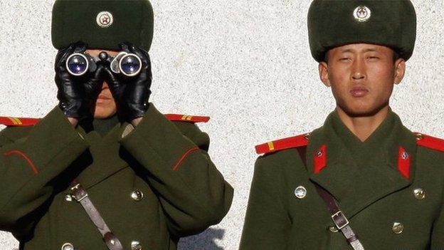
Two classic examples of No Man's Land are the demilitarised zone between North and South Korea, and the UN buffer zone that stands between the Greek and Turkish-controlled territories in Cyprus - both born of conflicts that were never entirely resolved.
Unlike the poisoned Zone Rouge of Verdun, both are still inhabited, with "peace villages" in the Korean DMZ, and working farms in the Cyprus buffer zone.


Find out more
•Alasdair Pinkerton and Noam Leshem spoke to the BBC World Service breakfast programme Newsday
•Newsday is on air Monday to Friday

Both of these buffer zones have existed for decades, but Pinkerton and Leshem also want to apply the term No Man's Land to areas temporarily, or even fleetingly, abandoned by the state.
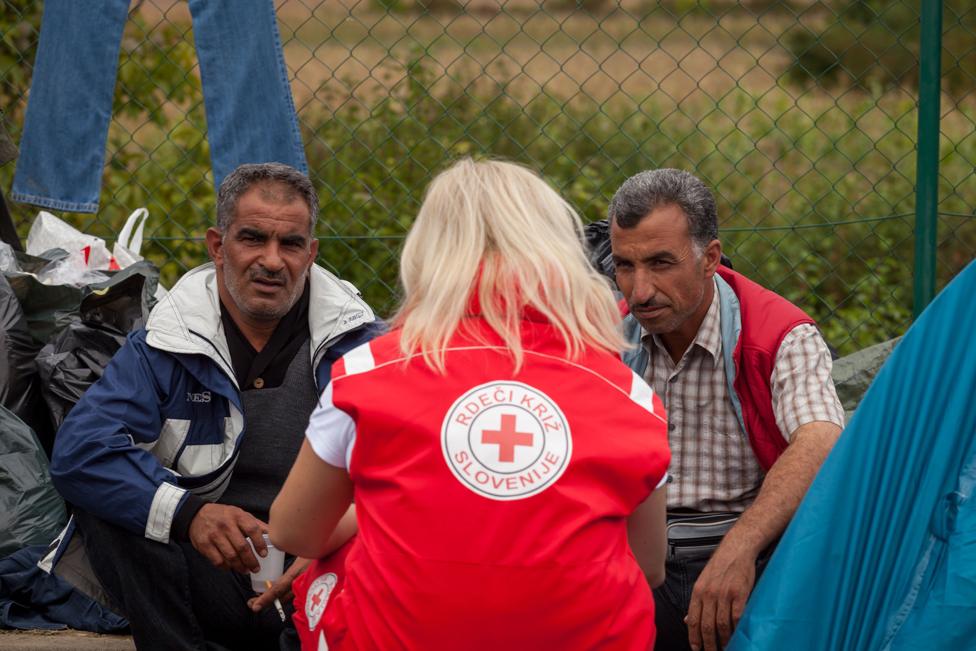
"One of the fascinating things we saw on the Slovenia-Croatia border was a zone, adjacent to the border crossing itself, that was governed by aid agencies, populated by volunteers and the media - but that was completely absent of any state bodies," says Leshem.
"The policemen and military formed a very clear line, but they didn't cross into the No Man's Land - the area that was populated by that vulnerable community.
"What we're seeing is the formation of these sites as a direct result of the abdication of responsibility by the state, and the stepping into these sites by civil society organisations."
He argues that migrants making their way across Europe face a political, legal, economic and environmental abandonment. He points to the "immense amount of rubbish" he saw at border zone gatherings of migrants. "The stench sets these places significantly apart from everything around them."

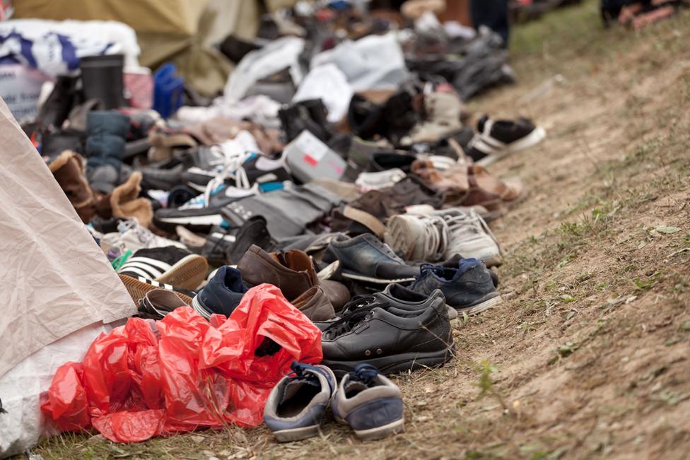
Pinkerton adds that political decisions can create sites very quickly. "Budapest railway station is a really interesting example of how suddenly a population found itself immobilised, and was forced into a pedestrian underpass," he says.
"There's a kind of legal or political abandonment taking place that manifests itself in a particular site at a particular time."
The researchers' final destination, which they aim to reach in mid-October, a month after setting off from the Royal Geographical Society in London, may well be unique.
It is a lozenge-shaped desert territory sandwiched between the borders of Egypt and Sudan, known as Bir Tawil, and once described as a "cartographic monstrosity".
Disavowed by both countries, it became a No Man's Land through an quirk of imperial geopolitics. The lines on conflicting maps drawn up by the British at the end of the 19th Century put Bir Tawil on different sides of the border, while at the same time awarding a strategically important coastal area, the Halayeb Triangle, to both countries.

Map courtesy of the Royal Geographical Society, which is supporting the project.
Both nations insisted on their ownership of Halayeb, using whichever map supported their claim. But neither document gave both territories to one of them. So to claim the coastal triangle meant they had to disavow the landlocked desert of neighbouring Bir Tawil.
This history is reflected in internet search results which return plenty of maps - along with pictures of an American girl whose father laid spurious claim to the territory last year - but only a handful of images of the place.
Although officially uninhabited, Leshem says the area is traditionally used by the nomadic Ababda people who live in the Egypt-Sudan border region.
But aside from sand, and an archaeological site marking the ancient well from which the area takes its name (Bir is Arabic for well), the researchers have little clear idea what they will find there - or what administrative hurdles they might have to negotiate to get into the area.
"This is probably the last truly unclaimed piece of land left on earth, other than maybe Antarctica," says Pinkerton. "But Antarctica is itself covered by a treaty, so there is a piece of internationally agreed legislation. That is very different to Bir Tawil."

More from the Magazine
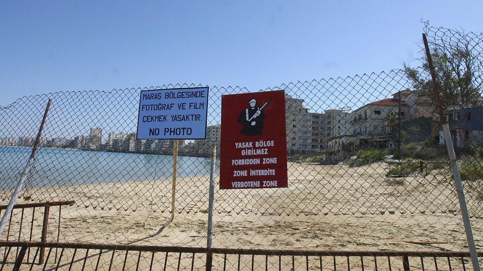
Varosha was once a booming resort in Cyprus - the rich and famous were drawn by some of the best beaches on the island.
But 40 years ago, after years of inter-ethnic violence culminating in a coup inspired by Greece's ruling military junta, Turkey invaded Cyprus and occupied the northern third of the island.
As its troops approached Varosha, a Greek-Cypriot community, the inhabitants fled, intending to return when the situation calmed down. However, the resort was fenced off by the Turkish military and has been a ghost town ever since. A UN resolution of 1984 calls for the handover of Varosha to UN control and prohibits any attempt to resettle it by anyone other than those who were forced out.

Subscribe to the BBC News Magazine's email newsletter, external to get articles sent to your inbox.