What are the UK's top areas for running and cycling?
- Published
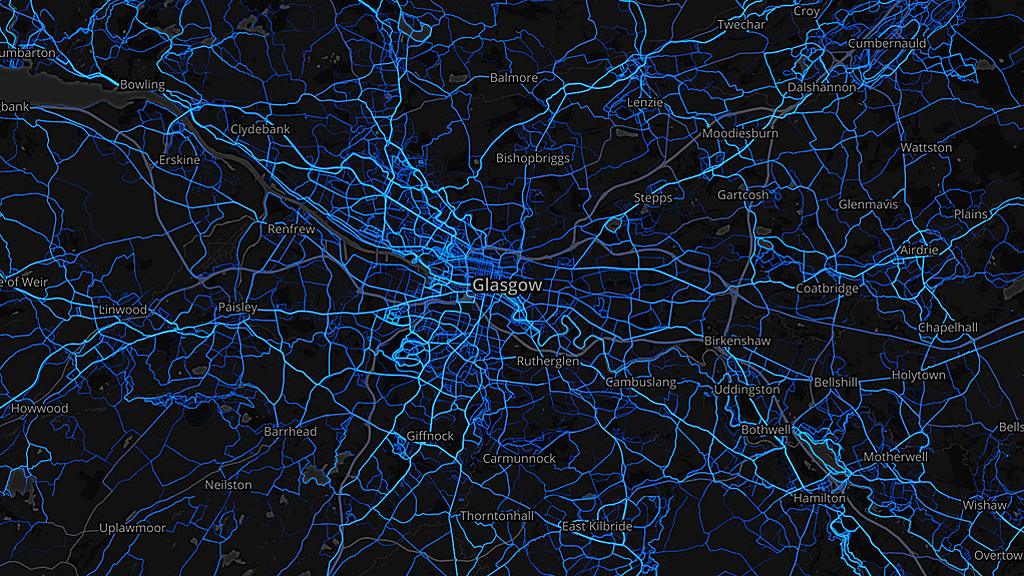
Whether on two legs or two wheels, data reveals which areas of Britain are the busiest for running and cycling. And also where the fastest, longest, hilliest and flattest journeys are made.
The blue veiny lines criss-crossing Glasgow in the image above show running routes. The thicker and brighter the line, the more popular the route.
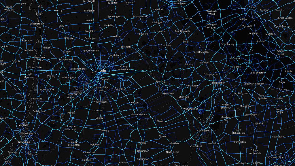
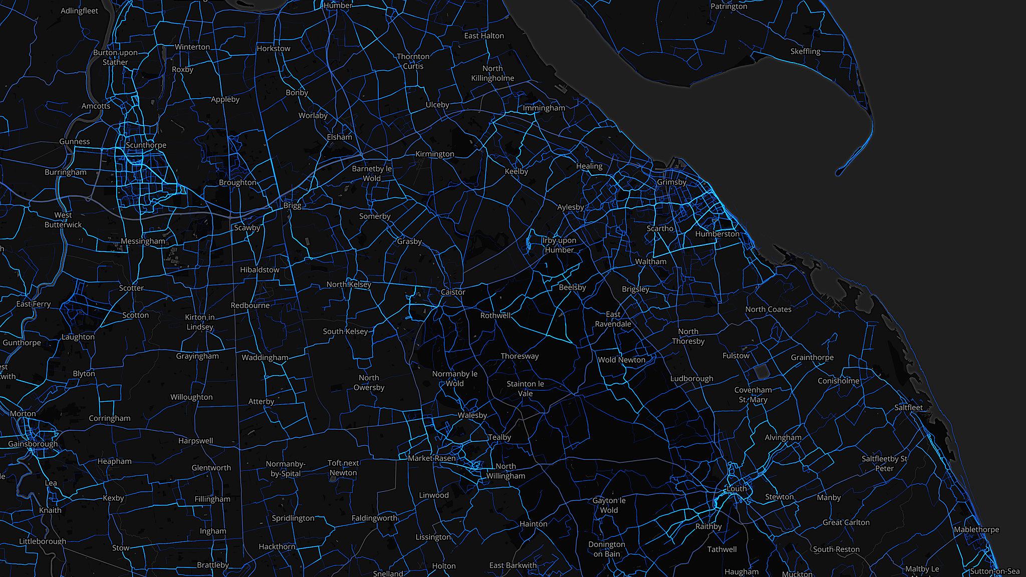
Similarly, in the image below, a network of cycle routes cut their way across part of Lincolnshire.
The colourful visualisations, called heatmaps, are from Strava - which describes itself as a social network for athletes. The data comes from Strava's End of Year Insights, external, which includes nearly 11 million runs and over 23 million cycle rides made in the UK in 2015.
Glasgow, it turns out, was the place where runners were fastest on average - with a pace per run for both men and women combined of five minutes 17 seconds per km (8:30 per mile).
Lincolnshire, with its relatively flat landscape, recorded the fastest average cycle ride speed - at 24.4km (15.16 miles) per hour.
Scroll down to see other interesting snippets of data and the top 10 areas for both running and cycling.
On phones and tablets these images are best viewed on the BBC News App - where you can tap to zoom in closer.

Across the UK, men recorded an average pace of 5:17 per km (8:30 per mile), for their average running distance of 8.4km (5.22 miles).
Women recorded a pace of 6:13 per km (10 minutes per mile), over their average 7km (4.35 mile) runs.

Powys
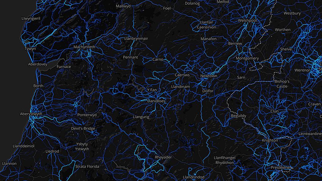
This area of mid-Wales had three running milestones in 2015.
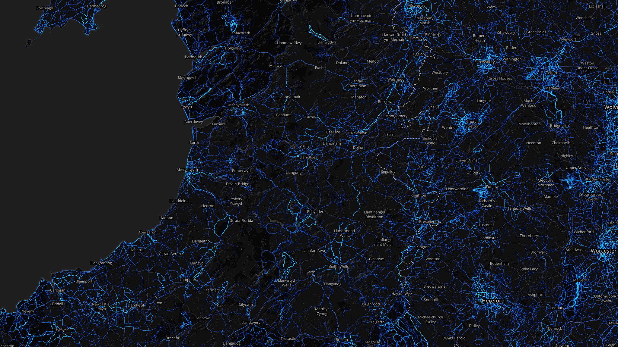
It took top spot for hilliest average run - with an average elevation of 177m (581ft).
It also came top for longest average distance and longest average time on the move - at 9.8km (6.09 miles) and 67 minutes.


North-east Lincolnshire
While Lincolnshire took flattest average cycle ride, it was North East Lincolnshire - the unitary authority based around Grimsby and Cleethorpes - which saw the flattest average runs, at just 11m (36ft) of elevation.


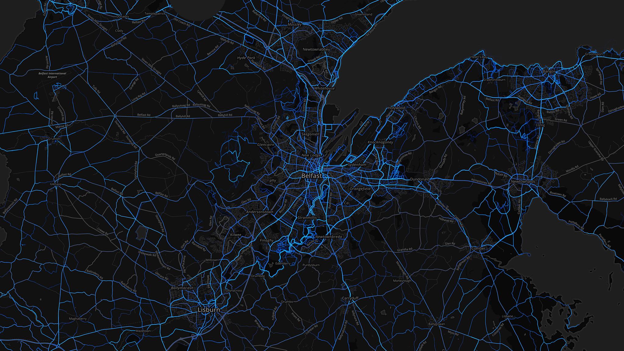
Belfast
Northern Ireland's most active region for running was Belfast - with the banks of the River Lagan, snaking south through the city, proving a popular route.


1. Greater London
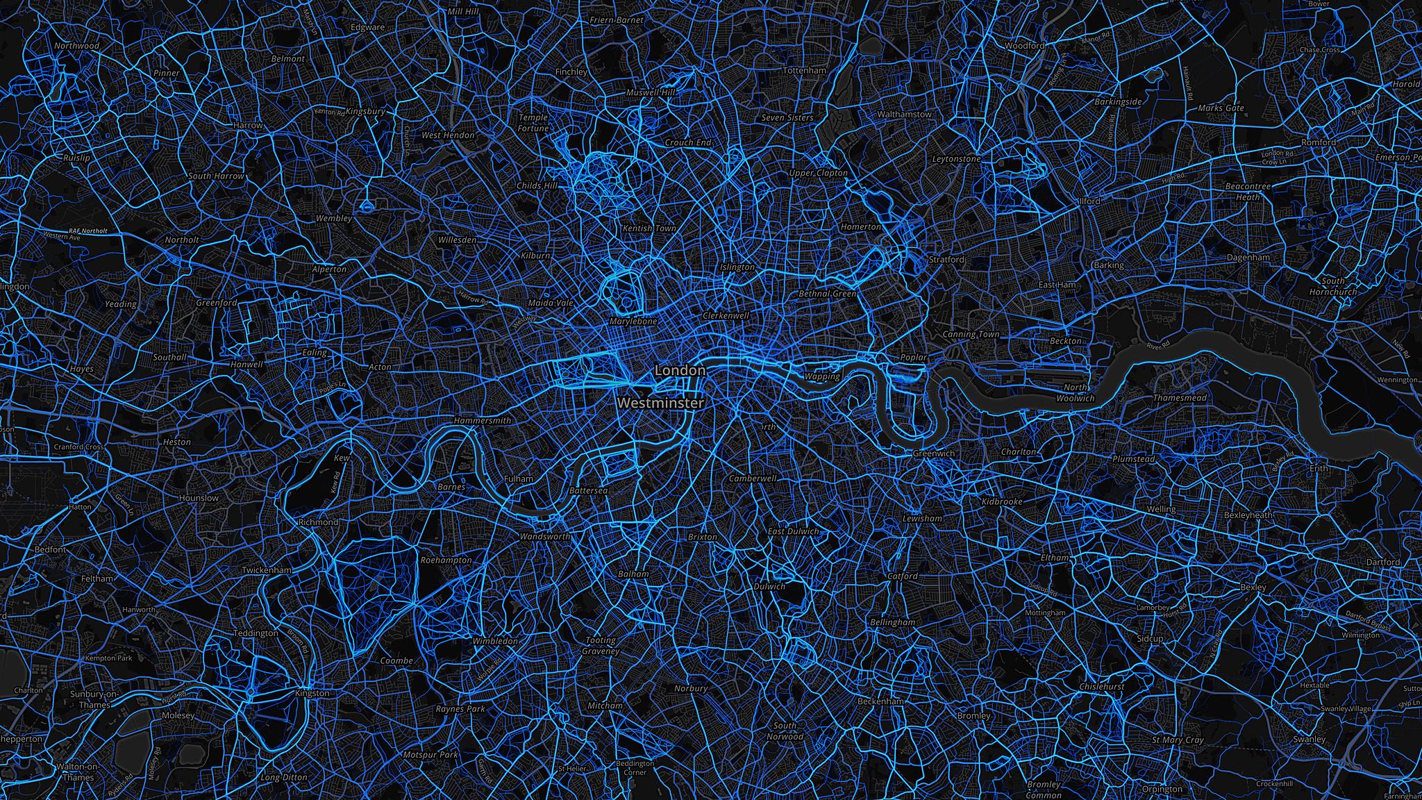
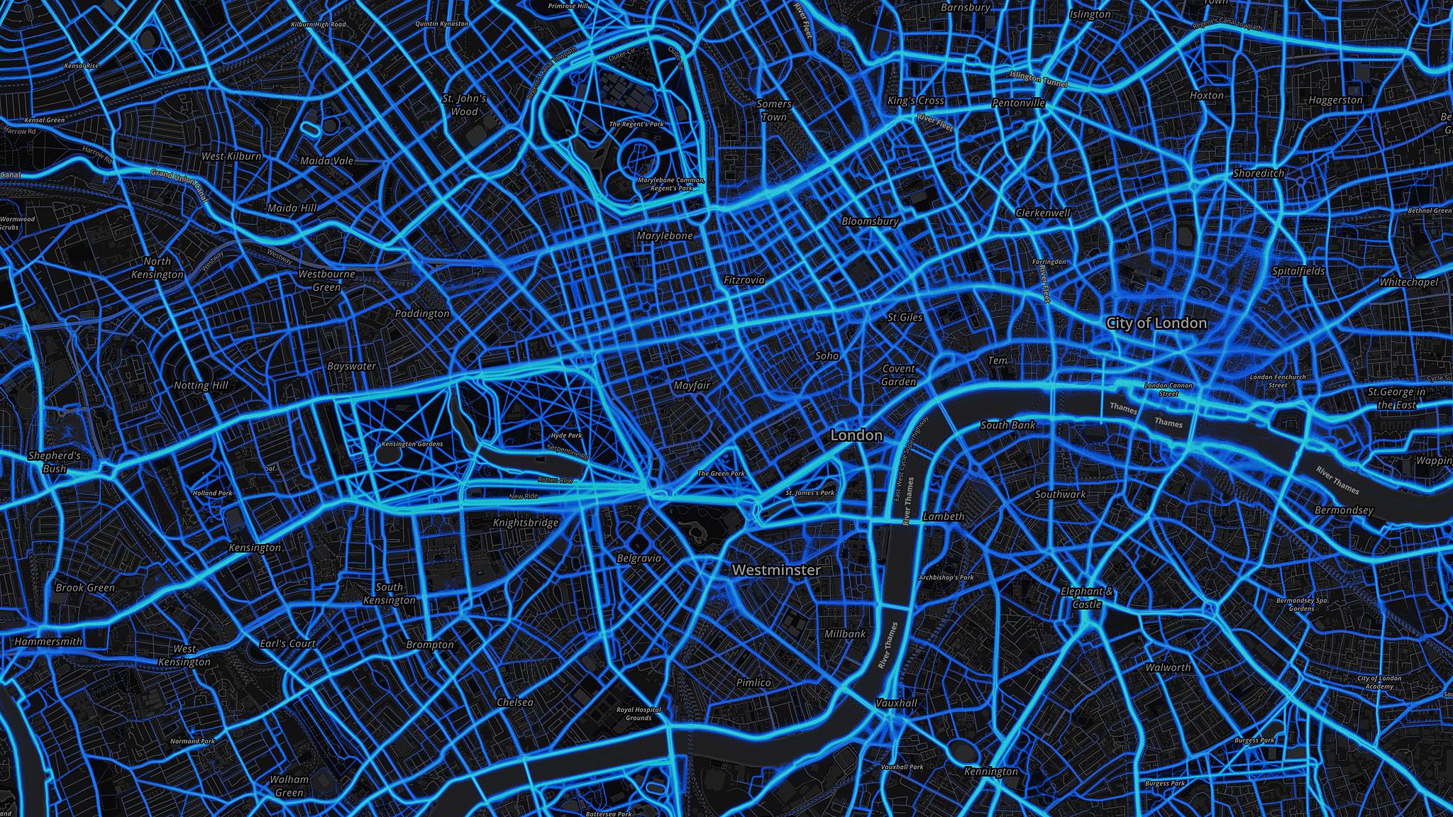
With its huge population pushing the capital to the top of the list, the River Thames towpath through London is a popular route - as are runs through Regent's Park and Hyde Park in the centre of the city.


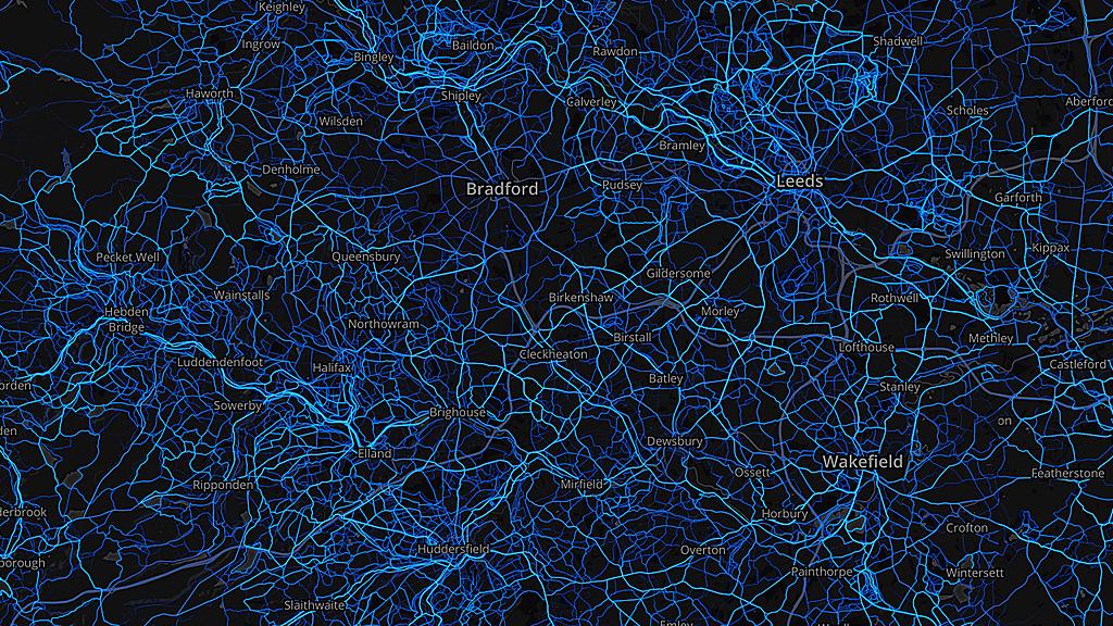
2. West Yorkshire
Here many running routes hug hillsides in the Pennines - and end up looking like contour lines.


3. Greater Manchester
The main commuter routes into Manchester are popular - and there is plenty of traffic along the twisting River Mersey a few miles south of the city centre.


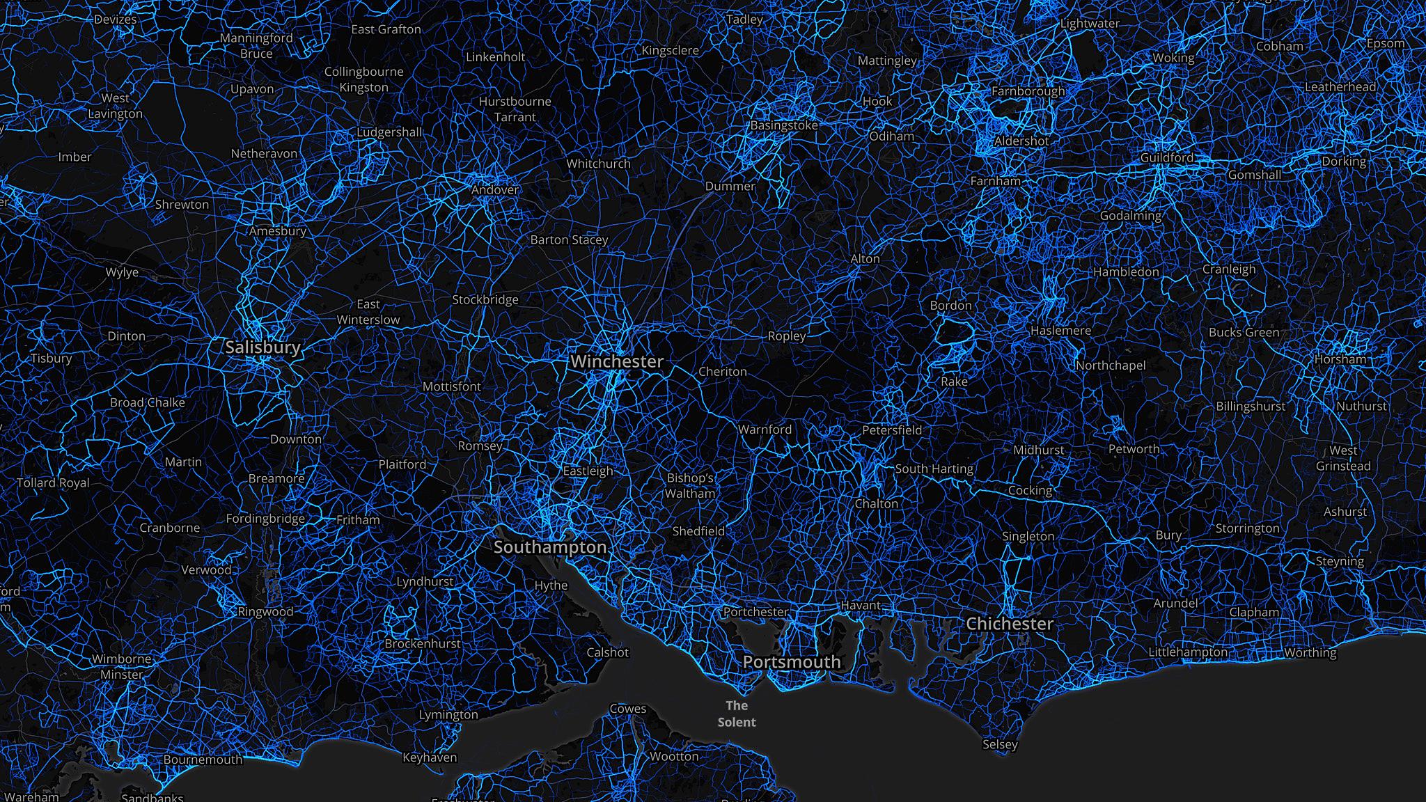
4. Hampshire
Popular areas include the New Forest, along the coast between Southampton and Portsmouth and out into the countryside from Basingstoke.


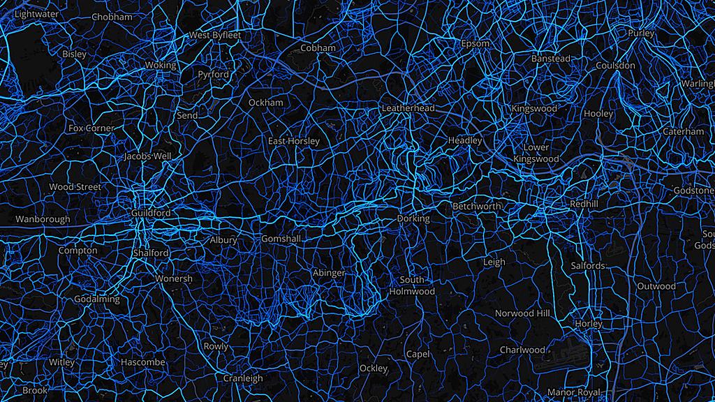
5. Surrey
A close up on Surrey reveals a delicate web of routes along the North Downs - from Guildford to Redhill.


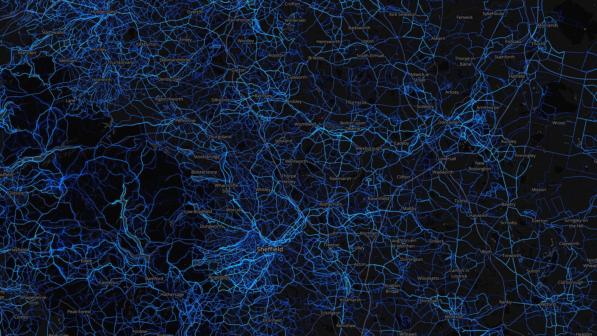
6. South Yorkshire
As with West Yorkshire, a network of hill-hugging routes stretch out into the Peak District from Sheffield.


7. Cumbria
A distinctive view of the coast of north-west England - with the Lake District centre of the frame.


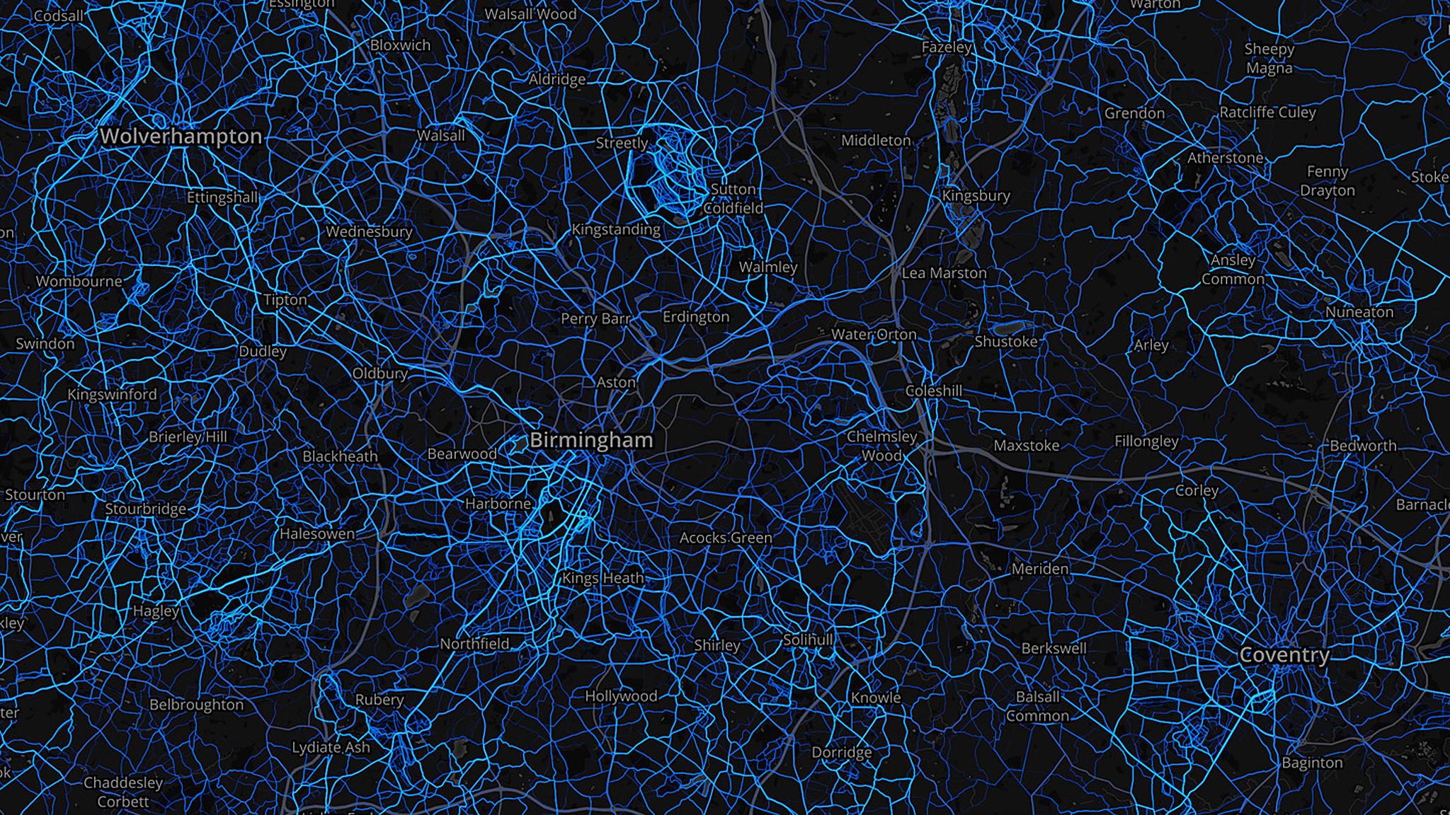
8. West Midlands
South-west Birmingham is popular with runners - and to the north of the city, there is a noticeable cluster around Sutton Park in Sutton Coldfield.


9. Kent
Routes with a sea view are busy - from Thanet to Whitstable on the north coast, and past Dover and Folkestone on the east coast.


10. Lancashire
It's busy around Preston and Lancaster, but also along the seafront at Blackpool.


Across the UK - using the 2015 data from Strava - the average speed for a male cyclist was 24.3km (15.1 miles) per hour.
For women, it was 19.8km (12.3 miles) per hour.

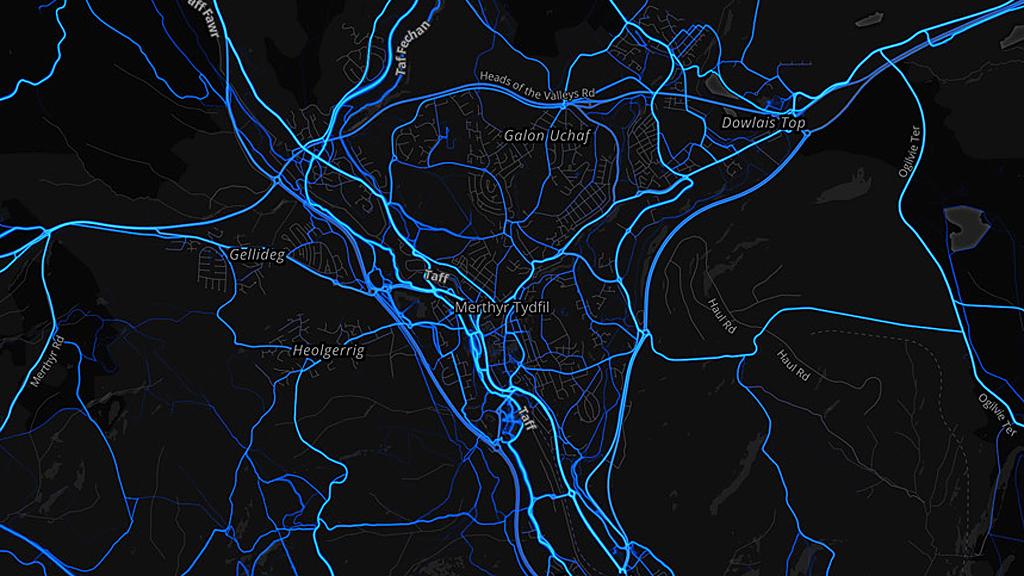
Merthyr Tydfil
The county borough at the top of the South Wales valleys recorded the hilliest cycle rides - with an average elevation of 630m (2067ft) per journey.


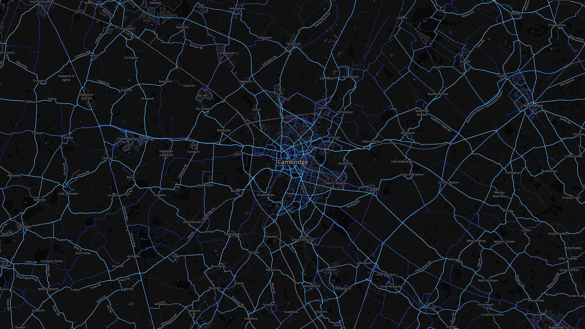
Cambridgeshire
Eastern England saw the flattest average ride - with Cambridgeshire recording 119m (390 ft) elevation per trip.


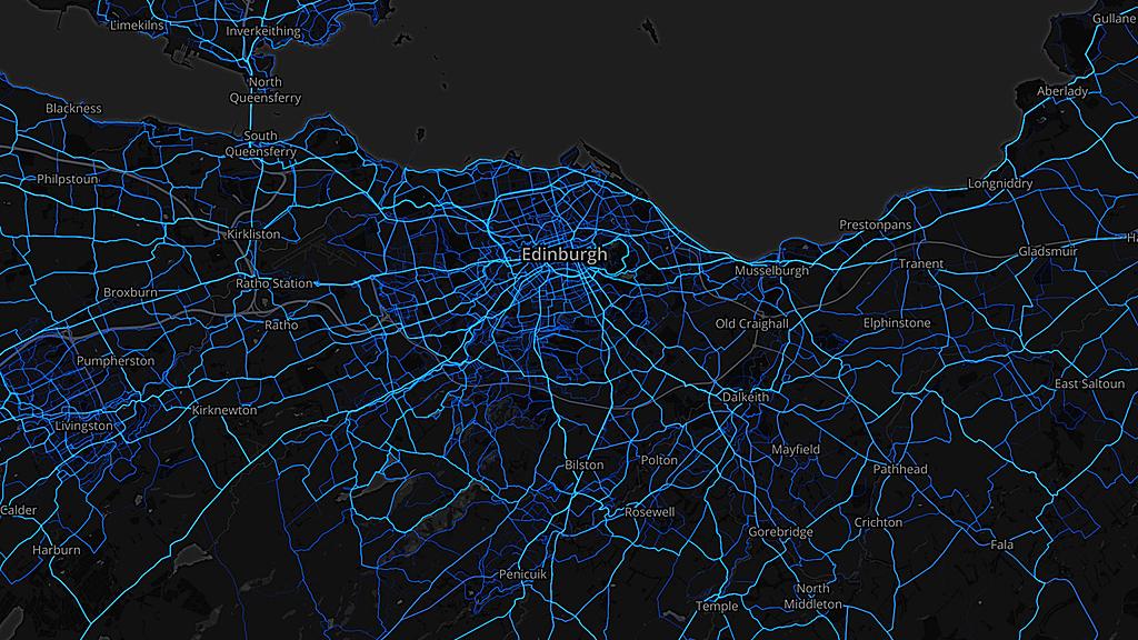
Edinburgh
The Scottish capital was home to the shortest average ride - at 20.7km (12.86 miles).
While the length does not seem particularly short, the data includes both recreational rides and commutes.
Strava says the average commute distance across the UK is 15.9km (9.88 miles).


Pembrokeshire
In contrast, south-west Wales saw the longest rides - at 39.8km (24.7 miles) on average.
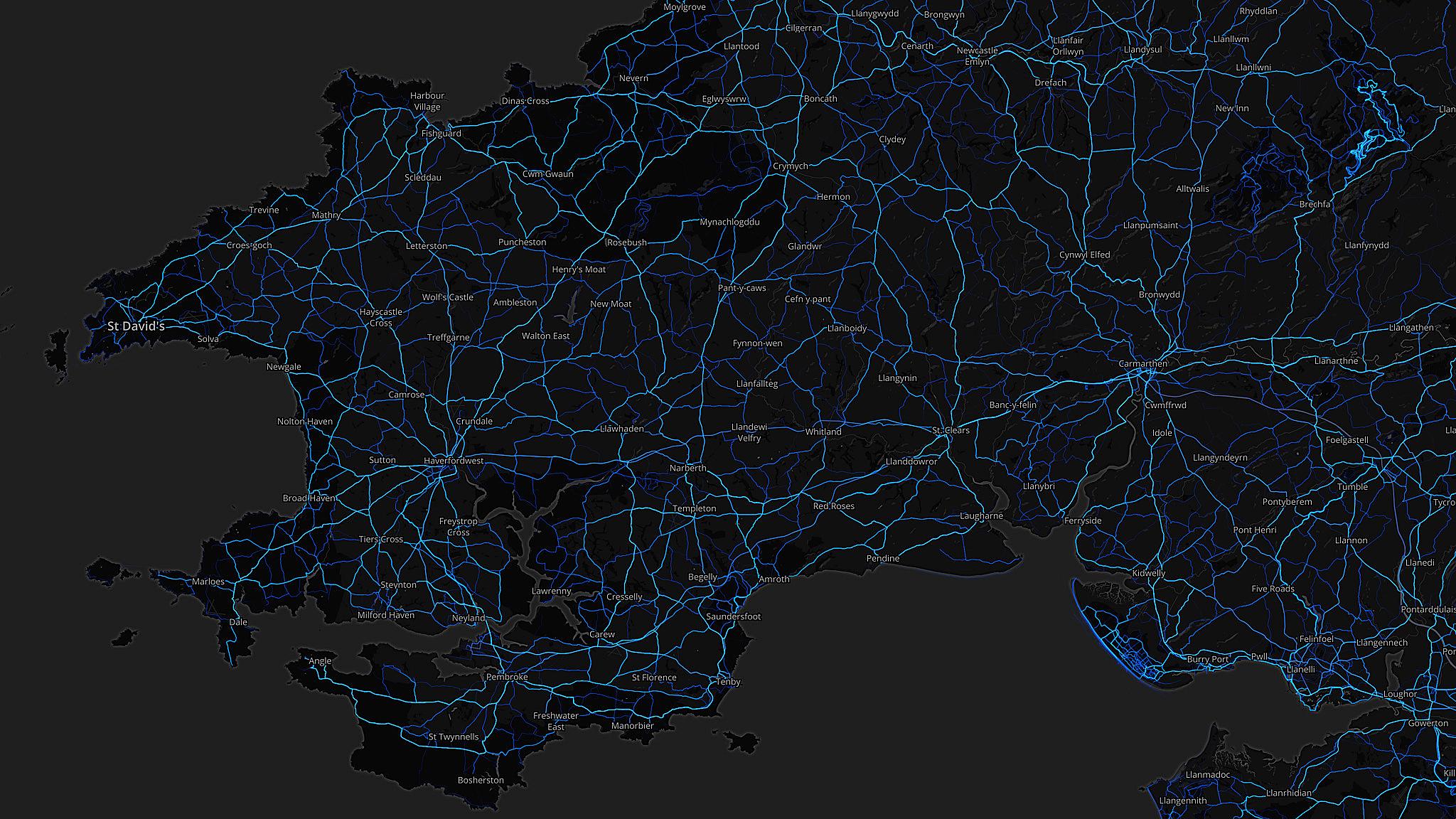


1. Greater London
As with running, it's not that surprising that the UK capital came out on top - but the cycle maps for London show a strong network of commuter routes.
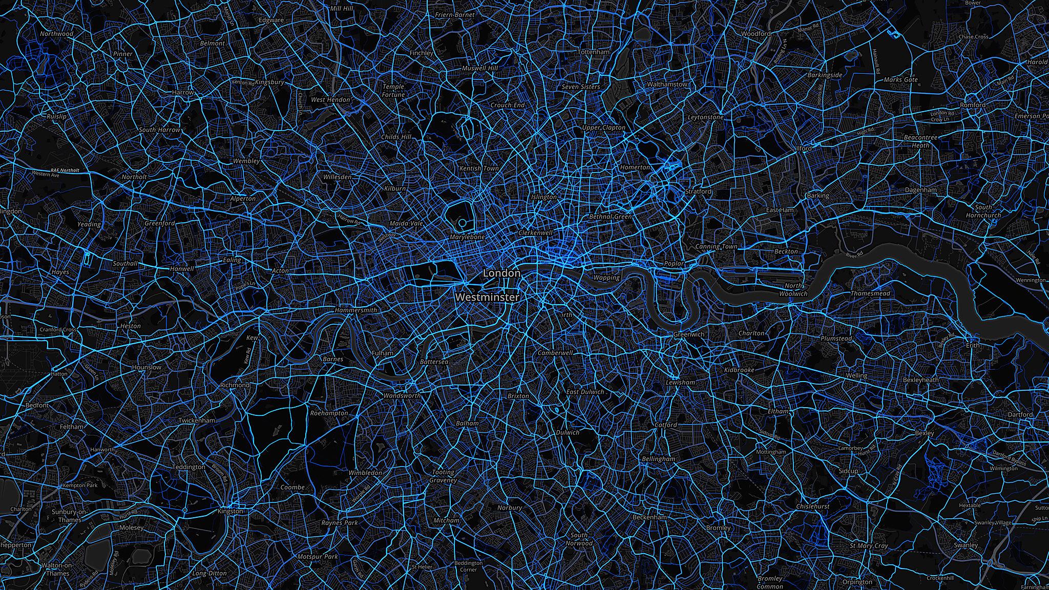
That's especially the case on the main arteries through the centre of the city.
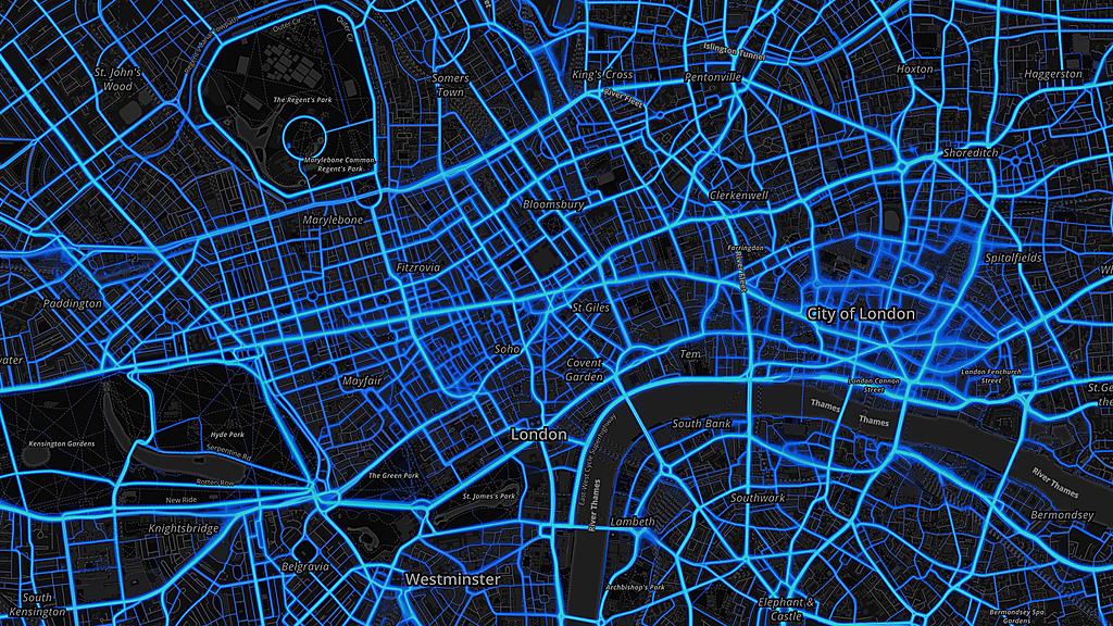


2. West Yorkshire
There's an even spread across the county, but with Leeds beating Bradford in the number of rides.


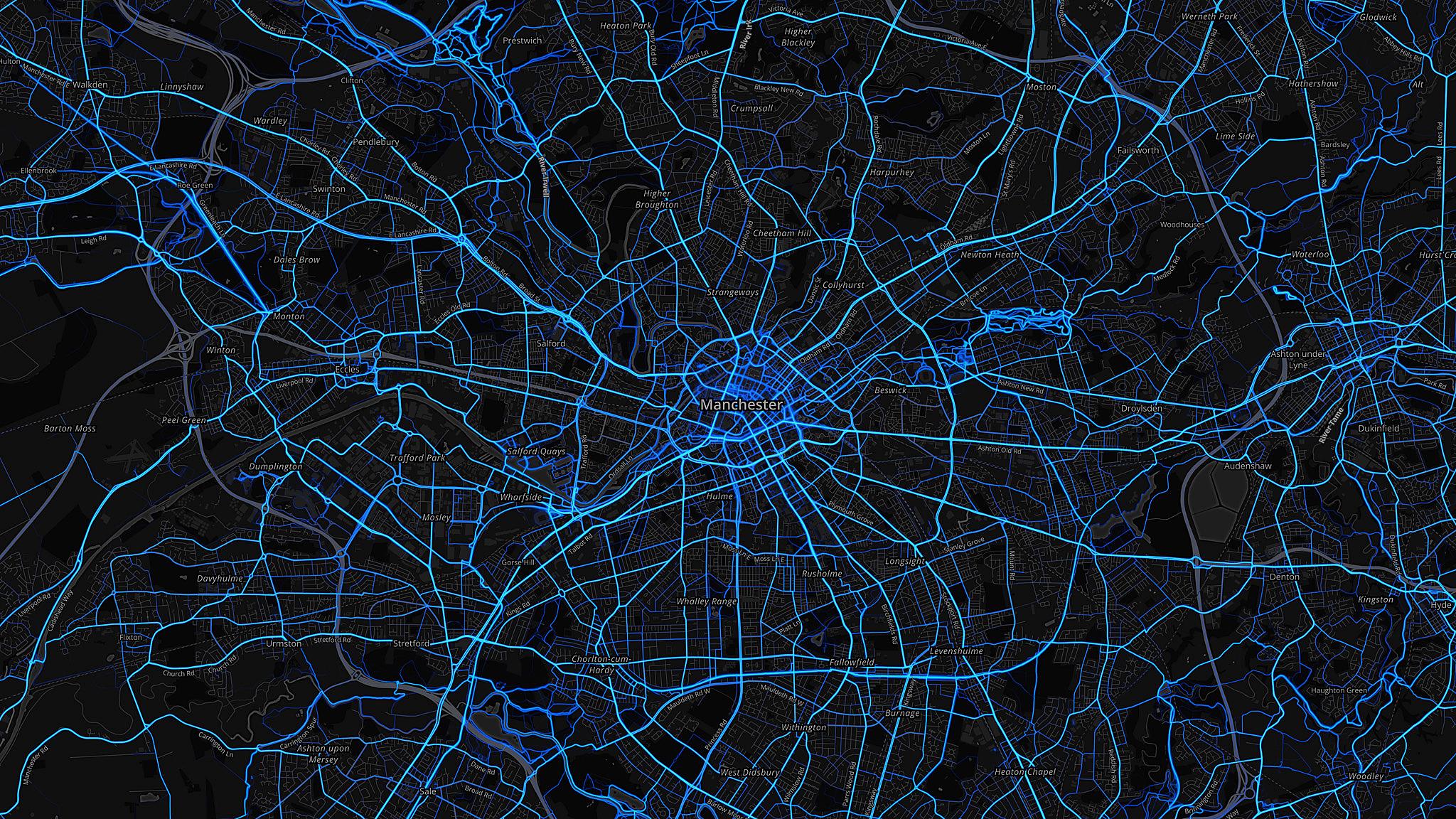
3. Greater Manchester
A strong show on the commuter routes from the south and west - but also a tangled mix of blue to the east of the city centre, in the parkland around the National Cycling Centre.


4. Surrey
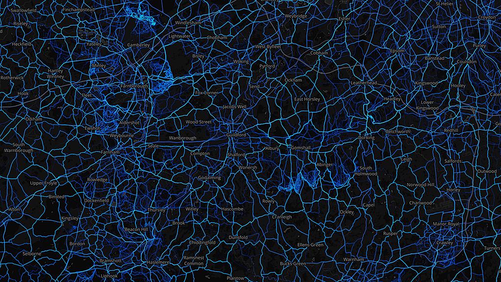
More leisure rides here, in the countryside to the south-west of London. Like with the running map - there are clusters of lines in the Surrey Hills to the east of Guildford.
And similar patterns in the areas of heathland on the Surrey/Berkshire/Hampshire borders around Farnborough and Fleet.


5. Hampshire
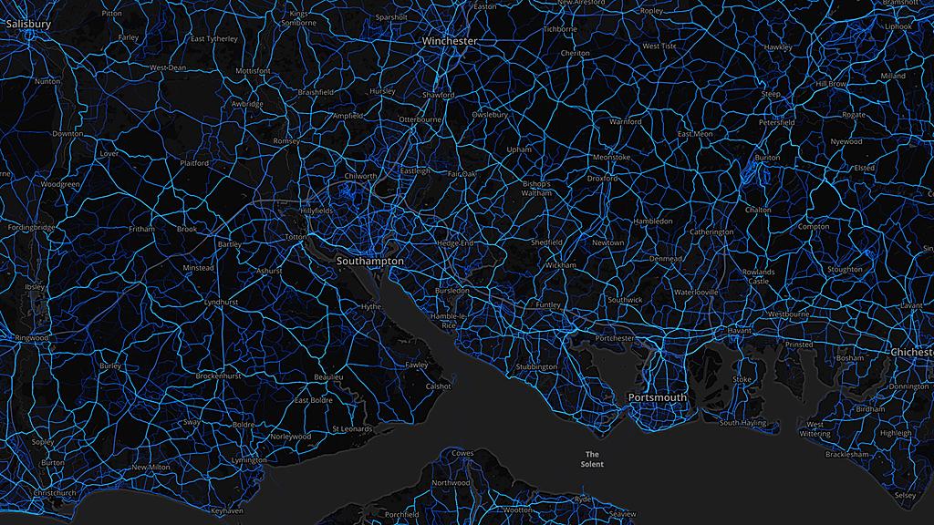
A mix of commutes and leisure routes here - with a complex network of light and dark blues through the New Forest, in the south-west of the county.


6. Lancashire
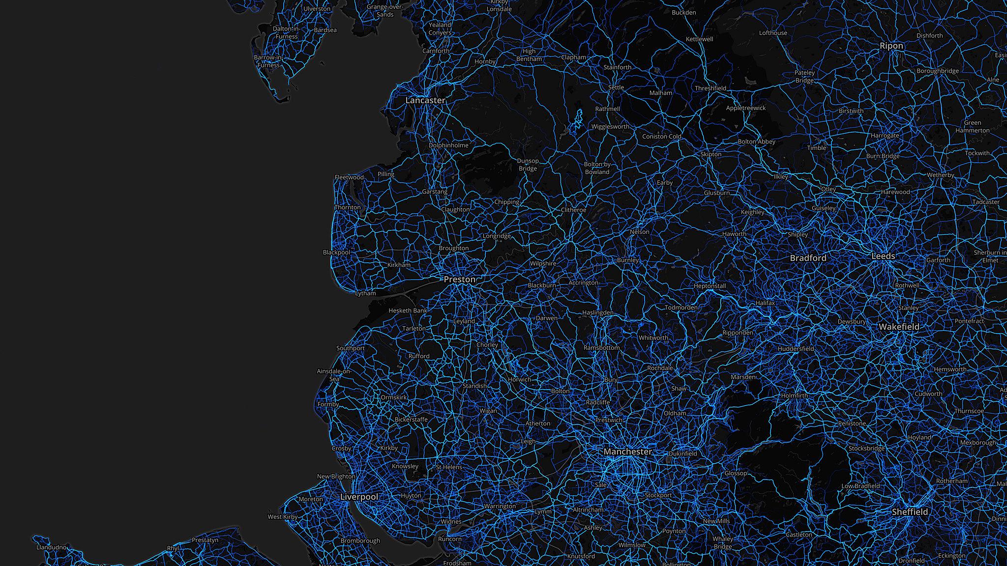
A beautiful web of lines from the coast up into the hills - with the seafront at Blackpool again proving popular.


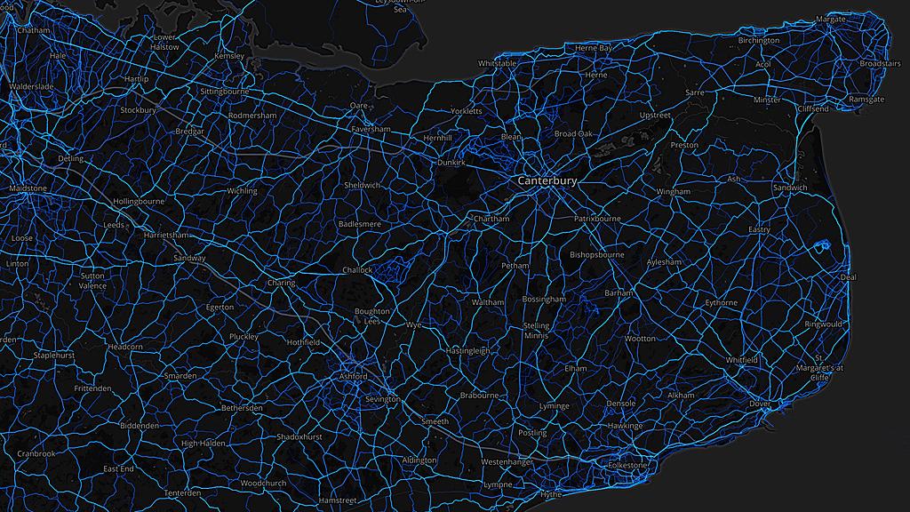
7. Kent
There's a very even spread across Kent - with a regular pattern of blue lines across the east of the county.


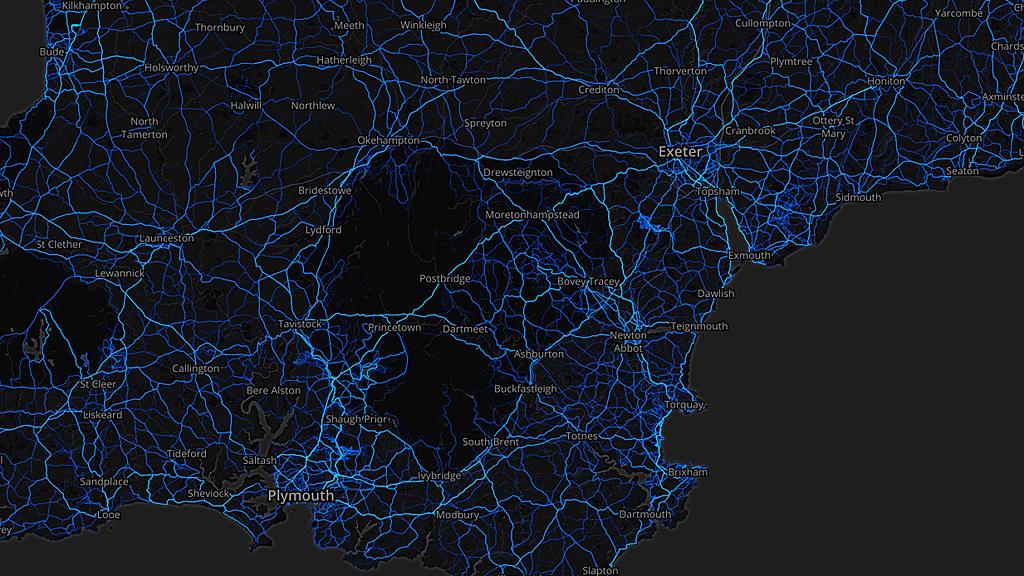
8. Devon
Both sides of the Exe Estuary are popular - as is the coastal route around Torbay - and routes between Exeter and Plymouth, with one travelling high across Dartmoor.


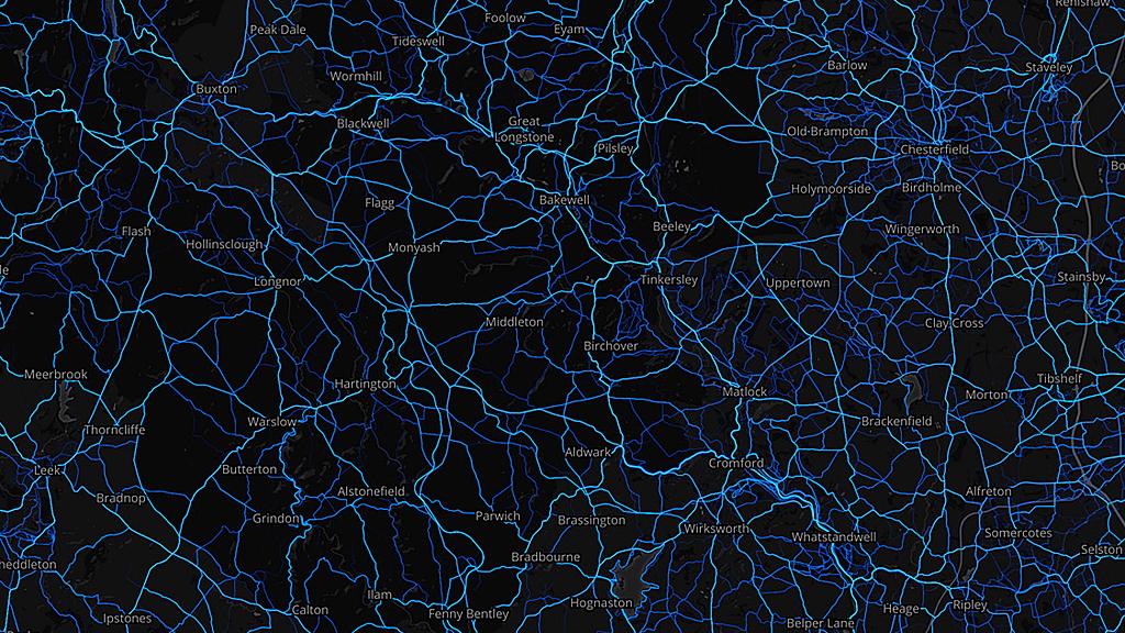
9. Derbyshire
In addition to the commutes around Derby in the south of the county, this image shows there is a clear network of leisure rides up into the Peak District, to Bakewell and beyond.


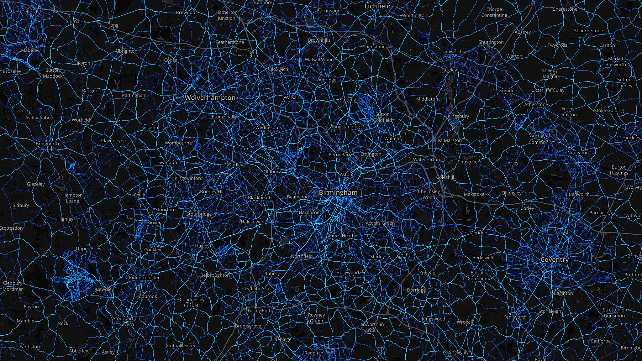
10. West Midlands
Another complex network across the middle of England.
Sutton Park to the north of Birmingham city centre is again noticeable - and a straggly cluster of rides in the south-west of the frame, in Wyre Forest, on the Worcestershire/Shropshire border.
Related: Strava Global Heatmaps, external
All images subject to copyright - Strava.com / MapBox / Open Street Map.