Gaza war in maps and satellite images
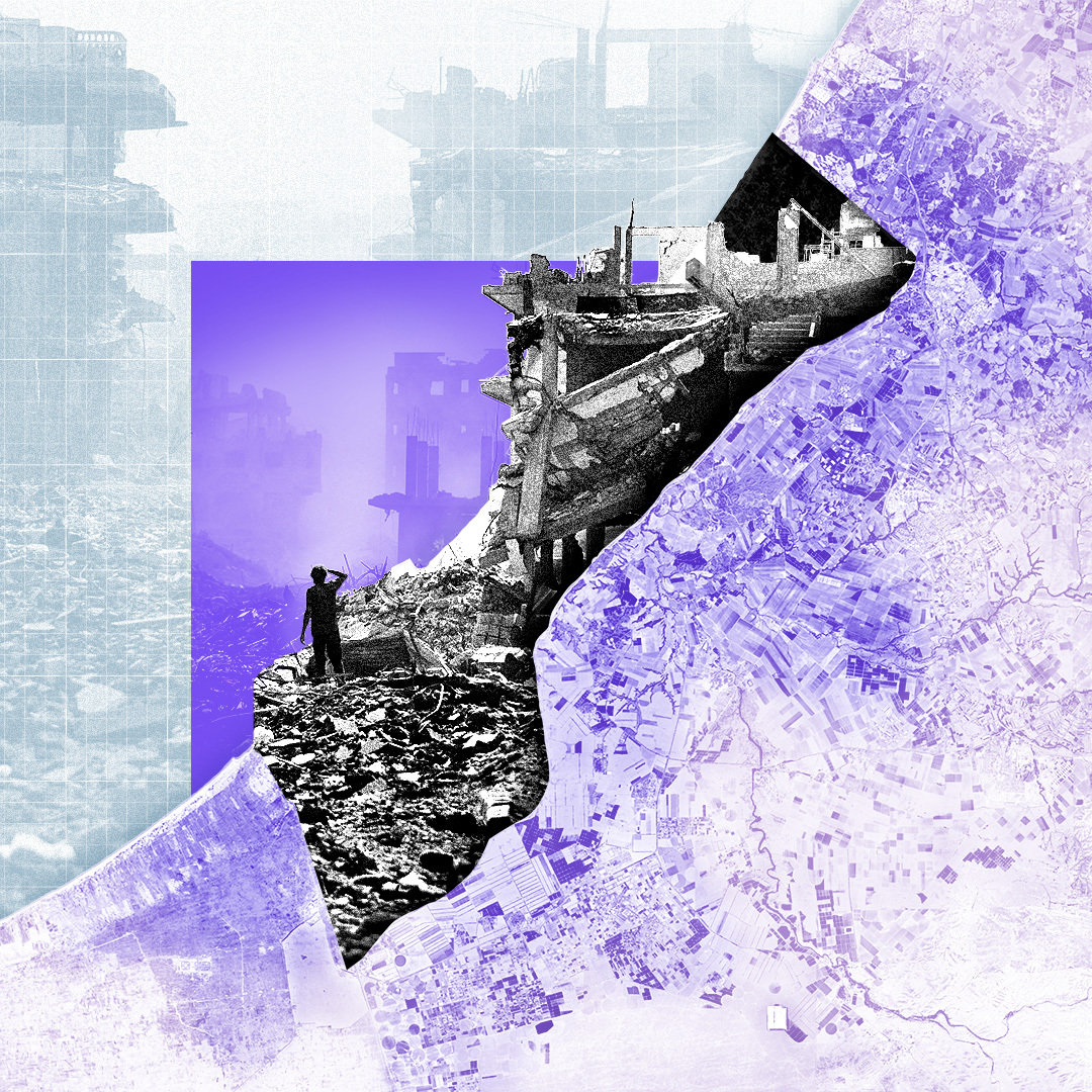
Two years of fighting have devastated Gaza.
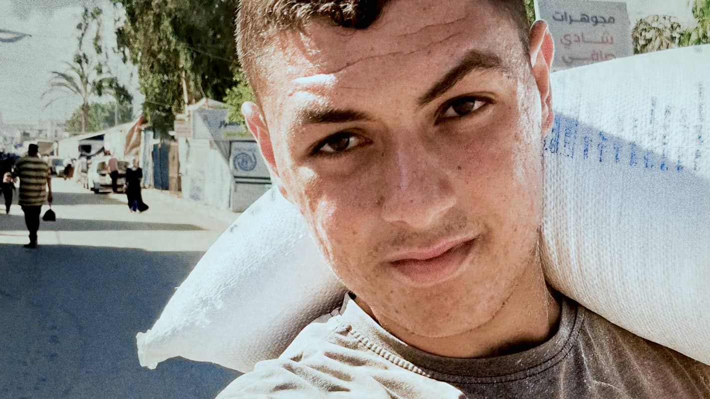
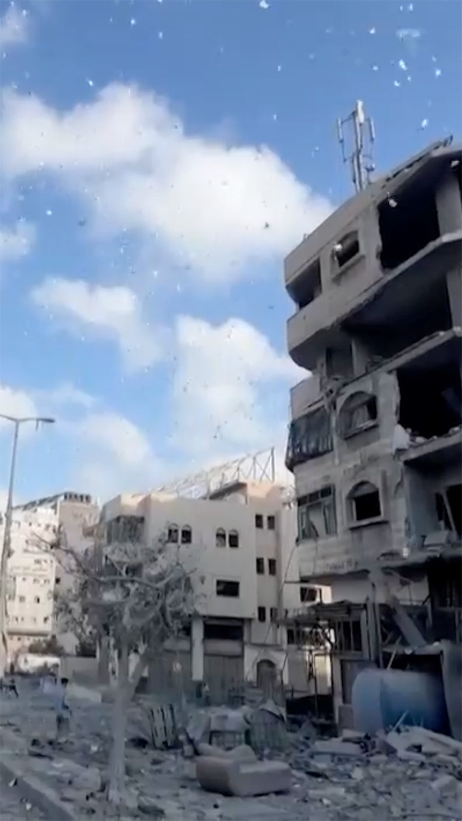
Israel’s bombing campaign and ground invasion have killed more than 67,000 Palestinians according to the Hamas-run health ministry, nearly the entire population has been forced to move, and the UN says most homes have been damaged or destroyed.
The offensive came in response to Hamas's unprecedented cross-border attack on 7 October 2023, in which about 1,200 people were killed and 251 others were taken hostage.
Israel said it was trying to destroy the military and governing capabilities of the Islamist group, which is committed to Israel's destruction and has been in control of Gaza since 2007.
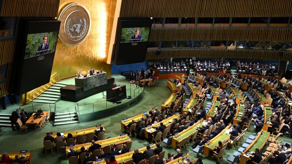
The first phase of US President Donald Trump’s peace plan has come in effect, with the release all 20 living hostages by Hamas and hundreds of Palestinian detainees and prisoners held by Israel.
Israeli forces have withdrawn to an agreed area which still leaves them in control of about 53% of the territory. Under the terms of the deal, aid lorries will also be allowed into the Strip to bring desperately needed aid to Gaza's population.
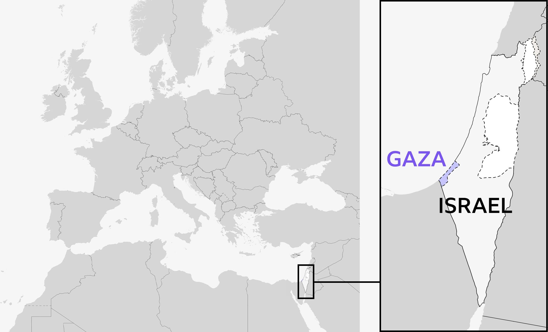
Gaza is only 41km (25 miles) long and 10km wide - about a quarter of the size of London - surrounded on three sides by closed borders with Israel and Egypt and by the Mediterranean Sea to the west, where Israel imposes a blockade. It is home to more than 2 million people.
More than 90% of homes are estimated to be damaged or destroyed; the healthcare, water, sanitation and hygiene systems have collapsed; and UN-backed experts say there is famine in Gaza City.
A United Nations commission of inquiry says Israel has committed genocide against Palestinians in Gaza - although Israel has rejected the commission’s report, describing it as "distorted and false".
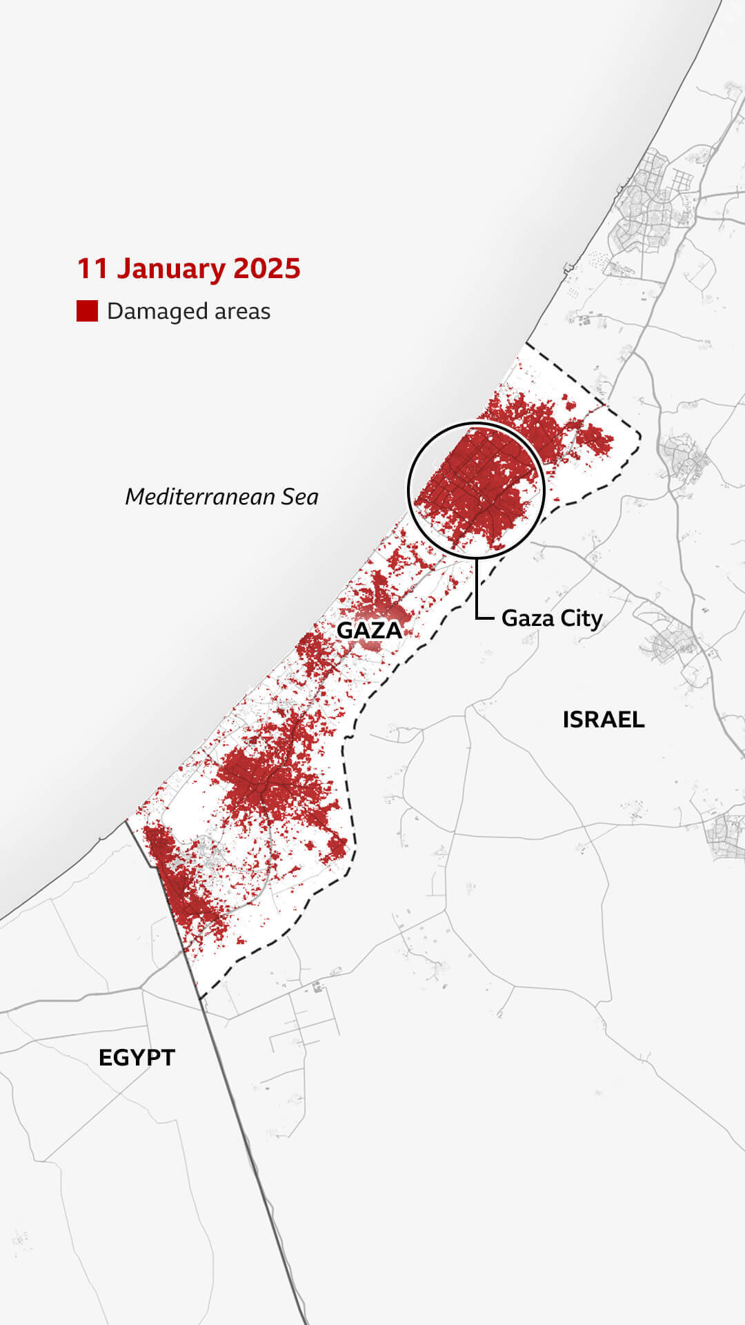
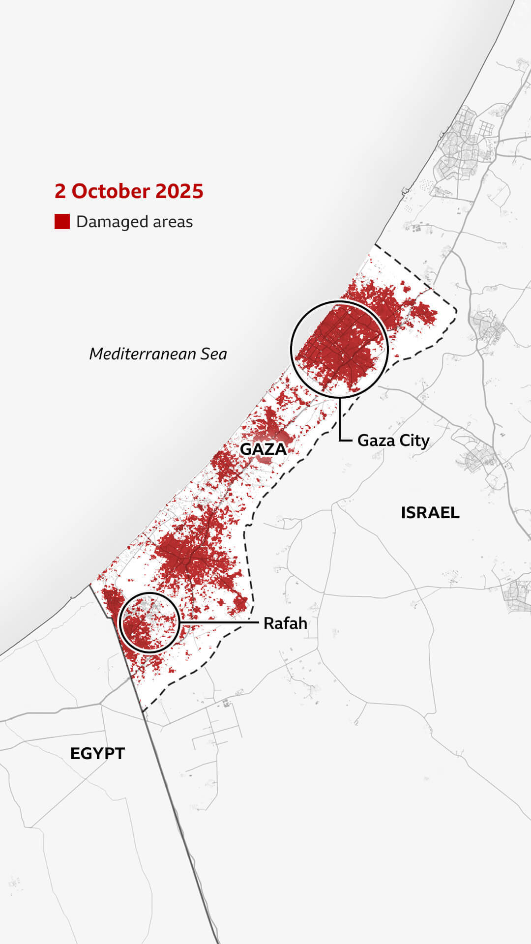
This visual guide shows how Gaza has become in large parts uninhabitable.
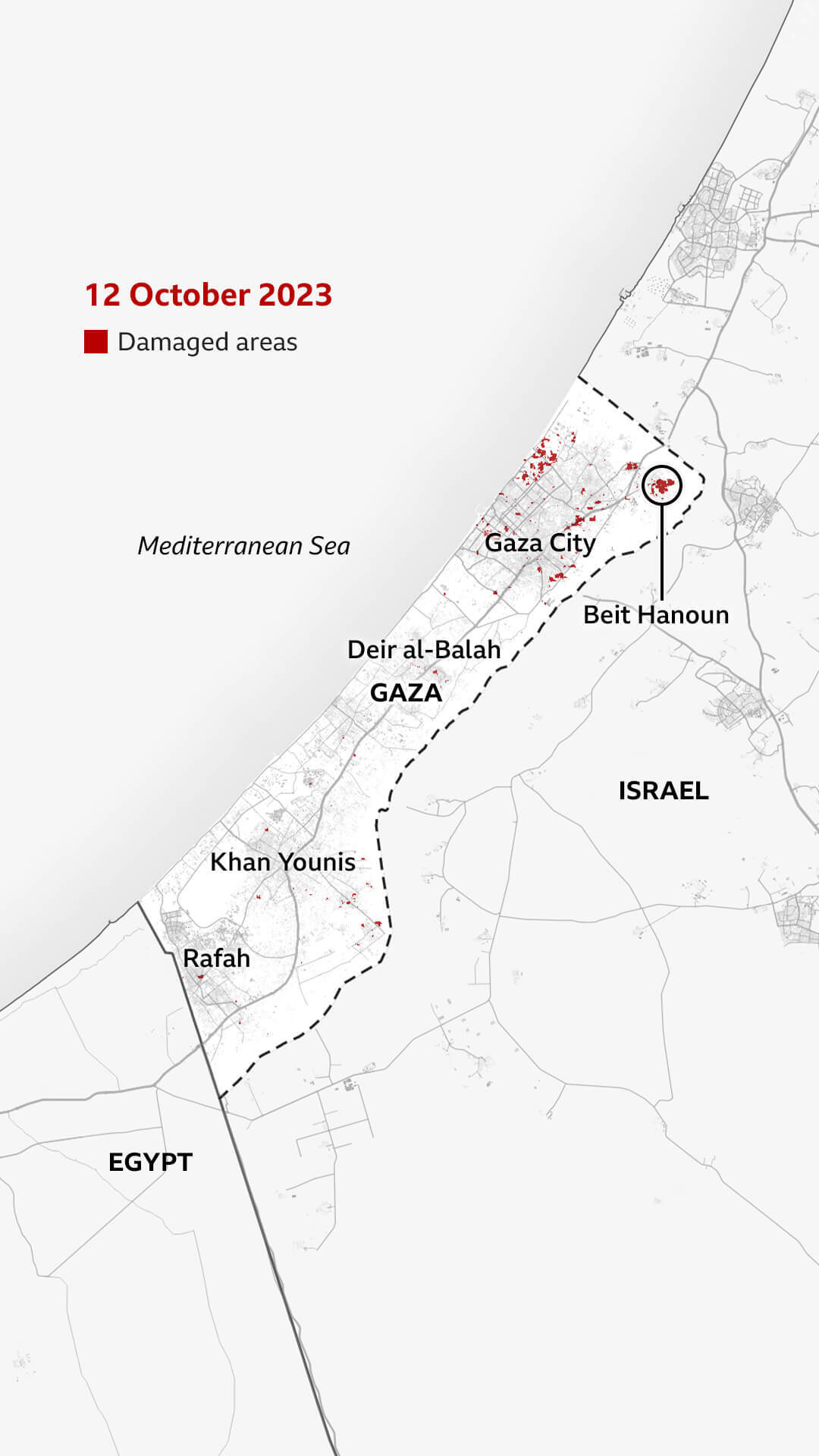
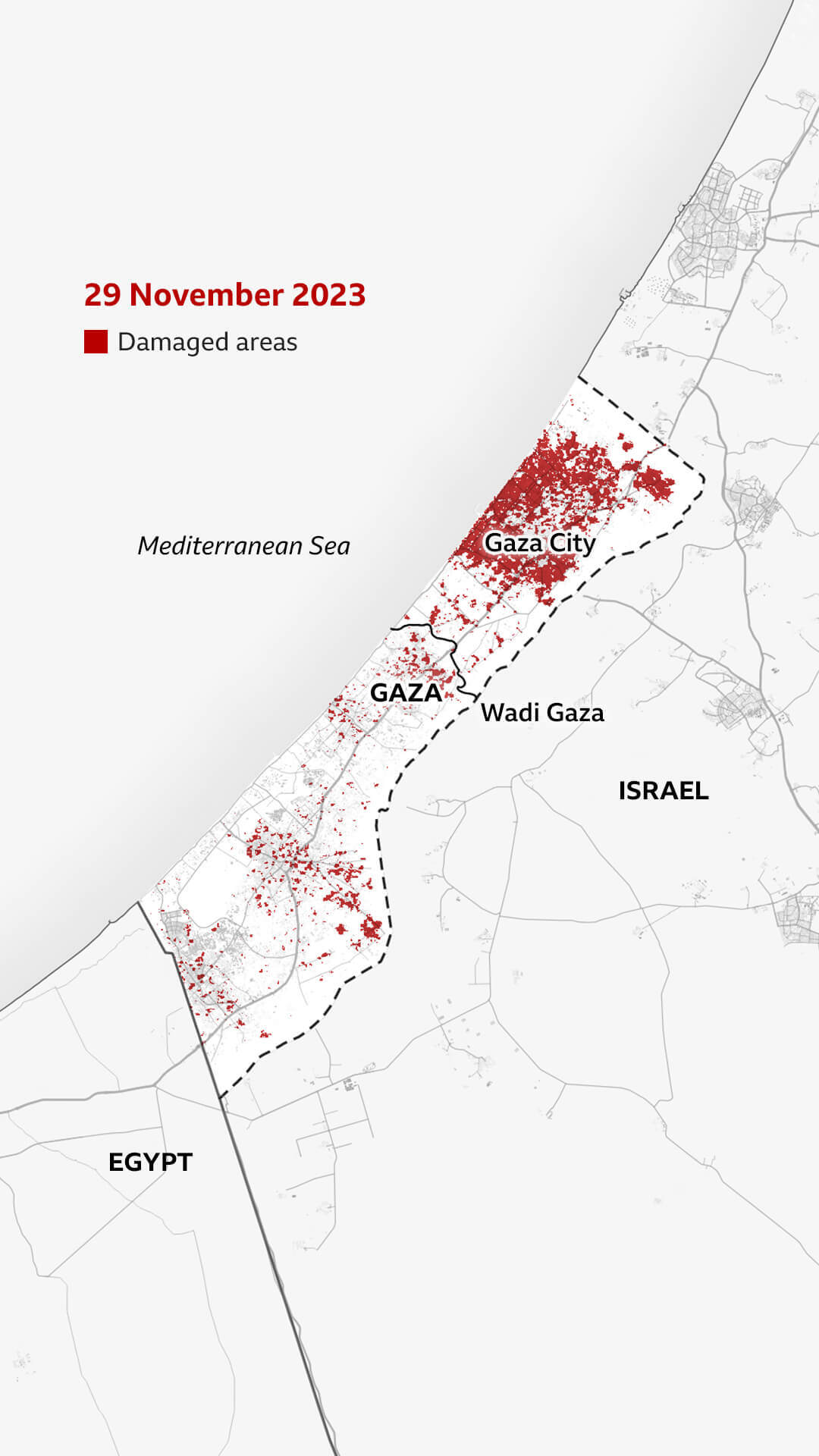
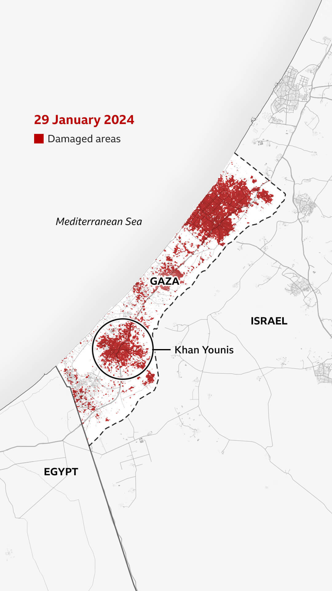
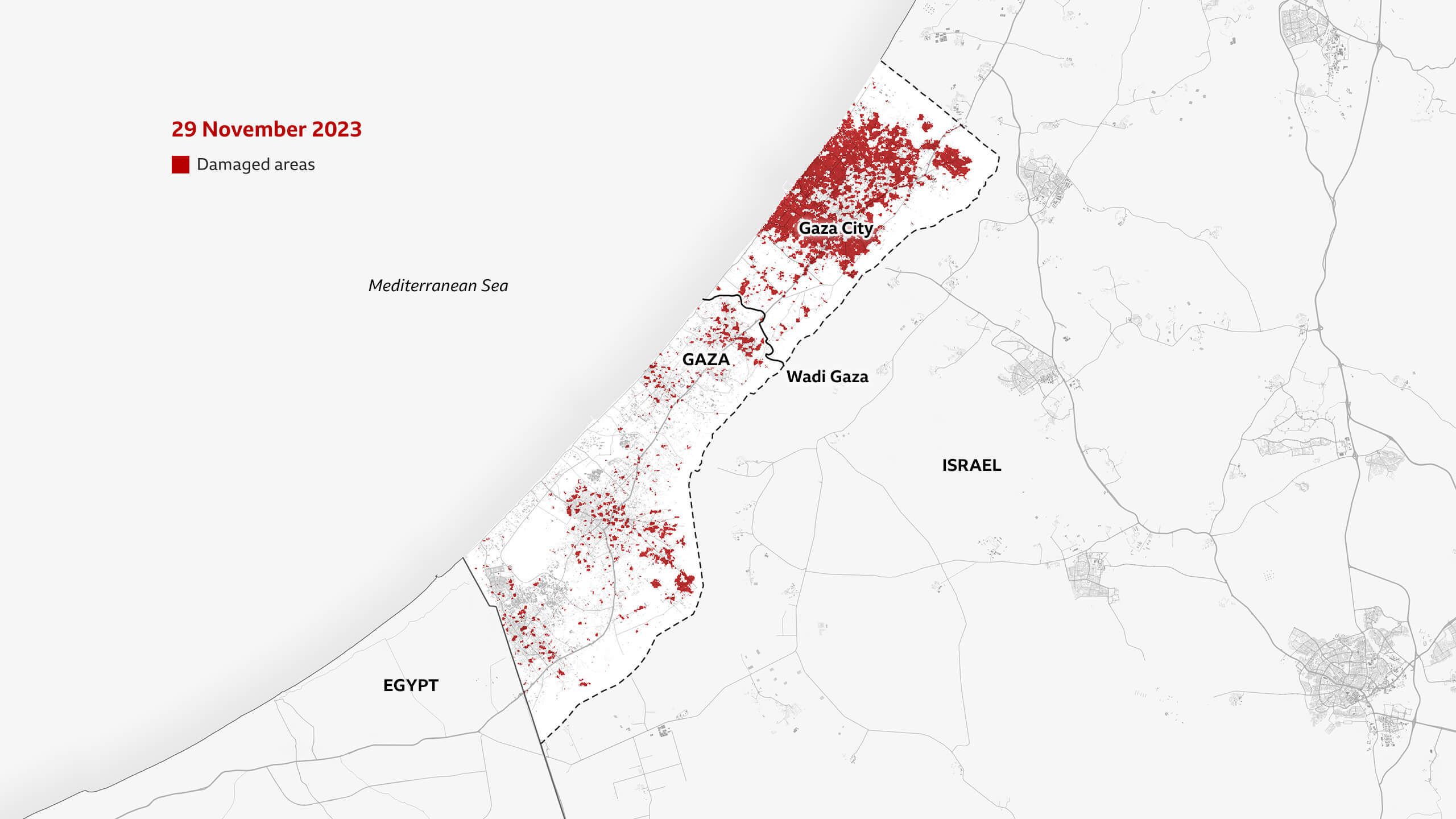
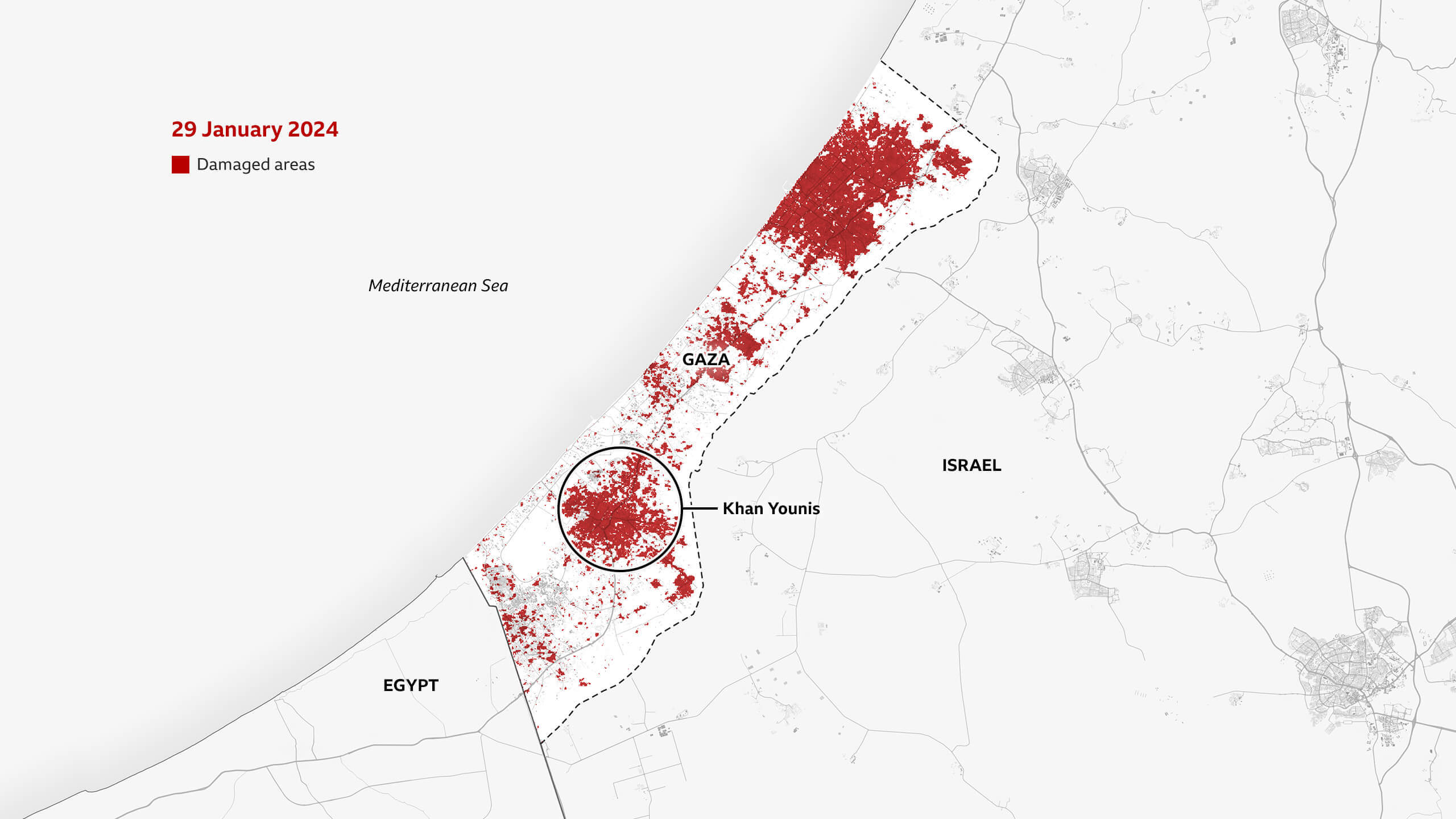
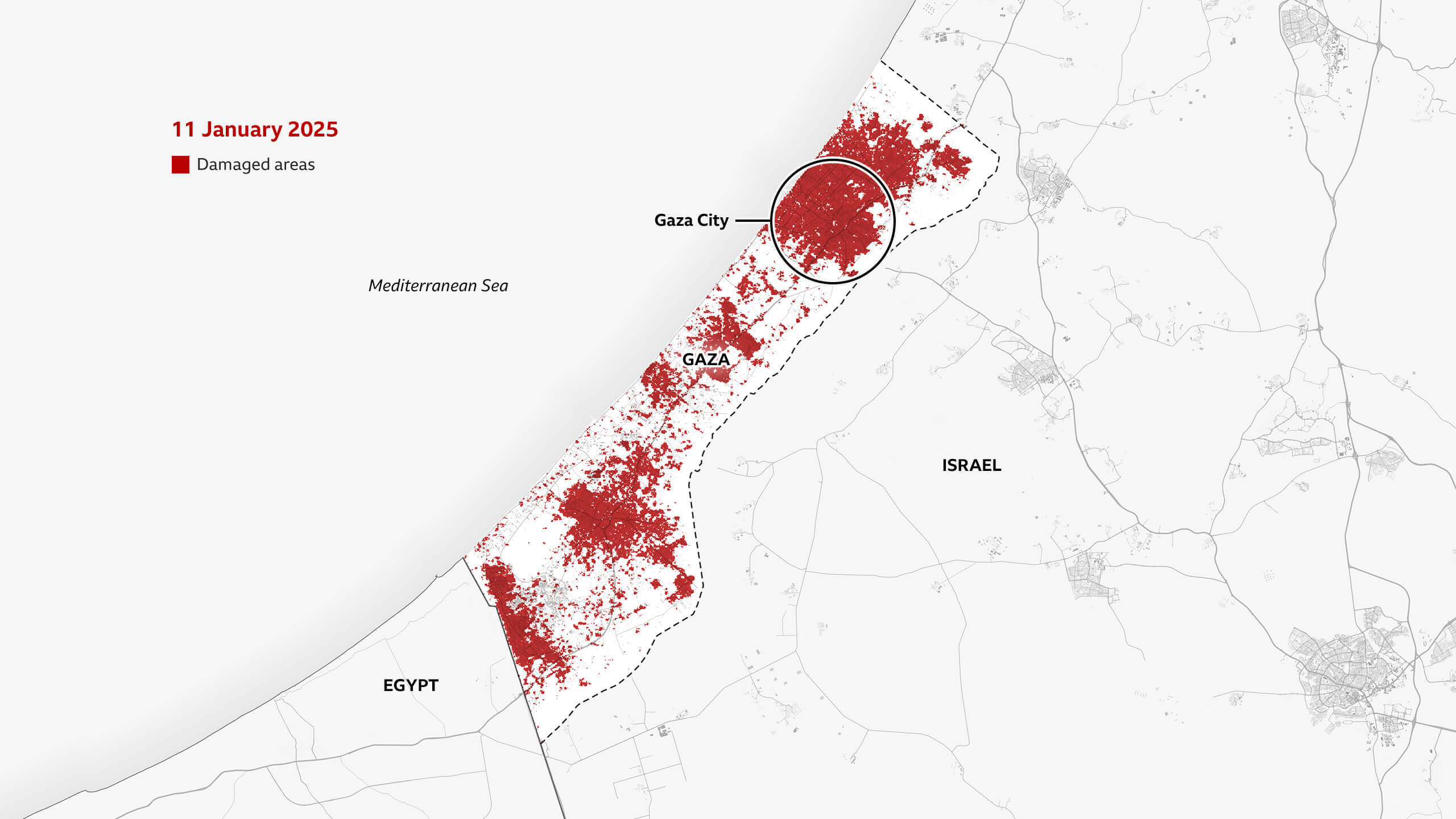
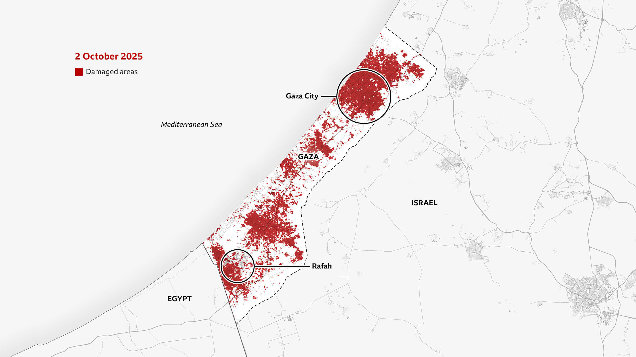
How the destruction spread
Israel's campaign initially focused on northern Gaza - where it said Hamas fighters were hiding among the civilian population. Hamas denied this.
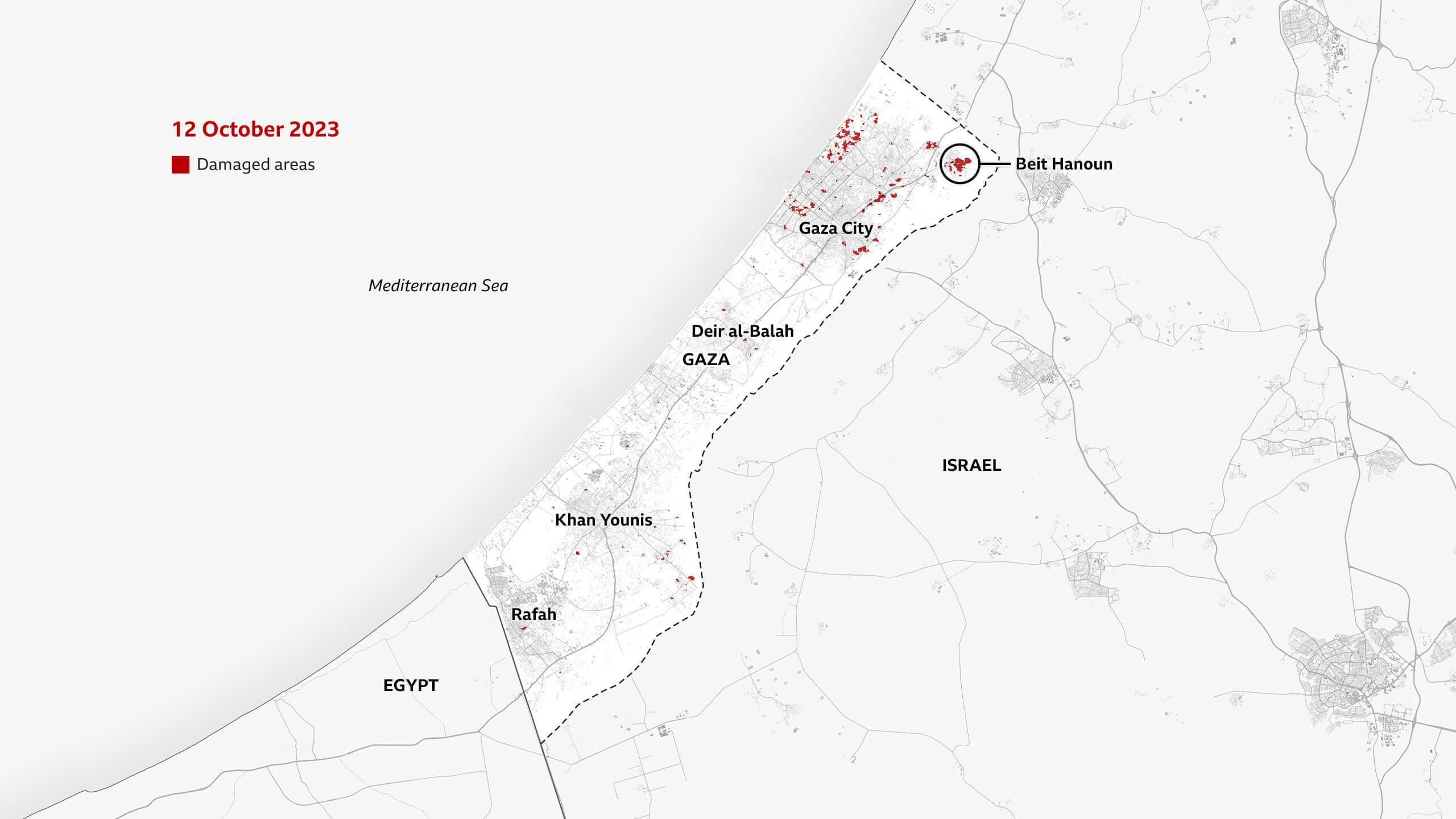
Throughout the war, Hamas - which is designated as a terrorist organisation by Israel, the UK and many other countries - and other armed groups allied to it have been engaged in intense battles against Israeli forces on the ground. They have also fired thousands of rockets into Israel, especially in the first months of the war.
But in Gaza, entire districts have been razed to the ground, hospitals and mosques have been destroyed and agricultural land where greenhouses once stood have been reduced to sand and rubble by heavy vehicles and tanks used for demolitions by Israeli troops.
Israel says Hamas uses civilian buildings such as hospitals for military purposes - but Hamas denies that.
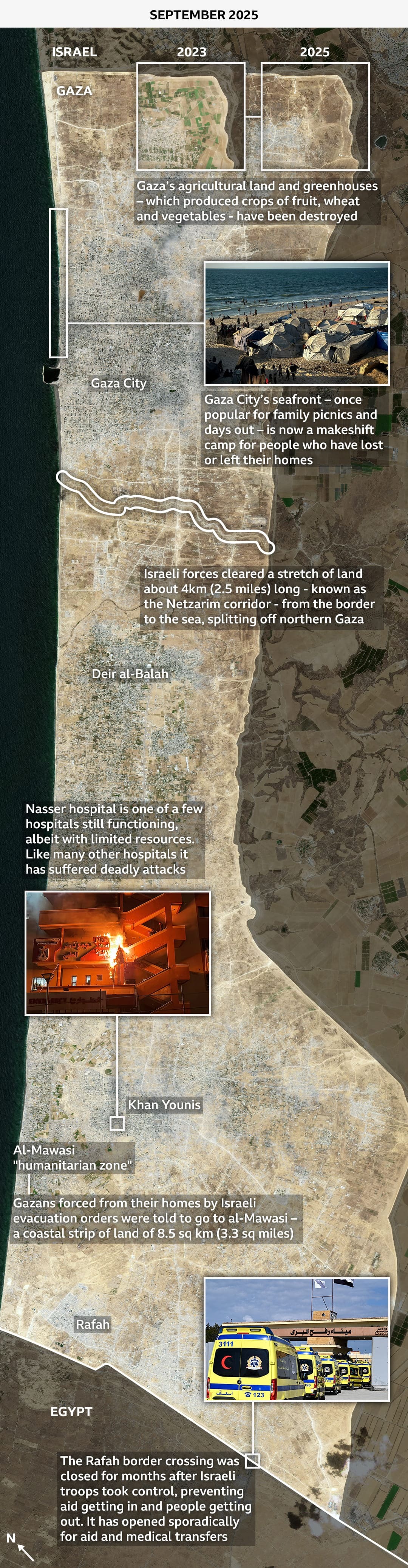
Before the war, most of Gaza's 2.1 million people lived in its four main cities - Rafah and Khan Younis in the south, Deir al-Balah, in the centre, and Gaza City.
Within 10 days of 7 October 2023, Israel’s offensive had forced nearly half to leave their homes, according to the UN's Palestinian refugee agency (Unrwa).
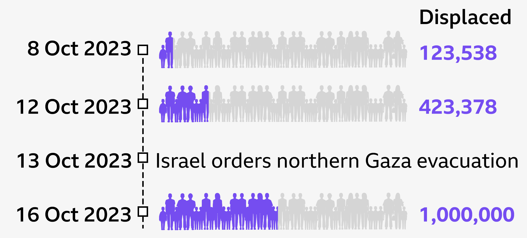
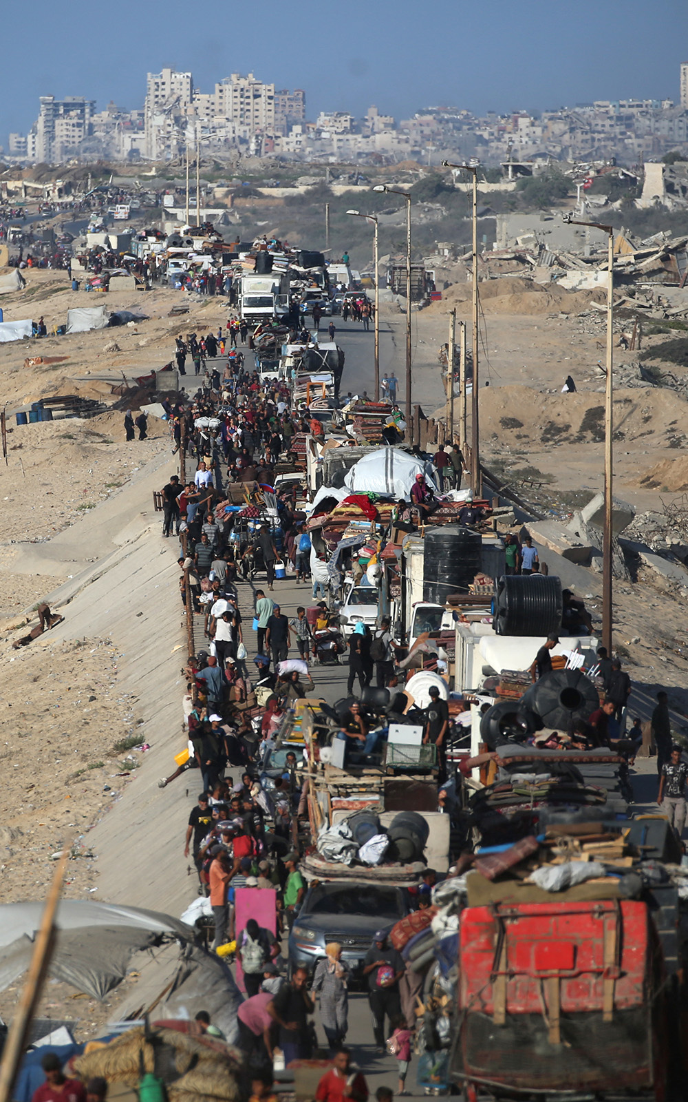
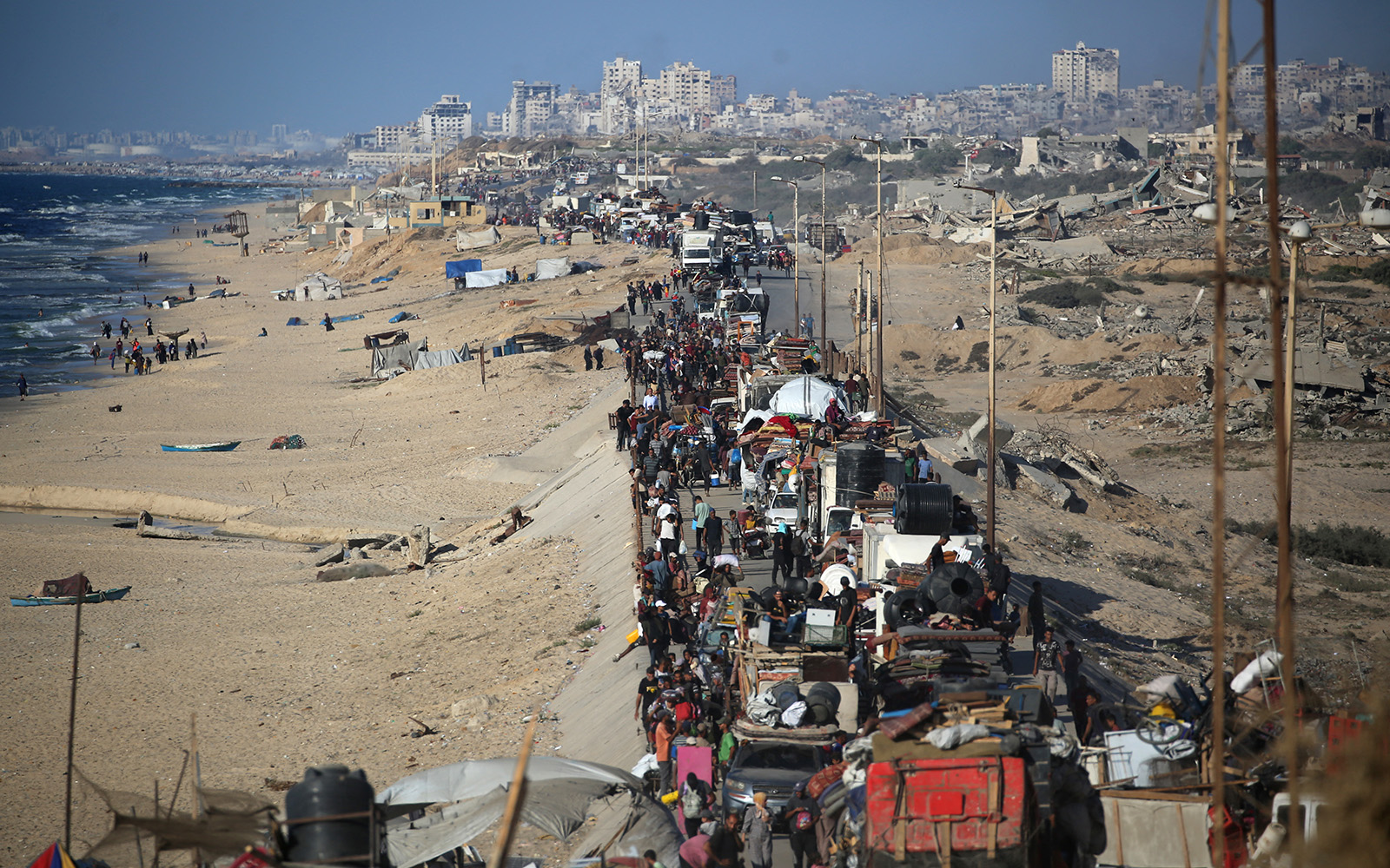
And by the time the ceasefire was declared 15 months later, an estimated 1.9m people had been internally displaced - they remain unable to return home.

Families have moved multiple times as Israel changed the focus of its operation, initially telling people in the north to move south of Wadi Gaza river, which cuts the Strip roughly in half, and later ordering people to leave a series of "evacuation zones" in the south.
Leaflet drops by the Israeli army warned people to leave ahead of operations in the area. However, not all Israeli strikes are preceded by warnings.
Restricted areas grow
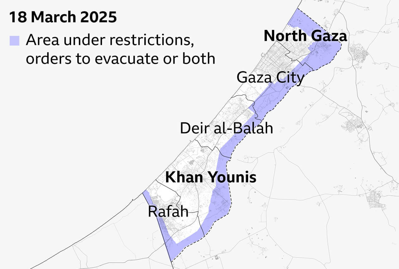
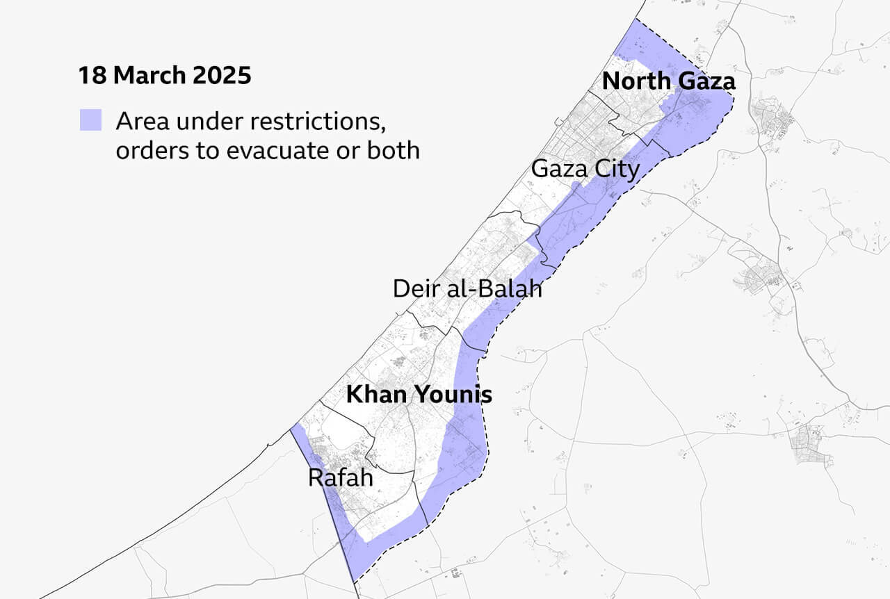
Since Israel ended the ceasefire in March, it has designated more and more areas of Gaza as no-go zones - where restrictions are in place - or making them subject to displacement orders, meaning Gazans have been told to leave completely.
Initially the orders to evacuate covered two areas - in the North Gaza and Khan Younis governorates - with a “no-go” area in place along the whole border.
Aid agencies have to co-ordinate with the Israeli authorities to operate in the "no-go" areas.
Israel had also blocked any humanitarian aid from entering Gaza at the start of March - accusing Hamas of commandeering it. Limited aid is now allowed in, although aid agencies still say it is nowhere near enough.
By the start of April all the UN-supported bakeries in Gaza had been closed, most fresh vegetables were in very limited supply and hospitals were rationing painkillers and antibiotics.
The NGO ActionAid warned that a "new cycle of starvation and thirst" loomed.
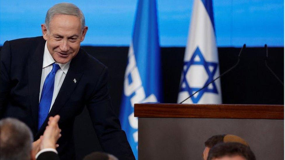
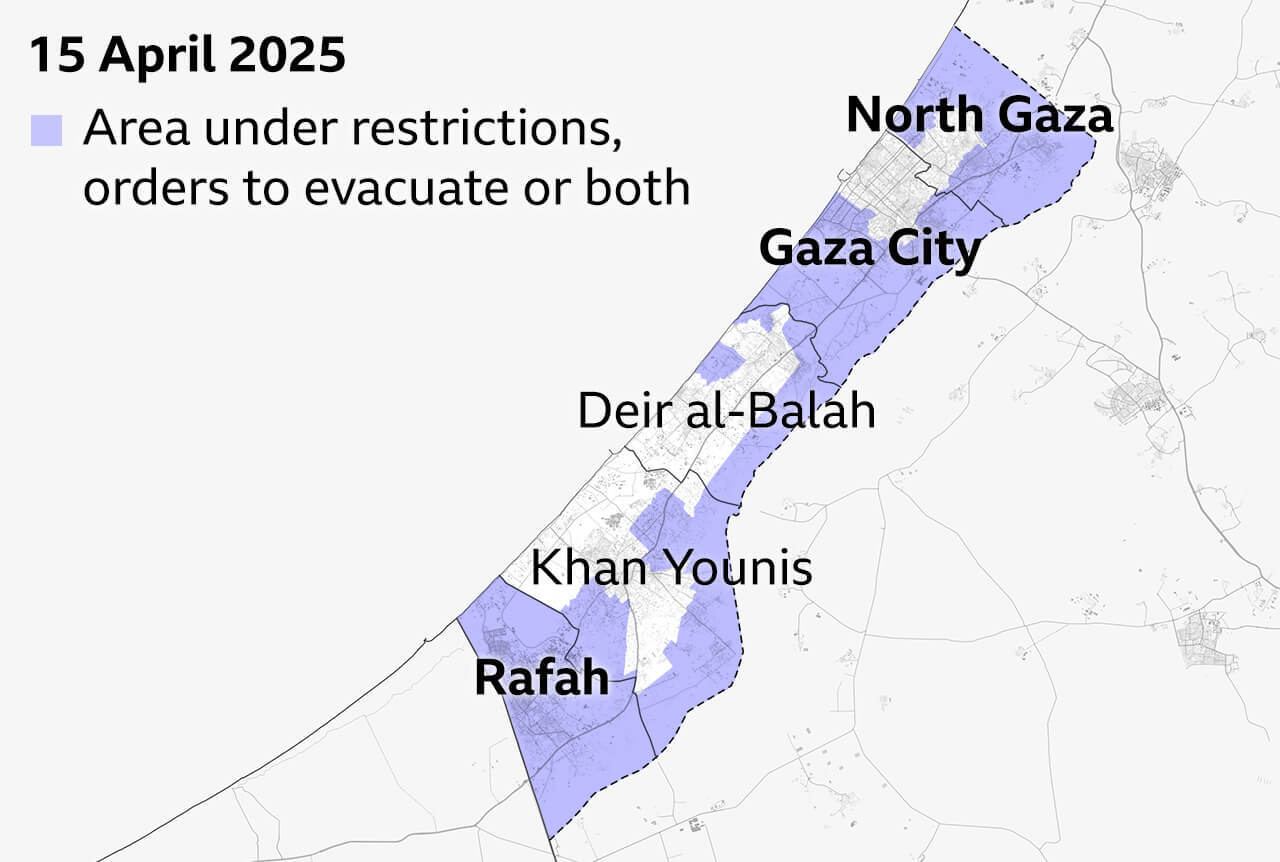
Israel’s defence minister announced on 16 April that Israel would set up security zones in Gaza to provide a “buffer” to protect Israeli communities even after the war ended - Hamas has insisted that Israeli forces must withdraw from Gaza under any permanent ceasefire.
At the time almost 70% of Gaza was affected by Israeli restrictions - including most of the North Gaza and Gaza City governorates in the north and the whole of the Rafah governorate in the south, according to the UN.
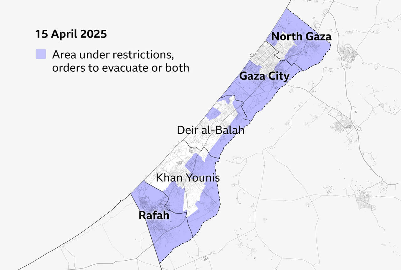
And in May, Israel launched a ground offensive named Operation Gideon's Chariots, which Netanyahu said would aim to secure the release of the 48 remaining hostages - 20 of whom are thought to be alive - and "complete the defeat" of the Palestinian armed group.
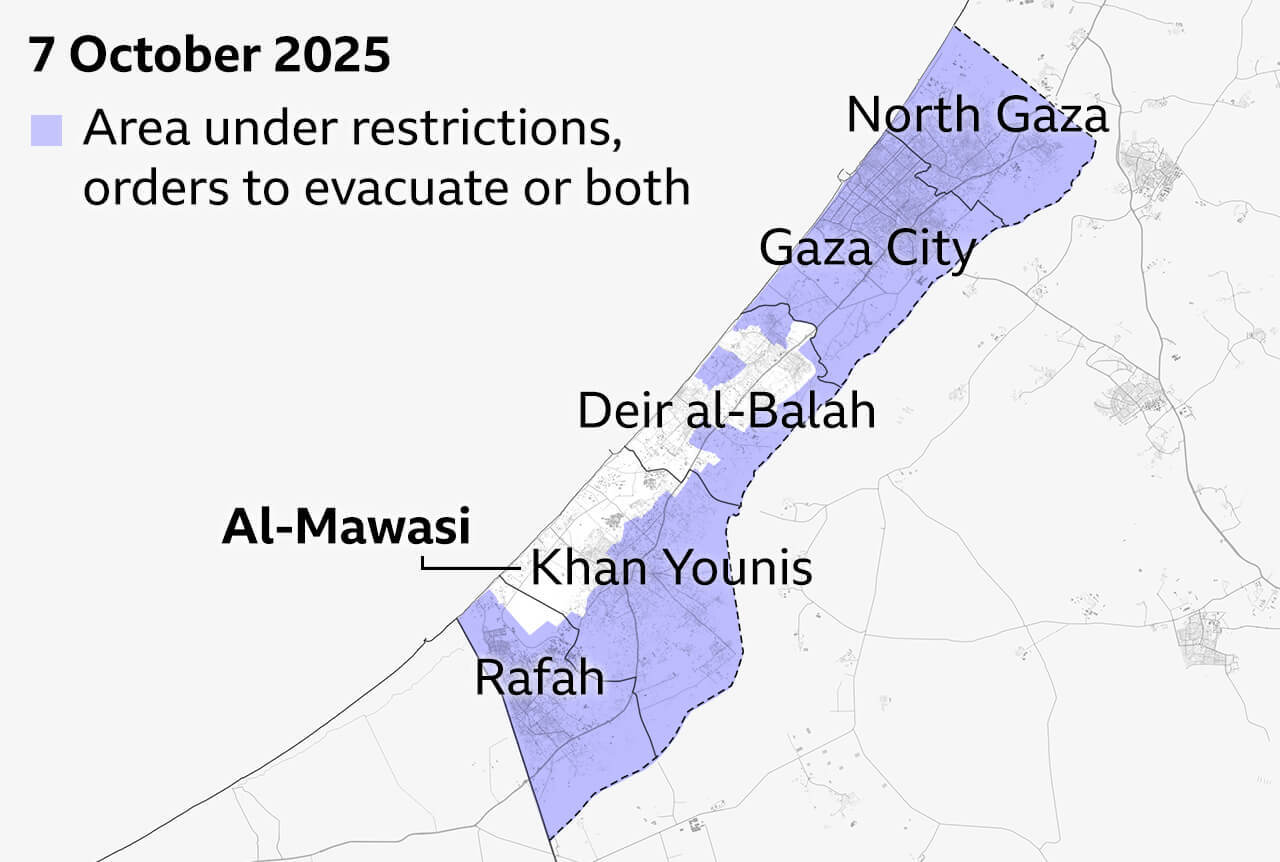
Since then the areas covered by displacement orders and other restrictions have been extended to cover 82% of Gaza, according to the UN.
The first phase of the operation focused on targets in Rafah, Khan Younis and northern Gaza but in August Israel announced plans to capture and occupy all of Gaza City itself - which it has called the “last stronghold” of Hamas.
The city had been the most densely populated part of the territory before the war, with 775,000 people living there.
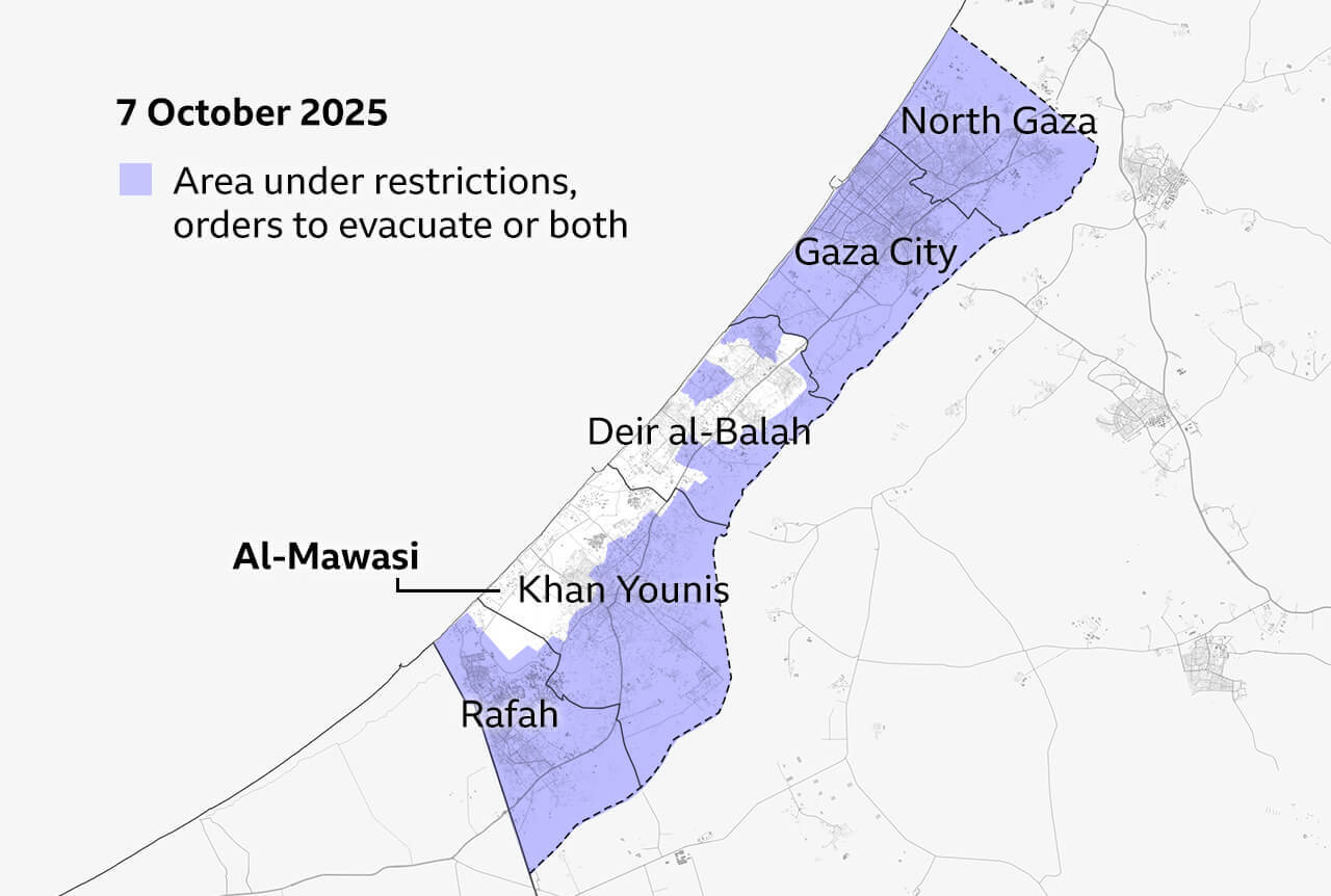
Those who remained there were ordered to move south to al-Mawasi in the south west of the Strip which Israel has designated as a “humanitarian area” - even though it has continued to carry out deadly strikes there and which the UN said was already overcrowded and unsafe.
Hundreds of thousands of residents have so far fled Gaza City, where a famine was confirmed in August 2025 by a UN-backed body.
But hundreds of thousands more remain there in dire humanitarian conditions, with health and other essential services collapsing.
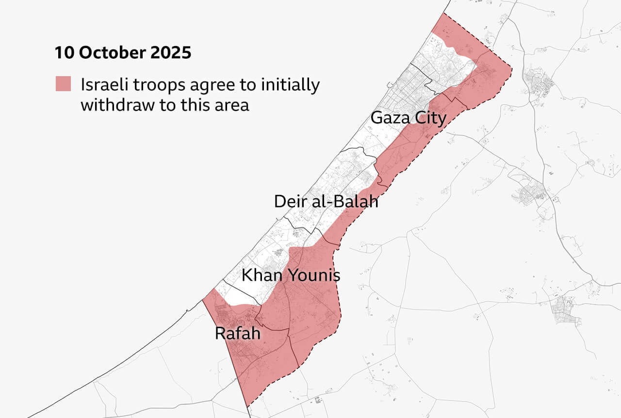
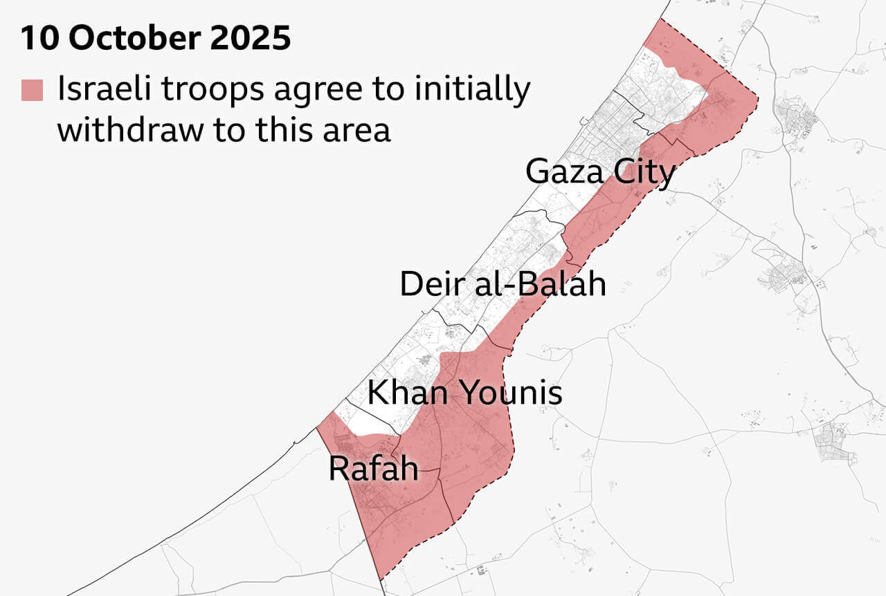
In October, after US President Donald Trump unveiled his 20-point Gaza peace plan, there was a breakthrough in negotiations and Israel and Hamas agreed to the first phase of a ceasefire and hostage release deal, paving the way for an end to the conflict.
Israeli forces agreed to withdraw to an area around the edge of Gaza, that still leaves them in control of about 53% of the territory.
On 13 October, the 20 living hostages being held by Hamas were released. In exchange, about 1,700 Palestinian detainees and about 250 prisoners have been released by Israel.
According to the deal, aid lorries will be allowed to enter Gaza to bring desperately needed aid to the population.
Data and image sources
Damage analysis of Copernicus Sentinel-1 satellite data by Corey Scher of CUNY Graduate Center and Jamon Van Den Hoek of Oregone State University. Map data from OpenStreetMap. Population displacement data from Unrwa. No-go areas and displacement zones from UN Ocha. IDF withdrawal line from Israel Defense Forces. Satellite images from Planet Labs PLC, other images from Getty and Reuters.