Autosub surveys deep ocean floor off Land's End
- Published

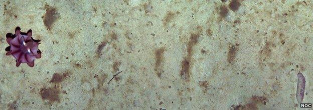
A sample image shows a dumbo octopus (25cm diameter) at top left
A British robotic sub has photographed a vast tract of deep ocean floor some 560km southwest of Land's End.
The images will be stitched together to provide a seamless view of what is happening on the seabed over an area the size of a city.
The 4,800m-deep survey was undertaken by Autosub6000, a vehicle operated by the National Oceanography Centre, external.
It will give scientists the opportunity to study the changing environment on the Porcupine Abyssal Plain.
As well as the pictures, the NOC-led team acquired data on the shape and composition of the seafloor, and took samples of its sediments.

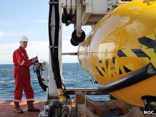
Autosub6000, the National Oceanography Centre's deep diving robot, about to be launched
The researchers want to catalogue the quantity and distribution of marine organisms living in the area.
These include creatures such as sea cucumbers, rattail fish and eels.
The information will then be compared with a repeat survey conducted in a couple of years' time.
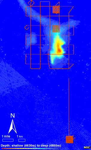
Autosub6000 gathered strips of imagery in an area some 20 km by 7 km.
In total, some half a million photos were taken over a two-week period.
These will be joined together in a continuous image measuring more than 300km in length that criss-crosses the survey target area.
Scientists will interpolate activity in regions not directly pictured.
Their intention is to end up with a kind of "street view" map of the ocean floor.
NOC believes the mosaic will be the biggest, most detailed map of a portion of the abyssal plain ever produced.
Dark depths
The survey is draped over a hill that rises some 250m above the plain.
The expectation is that the amount of biological activity will vary with height on and around the hill.

Autosub criss-crossed an area on the Porcupine plain that includes a 250m-high mound
"We want to try to understand at what scales these differences emerge," explained NOC team leader Dr Henry Ruhl.
"This is the thing that has been possible in landscape ecology for many years with satellites and aerial photos.
"There are all kinds of questions around that, such as 'what are the changes in biodiversity?' and 'what are the changes in carbon processing?'," he told BBC News.
The abyssal plain is dark - no sunlight permeates that deep, and the productivity is consequently very low.
To survive, organisms rely on the constant rain of particulate food material falling from above - phytoplankton, zooplankton and faecal matter.
One hypothesis to be tested is the idea that global warming in the North East Atlantic will reduce the amount of mixing between the top and bottom layers of the ocean, limiting the food supply to marine life on the sea floor.
"If the upper ocean becomes warmer, it will become more buoyant and have a tendency to mix less," said Dr Ruhl.
"That, we believe, will have a percent decline over time in the food coming back down and result in a reduction in the abundance of animals."
The Porcupine Abyssal Plain has been the site of long-term study, and the NOC team believes some of the approaches it has used at the location could now be employed elsewhere.
These applications would include surveying deep water marine protected areas, and assessing the impacts of deep-sea mining and oil and gas exploration.
Jonathan.Amos-INTERNET@bbc.co.uk and follow me on Twitter, external