Falkland farewell for 'Space Ferrari'
- Published
- comments
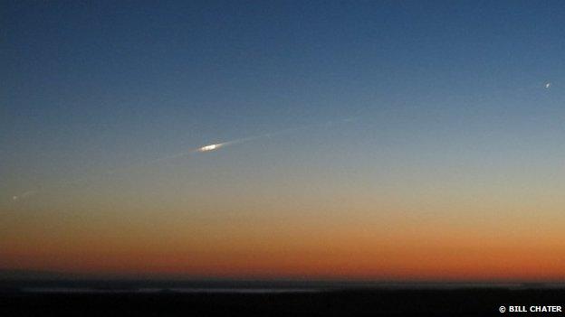
The fragmenting satellite cut a white trail across the sky above the Falkland Islands
The final moments of the Goce satellite were caught on camera as it blazed across the sky above the South Atlantic.
Falkland Islander Bill Chater managed to record the scene as he returned from a day's outing to see penguins.
“We saw what we first thought was a shooting star,” Bill told me.
“It soon became obvious it was the satellite we had heard about on BBC Radio News an hour before.
“It left a long trail of smoke which was bright white in the dark sky, presumably lit by the Sun which we could no longer see.”
Goce's fall to Earth on Sunday night made it the first European Space Agency (Esa) mission to make an uncontrolled re-entry into the atmosphere in more than 25 years.
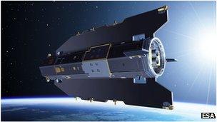
The Italian-built Goce satellite was dubbed the "Ferrari of space"
Esa has looked at the pictures acquired on East Falkland and says they represent - "in all likelihood" - the destructive end of its one-tonne probe.
Dubbed the "Ferrari of space" because of its sleek Italian design, Goce had spent the past four years making precise maps of Earth's gravity.
Its plunge through the atmosphere on Sunday became inevitable once the electric engine it had employed to stay in orbit ran out of fuel.
Tracking systems were deployed to monitor the rapid descent, with a final estimate for the location of the re-entry put close to the tip of South America, just east of Tierra Del Fuego.
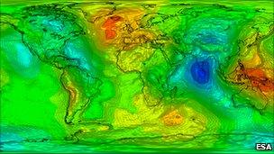
Goce's principal objective was to make maps of the variation in the pull of gravity across the Earth
American military data timed this event to have occurred at 00:16 GMT, or 21:16 local Falkland time - just as Bill, his wife Vicky, and dad, Tony Chater, were making their way home after spending the day with King Penguins.
“We were returning home from Volunteer Point,” says Bill.
“It was just getting dark following a long, spectacular sunset and as we came over Wall Mountain, heading south, we saw what we first thought was a shooting star.
“It was leaving a thick white trail of smoke and split into a couple of bits, before again breaking up into several smaller parts which all flew over our heads and disappeared northwards over Wall Mountain behind us.”
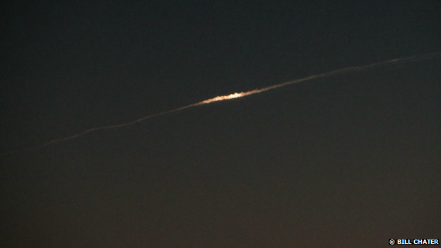
Bill Chater has video of the event
The description of the event fits, as does the location and timing. The direction of the fireballs – moving south to north – also matches what would have been Goce’s death trajectory.
Bill says he has video of the event but cannot share it because of the islands’ slow internet connection.
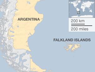
Goce started its descent from an operational altitude of 224km, and took a total of three weeks to fall to Earth.
The thermal and mechanical stresses that ultimately tore the satellite apart would have begun to take hold while it was still 80km from the Earth's surface. Experts had suggested some 200-250kg could have survived all the way down. If they did, these twisted and charred materials are now at the bottom of the Atlantic Ocean.
It was a violent end for one of the most delicate and sensitive space instruments ever built.
Goce’s data lives on, however.
Its exquisite maps of the subtle variations in gravity across the surface of the Earth will influence a diverse array of disciplines - from ocean and climate research to geology and civil engineering.
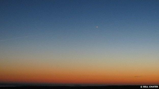
Esa says the pictures show - "in all likelihood" - the destructive end of its one-tonne probe