Hurricane Katrina: UK satellite revisits New Orleans 10 years on
- Published

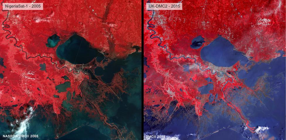
Spend a short while comparing the 2005 image with the 2015 return picture and the areas most affected by flooding will become apparent
When Hurricane Katrina made landfall in the morning hours of 29 August, 2005, it wrought devastation on a huge scale.
To get an overview of what they faced, disaster response coordinators needed satellite imagery, and the first picture to come in was acquired by a British-built, Nigerian-owned platform.
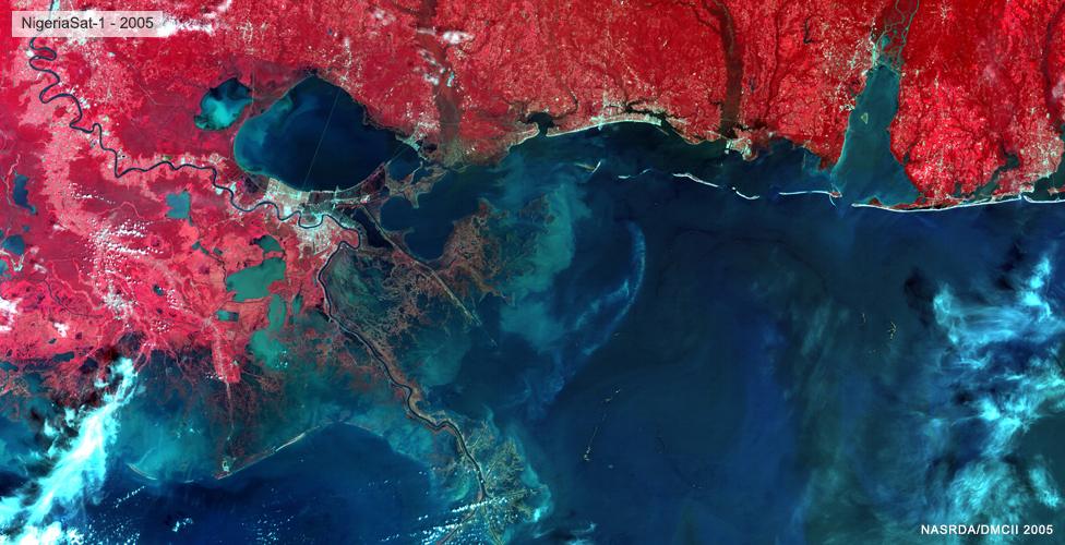
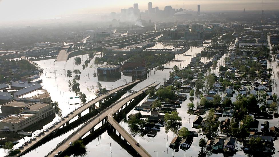
NigeriaSat-1 captured a wide-area image showing where the New Orleans levee system had been overtopped or breached. It laid bare the extent of the flooding in the city and all along the coastline.
NigeriaSat-1, which worked up until 2012, was part of the Disaster Monitoring Constellation, external of Earth-imaging spacecraft managed and operated from Guildford in southern England.
And one of the constellation's current members, called UK-DMC2, has been back to Louisiana and the Gulf region in recent days to take another picture to mark the 10th anniversary of Katrina.
At the resolution permitted on this page, the devastation may not be immediately obvious, but follow the path of the Mississippi River and you can begin to see where the red colour in the 2005 view literally turns a muddy shade, as compared with the 2015 perspective. This is St Bernard Parish, which was hit hard by the storm surge associated with the hurricane.
It is apparent also that the marshes beyond were severely inundated.
The "false" red is traditionally used to colour near-infrared wavelengths in which vegetation stands out particularly well in orbital photos.
Hurricane Katrina, external was the one of deadliest hurricanes to strike the United States in recent times. More than 1,800 people are thought to have lost their lives, and the cost of the damage exceeded $100bn.
Satellites are an invaluable tool in the wake of major natural disasters, be they cyclones, earthquakes, volcanic eruptions, or even bush and forest fires.
Their imagery provides important context for those trying to manage the response to the emergency, and will influence decisions on how best to move resources, such as medical supplies and logistics support, into a trouble spot.
The NigeriaSat-1 spacecraft was a compact imager weighing about 100kg. Built by Surrey Satellite Technology Ltd, external for the African nation, the platform provided multispectral (colour) pictures at a ground resolution of 32m per pixel, in a broad swath some 600km across. UK-DMC2, also assembled by SSTL and launched in 2009, is very similar in size, but has a slightly better resolution, at 22m per pixel.

A slightly wider view of the NigeriaSat-1 image from 2005. Katrina caused problems right around the northern Gulf

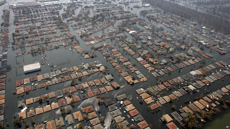
St Bernard Parish: The levee system failed, putting thousands of homes under water
Jonathan.Amos-INTERNET@bbc.co.uk, external and follow me on Twitter: @BBCAmos, external
- Published27 August 2015

- Published31 August 2015

- Published25 August 2015
