El Niño passes its peak while La Niña is possible this year
- Published

El Niño has now reached its peak according to scientists
The El Niño weather phenomenon has reached its peak according to scientists and is set to decline over the next few months.
Researchers say there is a 50:50 chance that it will be replaced by a La Niña event before the end of this summer.
La Niña which involves a cooling of the Pacific Ocean, usually brings wetter conditions to Asia, Africa and Latin America.
These events can typically last twice as long as an El Niño.
Warmest January on record
While the World Meteorological Organisation (WMO) reports that the El Niño event has reached its apex, external, it is still having a significant influence on the global climate.
In combination with human induced warming, global temperatures in January were the hottest, external for the month since records began in 1880. The data also showed the biggest divergence yet seen from the long term record.
"In meteorological terms, this El Niño is now in decline. But we cannot lower our guard as it is still quite strong and in humanitarian and economic terms, its impacts will continue for many months to come," said Petteri Taalas from the WMO.

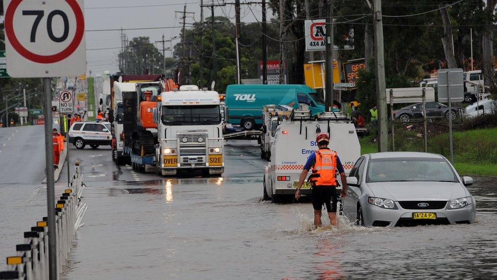
Serious flooding in Australia in 2012 was attributed to La Niña
"Parts of South America and East Africa are still recovering from torrential rains and flooding. The economic and human toll from drought - which by its nature is a slowly developing disaster - is becoming increasingly apparent in southern and the Horn of Africa, central America and a number of other regions," he said.
While the El Niño did bring some relief to drought-hit California, there have been concerns that it has tapered off, external in recent weeks.
But in the wake of El Niño, experts believe there is a good chance that a La Niña will arrive later this year .
"Most models indicate that El Niño will weaken, with a transition to neutral during the late spring or early summer 2016," according to the US Climate Prediction Centre.
"Thereafter, the chance of La Niña conditions increases into the autumn," they concluded.
According to the US National Oceanic and Atmospheric Administration (NOAA, external), there is a 50% chance of a La Niña this summer. They say that there is an 80% chance of it happening by the end of this year.
Not every weather centre is on the same page when it comes to predicting the appearance of the event that's also termed El Viejo (the old one) or the Anti-El Niño .
Australia's Bureau of Meteorology says that, external based on 26 El Niño events since 1900, around half have been followed by a neutral year while 40% have been followed by La Niña. They argue that international climate models right now suggest that there won't be a follow-on La Niña this year.
If forecaster are a little uncertain of the arrive of a La Niña, they are all remaining tight-lipped on the more important question of how powerful it is likely to be.
La Niña often improves fishing conditions in the Pacific Ocean off South America, thanks to the upwelling of cold, nutrient-rich waters.
It is also associated with heavier monsoons in South-East Asia, but it has also caused significant flooding in Australia in the recent past.
Another outstanding question is the impact of climate change on La Niña. A study last year suggested, external that extreme events were much more likely in a warming world.
Follow Matt on Twitter @mattmcgrathbbc, external and on Facebook, external.