Weather forecasting's post-1987 revolution
- Published
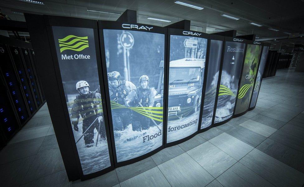
The power of modern supercomputers has been a game-changer
It was a weather forecast that went so disastrously wrong that it led to a television clip becoming globally famous during an airing at the opening ceremony of the 2012 London Olympics.
In the BBC weather studio on 15 October 1987, Michael Fish had drawn on Met Office guidance to dismiss any suggestion that Britain might be struck by a hurricane.
But that very night, great swathes of the country were battered by dangerously fast winds, including a previously unheard of "sting jet" that left as many as 18 people dead, and Michael Fish and his colleagues wondering what had hit them.
Now, as the 30th anniversary of that devastating onslaught approaches, I asked him what ran through his mind on that terrible morning. He replied: "I can't say it on camera."
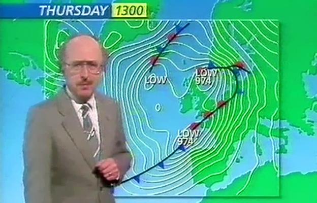
That broadcast: Michael Fish loves it and hates it
Meanwhile, the Met Office, rather than burying its failings back then, is using the opportunity to explain how its forecasts - indeed its whole approach to communicating severe weather - have been transformed.
There are some impressive figures to illustrate the point.
Back on that October day in 1987, the forecasting teams drew on a stream of weather information from satellites, ships and buoys. These observations totalled about 1,200 every 24 hours.
Compare that with the flood of data that pours in now: as many as 215 billion observations every day.
The fleet of satellites has expanded, the capability of each spacecraft has improved immeasurably and the range of measurements they can make has been revolutionised.
Add to that the automatic flows of data beamed in from aircraft, ships and buoys, together with a network of radar stations across the country that can measure rain to previously unheard of accuracies.
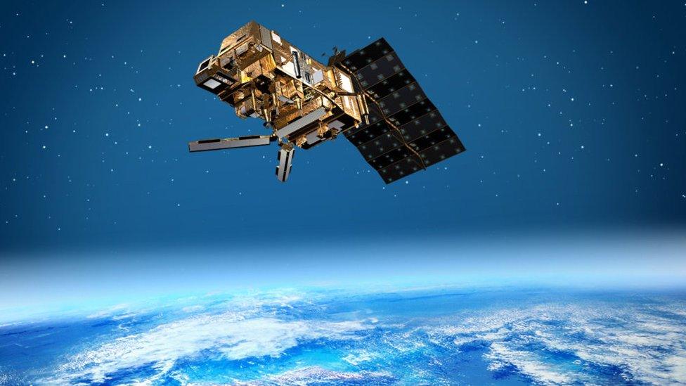
Artwork: There has been a step change in the observations from satellites
But the information is only of use when it's fed into computer models of the weather, to build a detailed 3D picture of what's happening in the atmosphere - and therefore what's likely to happen in the coming hours and days.
That task relies on raw computing power, and back in 1987 the Met Office's computer had a processing capacity that allowed it to make about 4 million calculations a second - very fast for the time.
But that amounted to about one-fifth of the power of an average smartphone, and the latest supercomputer at the Met Office can crunch numbers at a rate of 14,000 trillion a second.
That means the models of the weather can be run and rerun at far greater speeds than 30 years ago - when one or two runs a day was the norm.
Now, the models can not only be run several times a day but they can be compared with up to 50 others managed by other weather centres around the world - generating an "ensemble" of models that produces a spread of possible outcomes of any given weather situation.
And the models themselves have become much more "fine-grained". In 1987, the standard global weather model divided the world into grid squares of 150km - which seriously limited how well the weather could be understood. Now, those squares have sides of just 10km, massively improving the accuracy of any forecasts.
Back in 1987, the forecasters were doing the best they could but things went seriously awry. A Met Office analysis tried to explain why.
The computer model had originally suggested that the storm might head Britain's way, which led to a warning of a period of "wet and windy spells", soon to be regarded as a massive understatement. But the computer - "God", according to Michael Fish - then indicated that the storm would veer south towards France.
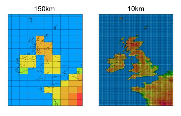
The global models then and now: Resolution today is on a finer scale
In the event, fuelled by warm tropical air flowing unusually from the south, the storm was passing over the Bay of Biscay which was only sparsely monitored by ships and buoys - the lack of data would prove fatal.
And to make matters worse, the latest batch of data, meagre though it was, arrived too late to be fed into the most detailed of the computer models that was being prepared as the storm advanced.
On top of all that, the particular structure of the storm allowed it to develop a vicious feature that had never been observed before - what became known as a "sting jet", a 50km-wide blast of extremely fast wind.
Along the English south coast, the gusts were so strong that the anemometer measuring their speed at Shoreham recorded 115mph - and then broke. Even now, Met Office experts have no idea how rapid the winds actually became.
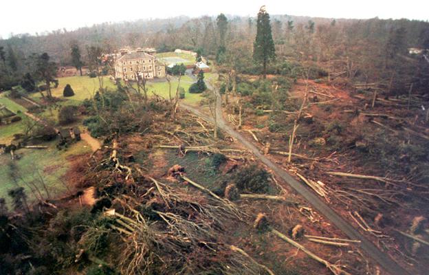
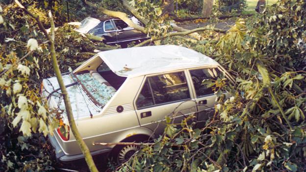
This storm, that might be expected only once every 200 years, struck trees that were in full leaf and standing on sodden ground which made them far more vulnerable to being blown over. In all, 15 million trees were lost.
Ken Mylne, a senior weather forecaster at the Met Office, said that even now the same storm would be "difficult to forecast" in detail but the broad outlines would be clearer.
"We can now estimate the uncertainty in real time and we can communicate the level of risk so the chance of being caught out would be much, much less."
After the storm, the Met Office set up a severe weather warning service and later introduced a system that highlights the likelihood of a range of possible impacts, emphasised by a colour code.
Long before approaching British shores, a rerun of the 1987 storm would be assigned a name. "Storm Michael", one Met Office official quipped.
So, the last word should go Michael Fish himself. He points to the dramatic improvements in technology to say that forecasters have a much easier time these days.
But what are his thoughts about that infamous forecast?
"I have some love and affection for it and I have a lot of hate for it as well. If I had a penny for every time that it's been played I'd be a multimillionaire by now."