How Greenland scorched its underside
- Published
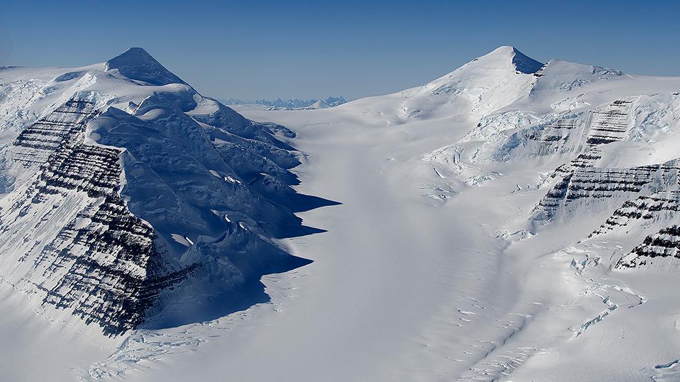
Greenland moved towards the Arctic as the Atlantic Ocean opened up
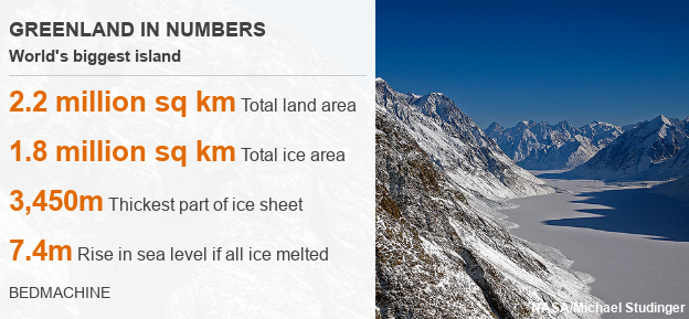
Greenland has been hiding a secret underneath its 3km-thick ice sheet.
From its northwest corner to its southeast coast, the world's biggest island has a band of relatively warm bedrock.
Scientists say this confirms Greenland ran over a hotspot of upwelling molten rock tens of millions of years ago as it shifted towards the Arctic.
It's like the underside of the island got a good roasting in the distant past and still has the big scar to prove it.
That hotspot, by the way, is the one which today is building Iceland in the middle of the North Atlantic.
The plume of broiling rock rising from deep inside the Earth has broken through the thin ocean floor at Iceland's location and is now creating new land with regular eruptions of lava.
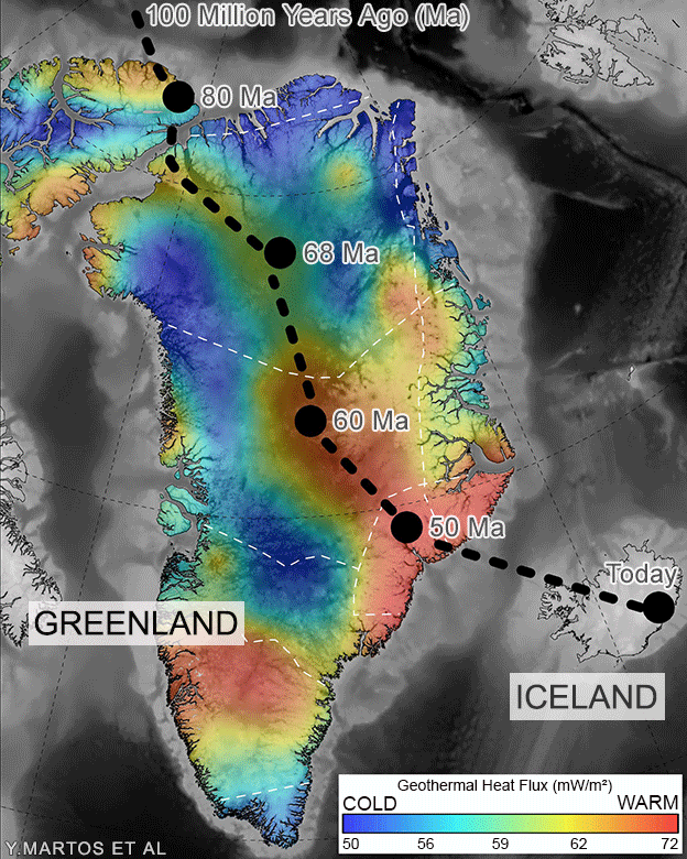
The heat map records Greenland's passage over the Iceland hotspot
A band of relatively warm rock runs from the island's NW to its SE
It took tens of millions of years for Greenland to complete the journey
Eventually, the warmer rocks will cool to match their surroundings
Today, Iceland is being built at the site of hot, upwelling material

Greenland's warm NW-SE band is reported by a team of researchers led by the US space agency (Nasa) and the British Antarctic Survey (BAS).
Their new map of "geothermal heat flux" is essentially a picture of the variation in warmth escaping from the Earth's interior. It's the most detailed ever produced for the region and is reported in the journal Geophysical Research Letters, external.
Why does this matter?
Two major reasons. First, it tells us about how the outer skin of the Earth - its network of tectonic plates - has shuffled around over time.
Scientists still debate the precise details of when and how America and Europe drifted apart during the opening of the Atlantic. It was thought that Greenland ran over the Iceland hotspot; we now have a better idea of the track it took.
Secondly, the map will help us assess the future of Greenland's ice sheet.
After Antarctica, this is the next largest store of frozen water on the planet - and it is melting - losing some 280 billion tonnes to the ocean every year. Sea-levels are rising globally as a result.
Climate change scenarios suggest further, accelerated melting. But the stability of the ice depends in part on the bedrock's temperature. The warmer the base, the easier it is for the ice above to move.
Computer models must take the heat flux into account when they try to project what will happen in the decades and centuries ahead.
How was the discovery made?
Because Greenland is covered by hundreds of metres of ice, it's extremely difficult to get access to the bedrock to calculate heat flux.
Boreholes have been drilled through the ice to record deep temperature data, but these drill sites are very sparse. Instead, the researchers will rely on indirect methods, and their most fruitful approach is to analyse the magnetism of rocks.
This property can be sensed by instruments flown by planes above the surface of the ice sheet. What happens next is really smart.
Scientists know the temperature at which hot minerals lose their magnetism. It's called the Curie temperature and it occurs at 580C.
The researchers will gauge how close this happens to where the rock meets the ice. The closer the Curie depth is to the boundary, the higher the heat flux.
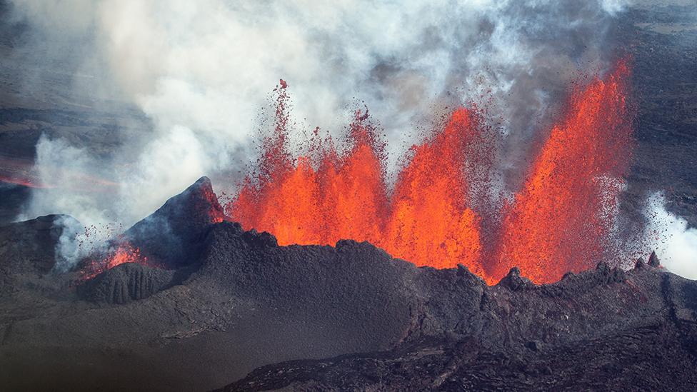
The hotspot has since broken through the ocean crust to build Iceland
How unexpected was the finding?
Greenland is a collection of old bits of continent that came together over a billion years ago.
Geologists call it a craton - a stable region of crust that is not undergoing major activity. It's not being stretched, split apart or squashed.
As such, Greenland's rockbed should not show much variation in temperature.
"We expected things to be uniform," explained the study's first author Dr Yasmina Martos from Nasa's Goddard Space Flight Center.
"But when we saw this track crossing Greenland, we thought, 'wow - this means something'," she told BBC News.
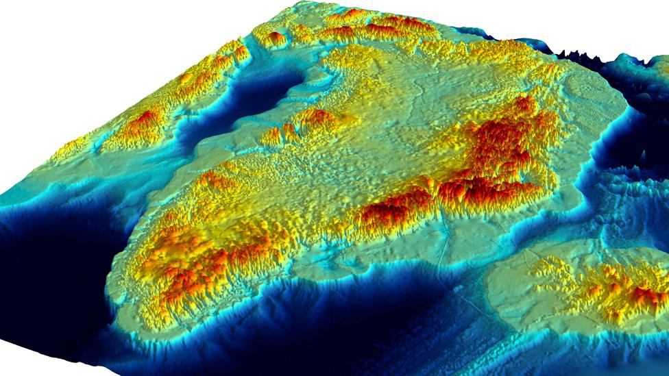
Insights on the past and future: A visualisation of Greenland without its ice covering
What else supports the hotspot idea?
Just seeing a track of warmth does not of itself prove Greenland ran across a rising plume of material.
But the scientists theorised that if it had then some magma should also have been accreted to the base of the continental crust that makes up the island. It's called under-plating.
And that's indeed what the team found when they examined gravity and seismic data - there is a wedge of dense material that aligns with the warm track.
"If you move a sheet of paper over a candle you get a scorch mark on the paper," said Dr Tom Jordan from BAS.
"The residual warmth along that line in the paper is like the hotspot trail we see in Greenland.
"And the soot mark on the underside of the paper would be like the under-plating that is burnt on to the bottom of the craton and which we can detect from the gravity and seismic signals."
Jonathan.Amos-INTERNET@bbc.co.uk, external and follow me on Twitter: @BBCAmos, external
- Published14 December 2017

- Published13 November 2017

- Published2 October 2017