Should the hurricane season begin earlier?
- Published

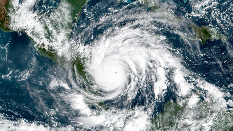
A satellite image of Hurricane Iota on 16 November 2020
The Atlantic hurricane season officially begins on 1 June. But over the past six years, significant storms have been forming earlier than this. So does the hurricane season need to start earlier - and is climate change to blame?
At a regional meeting of the World Meteorological Organization (WMO) this week, meteorologists and officials will be discussing a possible change to how the hurricane season is defined.
"The 2020 hurricane season was one of the most challenging in the 40-year history of [the] WMO's Tropical Cyclone Programme," says WMO Secretary-General Prof Petteri Taalas.
"The record number of hurricanes combined with Covid-19 to create, literally, the perfect storm."
The hurricane season has officially started on the 1 June since the mid-1960s, when hurricane reconnaissance planes would start routine trips into the Atlantic to spot storm development.
Over the past 10 to 15 years, though, named storms have formed prior to the official start about 50% of the time.
And the way they are defined and observed has changed significantly over time.
"Many of these storms are short-lived systems that are now being identified because of better monitoring and policy changes that now name sub-tropical storms," Dennis Feltgen, meteorologist at the US National Hurricane Center (NHC) told BBC Weather.
The 2020 Atlantic hurricane season was the most active on record with a total of 30 named storms. Two of those storms - Arthur and Bertha - formed in May.

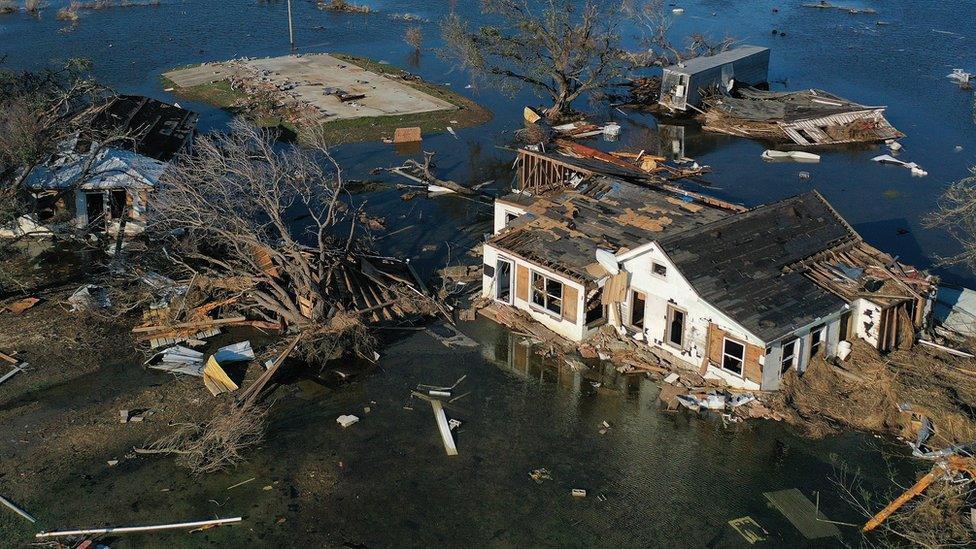
Flood waters from Hurricane Delta surround structures damaged by a previous storm, Hurricane Laura, in Louisiana during October 2020
As all the pre-determined names were used up, officials at the NHC had to move on to using the Greek alphabet for only the second time.
During the 2020 season, the NHC had to issue thirty-six "special" forecasts called Tropical Weather Outlooks prior to 1 June. These highlight areas in the Atlantic where meteorologists monitor activity.
Mr Feltgen said that "in order to provide more consistent information for late May and early June systems, NHC will begin to issue these outlooks routinely from 15 May this year".
Is this a step closer to officially recognising the season starting earlier?

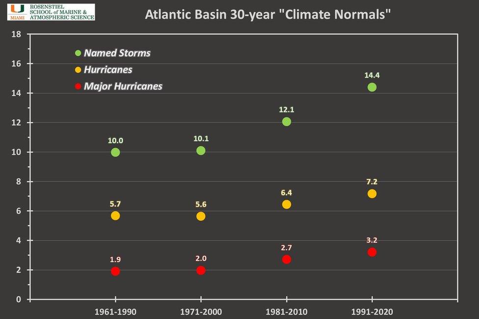
Graph showing the average numbers of named storms, hurricanes and major hurricanes in each 30-year climate average period
"Discussions will need to be made on the need for, and potential ramifications of moving the beginning of the hurricane season to 15th May."
When referring to the average or normal Atlantic hurricane season, meteorologists have used a 30-year climate average from 1981-2010.
But we now have a new climate period of 1991-2020 to consider and this dramatically increases what we should now consider "normal".
Data will be discussed and finalised by the National Oceanographic and Atmospheric Administration (Noaa) in May, ahead of the new season.
But data provided by Brian McNoldy, senior researcher at the University of Miami's Rosenstiel School, shows a 12-19% increase in named storms, hurricanes and major hurricanes.
Is climate change playing a role?
The number of named storms has increased over the decades, but there is no real evidence this is the result of a warming world.
Dr McNoldy notes "the big shift in counts is simply that there were several inactive seasons from 1981-1990 and several active seasons from 2011-2020".
"Once that inactive period drops out of the average, and is replaced by the active, it will increase the numbers"
The overall increase from 1961 is also likely to be due to better technology, along with observations over the Atlantic Ocean.
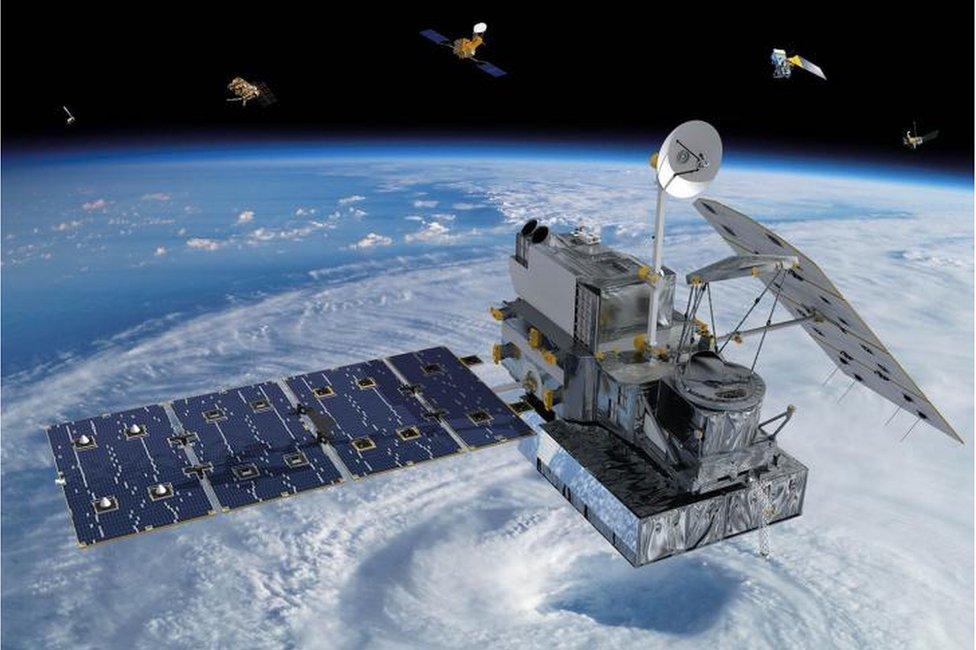
Since satellites came along in the 1980s, we can spot and monitor the development of tropical cyclones and name them when they meet the threshold.

Artwork: Weather monitoring satellites
We are simply able to record more.
However, it is thought climate change is having an impact on the intensity of tropical storms and hurricanes and therefore their potential impacts.
Experts have noted that, in recent years, tropical storms that make land are persisting far longer and doing more damage than in the past.
In a warming world, the atmosphere can hold more water and therefore has the ability to bring more extreme rainfall. With sea-levels rising, storms will also bring more flooding to low-lying areas.
Hurricane Harvey brought record rainfall in Houston, Texas, in 2017 when it dumped 127 billion tonnes of water and Dorian flooded large parts of Grand Bahama in 2019.