China GPS rival Beidou starts offering navigation data
- Published

China plans to launch a further 25 satellites to extend the reach of its navigation service
China's satellite navigation system has become operational, according to an official.
Beidou now offered location, timing and navigation data to China and surrounding areas,announced the project's spokesman Ran Cheng, external.
China has been working on the system since 2000 to provide an alternative to the US government-run Global Positioning System (GPS).
The move should make China's military less dependent on foreign technology.
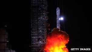
A launch earlier this month delivered the 10th of Beidou's satellites into orbit.
Beijing plans to send a further six satellites into space by 2012 to extend the system to most parts of Asia, and then expand the network to a total of 35 satellites offering global coverage by 2020.
Interested parties are invited to study a test version of the project'sInterface Control Document, external, which has been placed online
Missile guidance
Beidou - which translates as the Plough, or Big Dipper - promises to offer civilian users positioning information correct to the nearest 10m, measure speeds within 0.2m per second, and provide clock synchronisation signals accurate to 0.02 millionths of a second.
The Chinese military will be able to obtain more accurate data.
A 2004 study by Geoffrey Forden, a researcher at the Massachusetts Institute of Technology, US, suggested that Beidou could be used totarget cruise missiles against Taiwan, externalif a war broke out over the territory. Having its own system would protect China against the risk that the US could turn GPS off.
A 2011 report for the website defensepolicy.org suggested the network could also be used toguide drones to destroy foreign naval forces, externalwere China to come under attack.
However, Beidou's developers also stress day-to-day benefits for the public.
They told China Daily that the system could create a400 billion yuan ($63.2bn, £40.4bn) market, externalin related applications for the automotive, telecommunications, fishing and other industries by 2020.

The European Union's Galileo system aims to offer a partial service within the next few years
Alternative systems
Mr Ran also noted that the system is compatible and interoperable with the world's other navigation systems.
Beyond GPS, Russia operates the Glonass network. It recently launched a series of satellites to cover gaps in its system and reported earlier this month that it once againcovered 100% of the Earth's surface, external.
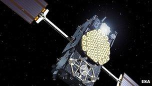
The EU is also developing its own system - Galileo.The first of its operational satellites entered orbit in October, external. The European Space Agency said the network should be completed in 2019.
Meanwhile, American defence developer Lockheed Martin is working toupgrade the US's system to GPS III, external.
The firm has begun constructing a prototype next-generation satellite in a facility near Denver.
The US Air Force said the new system would have more power, making it harder for enemies to jam it, and allowing the signals to penetrate deeper into built up cities and dense foliage.
The Congressional Budget Office has estimated that the project will cost $25bn by 2025.