Cutting-edge methods in search for flight MH370
- Published

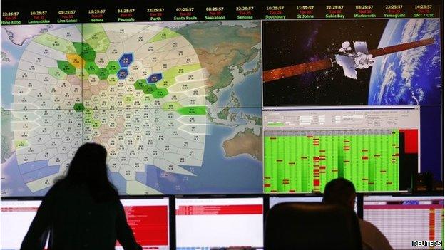
British firm Inmarsat compared data sent back from flight MH370 with similar aircraft
The British satellite telecommunications company Inmarsat has now pretty much confirmed what the world had feared - that Malaysia Airlines flight MH370 was surely lost in the southern Indian Ocean, south-west of Australia.
The satellite operator was receiving hourly "pings" from equipment on board the plane for at least five hours after the aircraft left Malaysian airspace.
Initially, these pings - which were essentially just "I'm switched on" messages - were used to plot two broad arcs, indicating a possible position at last transmission, and therefore a direction of travel - one going to the north, the other heading south.
A northerly route for the plane always looked doubtful because it would have taken the aircraft towards countries with sophisticated air-defence systems. The chances of it avoiding detection seemed slim.
But after reviewing all of its flight MH370 data, Inmarsat is now confident the southern arc contained the true course.
Doppler effect
The company examined the frequency spectrum of the ping transmissions and how they differed from pings emitted by other Boeing 777 flights.
This allowed engineers to model how the frequency might change very slightly as a plane travels through the sky.
This is the famous Doppler effect, which acts to "stretch" or "compress" radio waves emanating from moving objects. With a moving police car, the equivalent sound effect is to change the pitch of the siren.
The analysis is cutting-edge and has never been done before, but it has enabled Inmarsat's engineers to confirm that the southerly arc intersected the path taken by flight MH370.
The analysis tells us nothing about the final location of the ill-fated plane. It tells us nothing about any changes in altitude that the plane flew, other than it was airborne.
Neither does it tell us about its speed or its fuel capacity at the times of those pings. All this technique really does at the moment is tell us that the plane was moving one way rather than the other.

All that said, if certain assumptions are made about cruising speed, it is possible to narrow the likely zone of ocean over which the plane sent its seventh and last satellite connection. The UK's Air Accidents Investigation Branch (AAIB) has issued a map showing two different tracks - one for a constant speed of 450 knots; the other for 400 knots.
One has to remember that no-one knows how long the plane continued powered flight after the seventh ping, and it would likely have glided for a distance even after running out of fuel.
But the stomach-churning realisation that follows from the Inmarsat analysis is that the plane was moving far away from any landing possibility. The only conclusion can be that it did indeed eventually crash in the ocean.
Analysts will continue to probe the available data. Specifically, they are trying to understand the seventh ping - a partial connection - received just a few minutes after the sixth contact. What it means is uncertain. Possible explanations include technical glitches, power surges - it's all speculation at the moment. What is a puzzle is that a normal ping would not have been expected for nearly an hour.
People have asked whether the Inmarsat analysis is reliable, and the Chinese have demanded to examine all of the data themselves. But the London company's work has been checked by other satellite industry experts. There's high confidence the conclusions are robust.
Right 'haystack'
At least now search planes and ships know they are likely looking in the right "haystack", even if it is still a huge one.
But there is urgency. A lot of time has elapsed between the loss of the plane and confirmation that it surely fell into the southern Indian Ocean.
The priority is to get ships into the area to retrieve purported debris items, to help narrow the zone of the probable impact.
The flight recorders from flight MH370 will be close to that location, albeit about 3,500m down.
The batteries on these "black boxes" have perhaps a 30-day lifetime, meaning they will continue to ping their existence to searchers overhead for only a limited period.
When the batteries go flat, we move into a much more difficult phase - that of using remotely operated vehicles to actively look for the devices.
'Remoteness of area'
"The data on them should last for many years. We saw with Air France flight 447 that the black boxes were recovered two years after the fact, and the French were able to pull all the data off them," said Van Gurley from the Metron company, which took part in the search for flight 447.
"In this region of the Indian Ocean, the bottom is about two miles down. There are a number of technologies - sonar sleds and robotic vehicles - that can access that depth.
"The problem is the remoteness of the area because those robotic vehicles need a support ship and a support ship needs to occasionally go [into port] for fuel, water and food.
"So, given that the search area is 1,500 miles off Perth, just keeping ships on station for an extended period of time will be very challenging."
And Simon Boxall, an oceanographer at the University of Southampton, added: "We don't have very good maps of this region. It hasn't been surveyed much in the past.
"It doesn't have a strong interest in terms of the resources on the seabed. We've probably got better maps of the Moon's surface than this part of the seabed."