UK floods: Before and after images along the Thames
- Published
Wet weather continues to cause misery for homeowners across parts of the UK, leaving hundreds of properties flooded. The Environment Agency says more than 2,000 more properties are at risk.
A number of flood warnings are in place across Somerset, Berkshire and Surrey. Towns and villages along the River Thames have been inundated and water levels are expected to rise further.
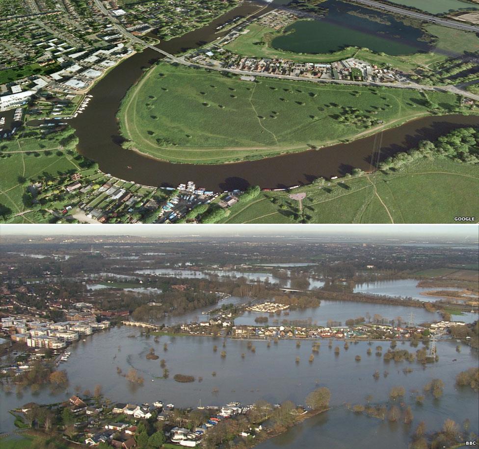
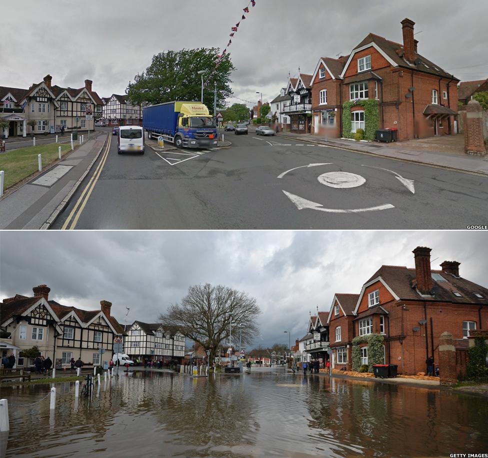
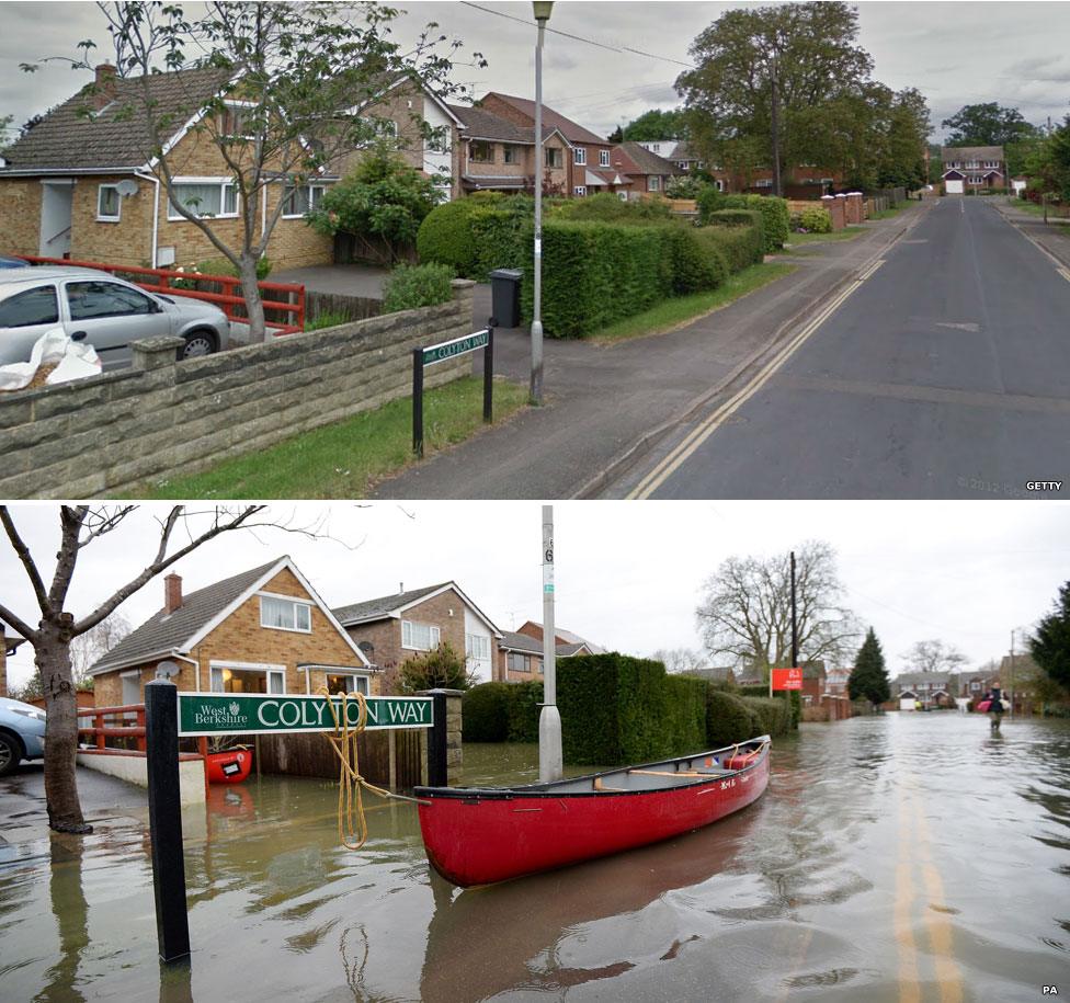
Aerial imagery and photographs from before and after the floods show the extent of the devastation caused.
Chertsey, Surrey

Around 1,000 properties have been reported as flooded in the past week, including 800 along the Thames. Chertsey, on the banks of the river, is among the areas that are currently the focus of Environment Agency and emergency services' operations.
Datchet, Berkshire

One of the worst-hit areas along the Thames is the village of Datchet in Berkshire. The water is knee-deep in places and homes and businesses have been flooded.

Purley on Thames, Berkshire

Also affected is Purley on Thames in Berkshire. The village was also hit by floods in January.
Eton, Berkshire

The Thames has burst its banks in Eton, Berkshire, and swans now swim where motorists usually drive. A number of roads are closed and there are no trains running between Staines and Windsor & Eton Riverside.