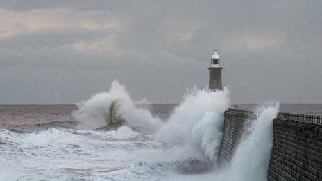
'Weather bomb' hits power and travel in northern UK
- Published
Correspondents assess the impact of the storm in Scotland, Northern Ireland and Blackpool
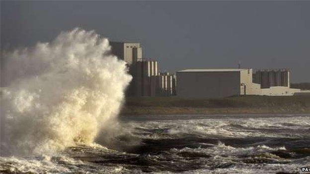
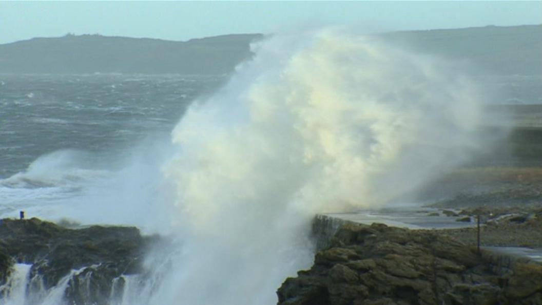
High winds and huge waves have affected north-western parts of the UK as bad weather hit power supplies and travel.
The "weather bomb" brought hundreds of lightning strikes, temporarily cutting power across the Western Isles.
Energy firm SSE said it had managed to reconnect 28,000 homes that had their supply cut, but 2,800 are still without power.
A wind speed of 144mph was recorded on the remote St Kilda islands, with gusts in excess of 80mph elsewhere.
A Met Office amber warning to "be prepared" for parts of Scotland and Northern Ireland was downgraded to yellow - "be aware" - at 18:00.
BBC Scotland correspondent Laura Bicker said the Western Isles and Northern Isles had "borne the brunt" of the storm's force and travel restrictions remained in place.
Explosive cyclogenesis - known colloquially as a "weather bomb" - is when a storm intensifies as the pressure at its centre drops rapidly (by more than 24 millibars in 24 hours).
The storm currently affecting parts of the UK formed in this way.
Video shows huge waves crashing on the coast around the Orkney Islands as a "weather bomb" hits Scotland
Speaking from Barra in the Outer Hebrides, Donald MacLeod, coxswain of the island's lifeboat, said there was rain, hail and "plenty of wind".
He said the storm had "grown through the night" on Tuesday, adding: "The swell conditions are pretty bad to the west - it's showing about 14m (45ft)."
Mr Macleod said this was "a lot deeper than we normally see" and was "definitely something to be wary of".
Power supplier Scottish and Southern Energy said the problem affecting the Western Isles was caused by lightning, but electricity has been restored to most homes, external.
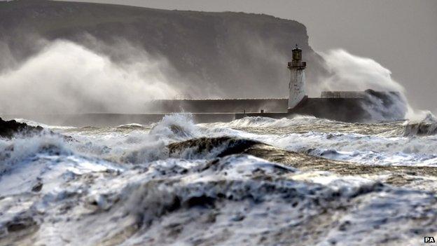
North-west England was also hit by high waves, as seen here at Whitehaven in Cumbria
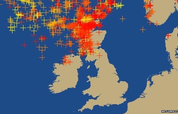
Lightning over 24 hours from 09:30 GMT on Tuesday, with darker colours showing more recent strikes
Earlier, Western Isles Council said all schools and nurseries would be closed, external, along with many other facilities. Many schools in the Highlands were also closed, external.
In Aberdeenshire, about 20 vehicles got stuck in icy conditions on the B974 Banchory to Fettercairn road. A gritter was sent and the vehicles were later freed.
Ahead of the forecast storms, ferry operator Caledonian MacBrayne warned of severe disruption to its services.
In other developments:
The Stromness lifeboat escorted a Spanish fishing boat to safety after it was hit by a large wave off Orkney
Stena Line services from Cairnryan to Belfast were cancelled after a ferry collided with part of the south-west Scotland terminal
Irish Ferries cancelled some services, external between Holyhead and Dublin
P&O's services, external between Larne and Cairnryan had delays of at least two hours
Stornoway Coastguard, external said the sea state could become "phenomenal", a term used to describe the worst conditions
Northern Ireland Electricity warned of a possibility of damage, external to the network in exposed areas, with its emergency crews and engineers put on standby
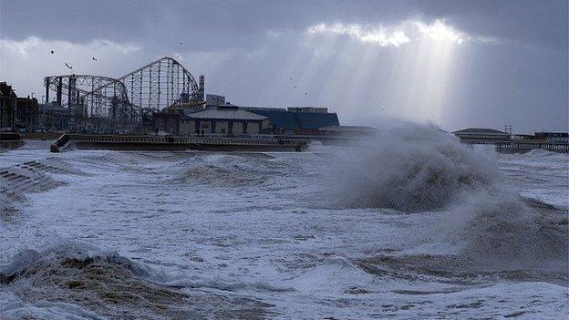
High waves crash onto the promenade in Blackpool
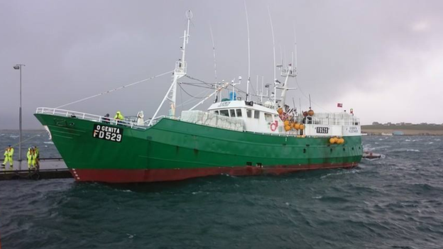
A Spanish trawler was escorted to safety by a lifeboat after being hit by a large wave off Orkney

How common are weather bombs?
What is a weather bomb? BBC weather's Peter Gibbs explains
Weather bombs happen fairly regularly.
There are usually several each year and they are more common in winter.
They are more likely to happen when the jet stream is strong.
Whether the weather bomb has an impact on the UK depends on where it happens.
In this case, according to BBC Weather's John Hammond, the problem is not so much the wind, but the colossal waves which have formed out at sea and are now moving towards UK coasts.

The Met Office's yellow "be aware" warning, external is in effect for Scotland and Northern Ireland, as well as north Wales and northern England.
Numerous flood warnings and alerts have also been issued, mostly in Scotland.
Richard Brown, of the Scottish Environment Protection Agency, said Caithness, Sutherland, the Western Isles, Orkney and Shetland were at the greatest risk of coastal flooding.
Argyll and Bute, the Firth of Clyde, Clyde estuary and Dumfries and Galloway could also be affected, he said.
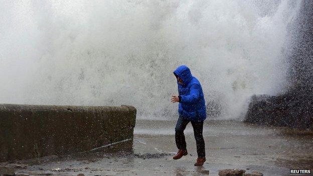
The ferocity of the waves took some bystanders by surprise in Portstewart
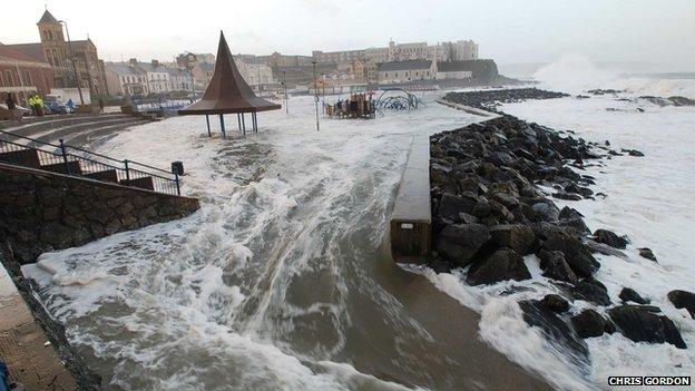
Water poured over the sea defences at Portstewart
Gusts of more than 60mph (95km/h) have been recorded in Northern Ireland, where the speed limit on the Foyle Bridge in Derry has been reduced to 30mph.
A second storm front is expected to track across the country overnight on Thursday, the Met Office said.
It said there could be gales and a band of heavy rain across much of England and Wales during the first half of Friday, which could then push eastwards before easing in the early afternoon.
Network Rail said some train services in Scotland were cancelled due to the weather, external.
ScotRail said a "limited service is running on some lines".

Height of the waves
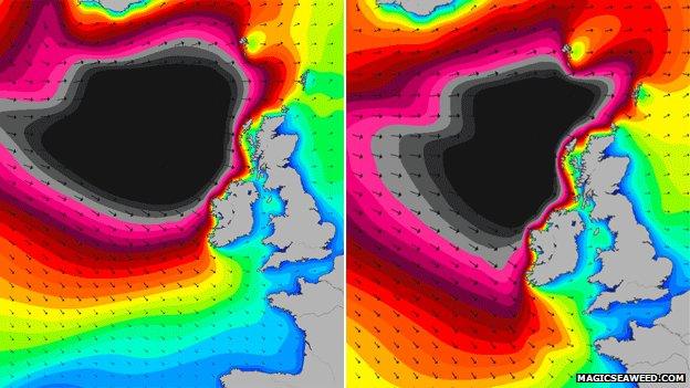
Surf forecast Magicseaweed.com produced a chart predicting the movement of swells from 06:00 to 15:00
The different colours in this chart represent different wave heights: black the highest at 48ft above a calm sea level and blue the lowest at two feet.
From the BBC:
Elsewhere:
- Published11 December 2014
- Published10 December 2014
- Published9 December 2014
