Bomber Command maps reveal extent of German destruction
- Published
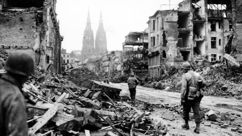
US troops advance through a destroyed Cologne in March 1945. Its cathedral, which was damaged but survived, can be seen in the background
The scale of devastation wreaked on Germany by RAF Bomber Command in World War Two has been revealed in detail in rare maps, published for the first time.
The bomb damage diagrams are aerial photographs of Berlin, Cologne and Dresden, overlaid with coloured areas indicating how much damage was caused by the strategic bombing campaign.
They were included in the campaign's so-called Blue Books - used as propaganda to justify the bombing raids.
The maps, held in the Imperial War Museum's archives, have been collated by military cartography historian Peter Chasseaud.
On the following four maps, colour coding is used:
Dark blue - area destroyed or badly damaged
Red outline - area fully built up
Green outline - area is 40-70% residential
Black outline - industrial areas
Numbers are used to mark buildings of interest like key factories, German ministries and the Gestapo headquarters.
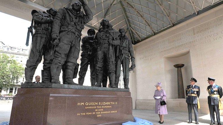
Almost half of the 125,000 Bomber Command lost their lives, and their military commanders' policy of large-scale area bombing near the end of the war has long drawn criticism.
The young volunteers of Bomber Command destroyed German cities with several "thousand-bomber raids", killing between 300,000 and 600,000 civilians.

Cologne
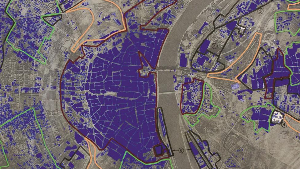
This aerial image of Cologne is from November 1944. The area to the west of the river, almost all coloured in dark blue, indicates the city centre.
Cologne had been the target of Britain's first "thousand bomber raid" on 30 May 1942.
"By this point, Cologne had been bombed many times," said Dr Chasseaud. "This image shows the result of many raids."
Studying the aerial photographs showed how much of the city had been destroyed - for example, if a shadow could be seen inside a wall, that meant its roof had collapsed.
Showing the most densely populated areas also indicated potential future targets.
Berlin
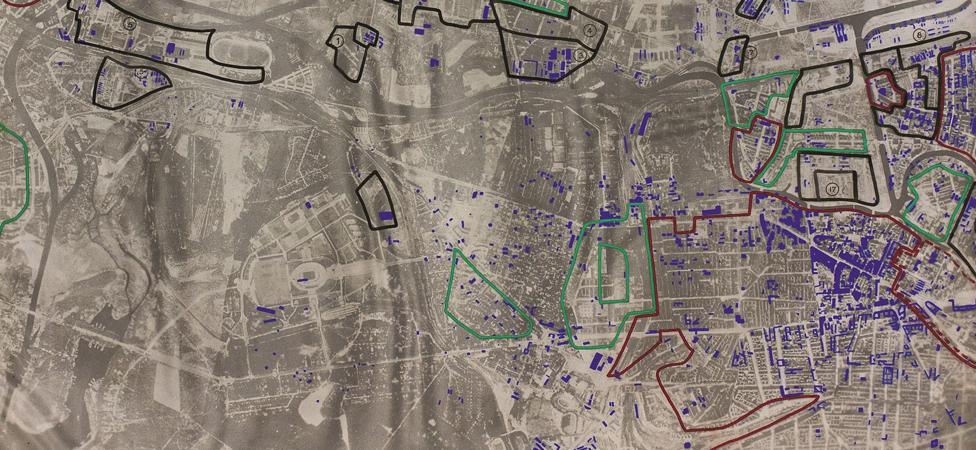
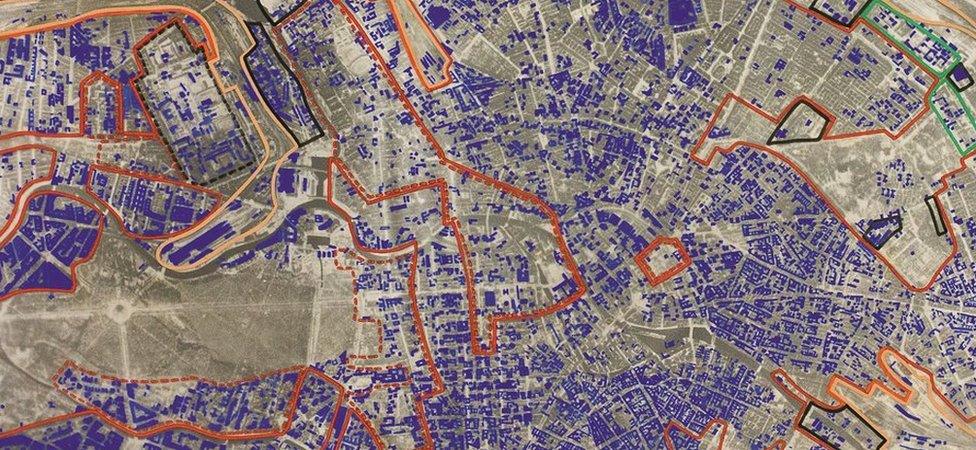
The two images of Berlin show how much the city had suffered during World War Two.
The first shows north west Berlin in December 1943, with the second image depicting north east Berlin in March 1945.
The raids - carried out by the United States Army Air Forces by day and the RAF at night - had become increasingly destructive from 1943 onwards.
Dresden
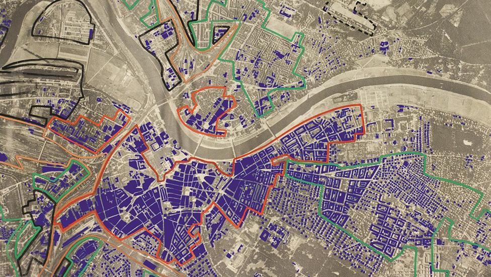
This Blue Book image shows Dresden in March 1945, just months before the end of the war. The city centre can be seen south of the river - largely in blue.
Dresden had been heavily raided the previous month, on 13 and 14 February, with more than 1,000 planes involved.
Some 25,000 people were killed in a firestorm and 75,000 of its 220,000 homes were destroyed.

British fire hazard maps, which show the areas of Berlin and Hamburg most susceptible to fire, are also being published for the first time.
Hamburg
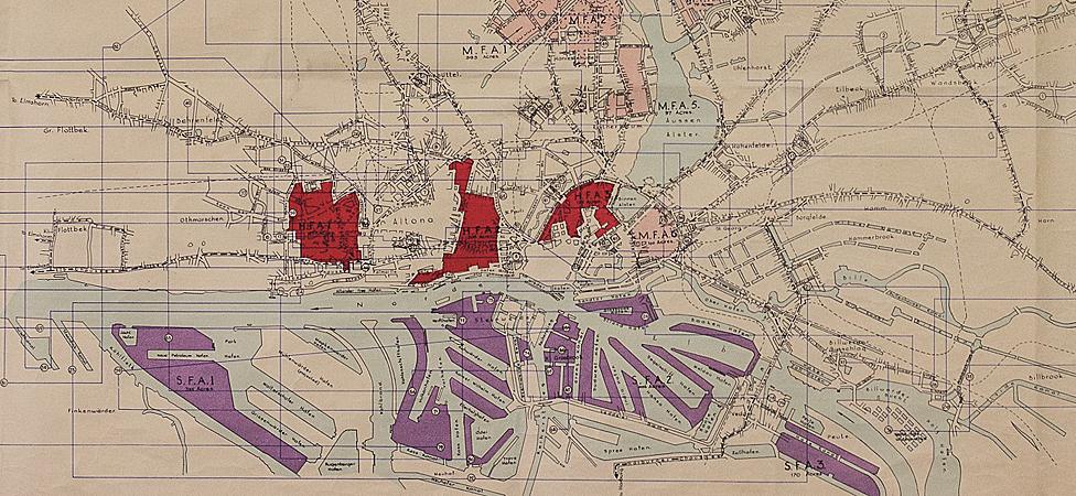
This 1944 map of Hamburg was produced to show which areas of the city would burn the most easily, said Dr Chasseaud.
The fire hazard maps are coded red, for areas of high flammability, pink, for areas of medium flammability and purple, showing industrial areas and docklands.
Areas that have already been destroyed are left blank and again, numbers are used to mark buildings of special interest.
Fire hazard map - Berlin
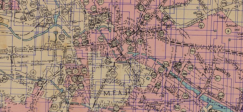
There are fewer areas in red on the Berlin fire hazard map, dating back to 1944, as it wasn't considered as easy to burn as some other cities, like Hamburg (above), said Dr Chasseaud.
This is because it wasn't a medieval wooden city, its buildings were not as close together and the centre of the city was more spacious than some others.

Dr Chasseaud explained: "I think it's important that maps like these, showing a very controversial episode from the war, notably the strategic bombing campaign, are in the open.
"There was a lot of opposition to the strategic bombing of Germany and debates fought in Parliament, and it's worth remembering that even during the war, people were speaking out against government policy and 'carpet bombing' in particular. There were huge civilian areas being targeted."
So-called carpet bombing - widespread bombing attacks - by the Allies became policy in 1942 after they decided that bombing a whole city was more effective than a more targeted approach.

History of Bomber Command
Formed in 1936
Mission to attack Germany's airbases, troops, shipping and industrial complexes connected to the war effort
Crews from UK, Canada, Australia, New Zealand and all corners of Commonwealth plus occupied nations including Poland, Czechoslovakia and France, and allied countries such as the US
Average age of bombers about 22
Switched to inaccurate night bombing to reduce casualties
First "thousand-bomber raid" in May 1942 - against Cologne, three months after "Bomber" Harris made commander in chief
Famous Dambusters raid of May 1943 struck at dams surrounding Ruhr Valley

Dr Chasseaud said there was a real "moral dilemma" over bombing civilian targets - adding this was a dilemma that remains today. Pinpoint bombing was seen as a "diversion" by Sir Arthur "Bomber" Harris, head of Bomber Command.
"His main aim was to break the civilian population and bring war to an end that way," he said. "But he was wrong. Civilian morale never cracked, as it never did in the UK.
"It's quite clear from these maps that Bomber Harris had his own private agenda and was very keen to propagandise on his own behalf, and that of Bomber Command."
Dr Chasseaud stressed that the casualties from Bomber Command "should never be forgotten", along with the casualties in Germany - which were "even worse".
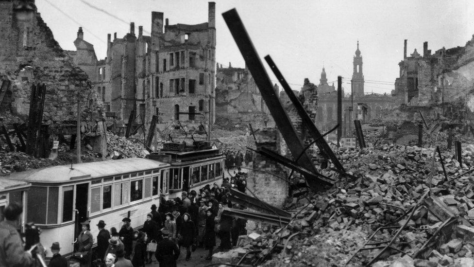
Bomb-damaged Dresden is pictured here in March 1946. Commuters can be seen boarding a tram amidst the rubble.
The Blue Books held by the Imperial War Museum were owned by the British Joint Staff Mission in Washington DC, who had been responsible for handling copies destined for then US President Franklin D Roosevelt.
Only a small number of the books, which were intended to show how effective the RAF campaign was compared with their counterparts in the US, were ever produced.
More than 150 maps from the Imperial War Museum are being published in Dr Chasseaud's book, Mapping the Second World War, published by Collins on 8 October.
- Published2 October 2015
- Published20 June 2012
- Published28 June 2012
