UK weather: Snow warning for some as mild conditions to end
- Published

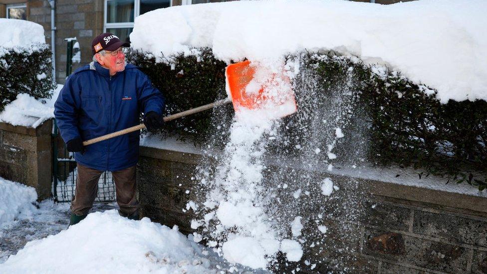
Snow covers the ground in Woolton, Liverpool in January.
The mild start to February is coming to an end, with falling temperatures in store and the risk of snow for some.
Above average temperatures will give way to a more seasonal winter chill over the next few days as colder air moves south across the UK.
The Met Office has issued a yellow warning for snow in much of north Wales and northern and central England on Thursday.
But there is some uncertainty over how much may fall and where.
Why is it hard to forecast snow in the UK?
The yellow warning, external, from 03:00 GMT Thursday to 03:00 Friday, covers a large area from north Wales, through parts of the Midlands and into northern England.
There is a small chance of power cuts, travel delays, some stranded vehicles and delayed or cancelled rail and air travel, and a slight chance that some rural communities could be cut off, the Met Office says.
Met office warning
Disruption is possible, with 2cm of snow forecast at low levels but as much as 10-20cm on higher ground such as Eryri, also known as Snowdonia, and the Pennines.
The snow is likely to turn back to sleet or rain through the day for lower levels at least as milder air spreads in from the south.
There are some uncertainties in the forecast which mean the warning area, location and amount of snow may change in the coming days - so it's worth keeping across the latest forecast from BBC Weather.
Met Office deputy chief meteorologist Chris Almond said: "While there are still lots of details to work out, the initial snow risk looks highest in northern England and Wales from Thursday."
Over the last few days, mild conditions have been felt across the UK, with temperatures way above average for early February.
BBC forecaster Darren Bett looks at where the snow may fall this week
On Sunday afternoon, the highest temperature was 14.9C in Pershore, Worcestershire, compared to the average of 8C.
Despite some signs of spring, with daffodils, crocuses and other plants starting to sprout, we are still in winter and cold air is never too far away.
On Tuesday and Wednesday, colder air will spread south to all parts of the United Kingdom. Temperatures will be back to around average with the chance of some wintry showers moving into Scotland and north-west England.
A yellow warning for ice, external will be in place from 00:00 until 09:00 overnight on Tuesday for parts of northern Scotland.
A separate yellow warning, external for rain is in place until 21:00 on Monday for north western parts of Scotland.
In a reverse to this, on Wednesday night, milder air containing rain will start to move back north into the UK.

Daffodils in bloom, with milder than average temperatures for the start of February
Milder, wetter air pushing into colder air is a classic winter battle that can result in snow falling.
It is not straightforward though and comes with forecasting headaches, especially when it's predicted a few days in advance.
Snow will fall but the detail of exactly where, when and how much snow is tricky.
It is likely further warnings will be issued throughout the week, the Met Office said.

Are you in an area where the Met Office has issued a yellow warning for snow? How are you preparing? You can get in touch by emailing haveyoursay@bbc.co.uk, external.
Please include a contact number if you are willing to speak to a BBC journalist. You can also get in touch in the following ways:
WhatsApp: +44 7756 165803
Tweet: @BBC_HaveYourSay, external
Please read our terms & conditions and privacy policy
If you are reading this page and can't see the form you will need to visit the mobile version of the BBC website to submit your question or comment or you can email us at HaveYourSay@bbc.co.uk, external. Please include your name, age and location with any submission.
Related topics
- Attribution
- Published26 November 2023
- Attribution
- Published27 October 2021
- Published18 January 2024