Lake District and Dales national parks boundary plans
- Published

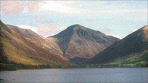
The Lake District is a popular tourist destination
A consultation has begun into revised boundaries for the Lake District and Yorkshire Dales national parks.
It follows one by Natural England last year on proposals to extend the parks, described as some of northern England's finest landscapes.
More than 1,300 people responded and, as a result, plans have been refined to include seven additional areas of land, with one deletion.
People can comment until 1 July, and a series of drop-in events will be held.
Extension proposals for the Yorkshire Dales National Park now include the Orton Fells, the Northern Howgill Fells and Mallerstang to the north, and the fells and River Lune between Firbank Fell and Ireby to the west.
The Lake District National Park proposals now include Birbeck Fells Common to Whinfell Common to the east, and Helsington Barrows to Sizergh Fell including the Lyth Valley to the south.
Local authorities, parish councils, interested groups and members of the public are being asked for their views on the suitability of the areas for consideration as national park.
The status offers protection to the landscape, but critics claim it can force up local house prices.