North Downs Way: First National Trail live on Google
- Published

Once completed, the Google tours will include all 15 National Trail routes
The first of 15 National Trails being made available on Google Street View has gone live.
The entire North Downs Way, a 153-mile trek from Farnham to Canterbury and the White Cliffs of Dover, external, can now be viewed online.
The trails, external cover some 2,500 miles in England and Wales.
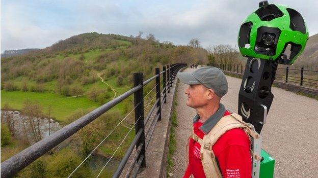
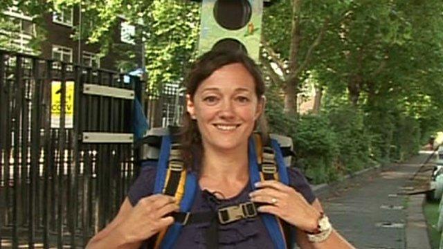
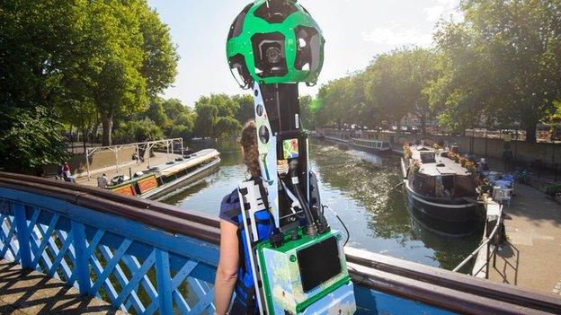
Rangers and volunteers will eventually film every mile using Google Trekker equipment - a backpack fitted with a cluster of 15 lenses.

The North Downs Way is the first trail to be mapped in its entirety
Other National Trails currently being mapped include the Yorkshire Wolds Way, which is the first of the trails to have all its stiles removed to make it more accessible.
A spokeswoman for Google said the Trekker technology enabled images to be gathered while manoeuvring through tight, narrow spaces or locations only accessible by foot.
She said the idea was to make the trails accessible to everyone.
Previous locations captured by the Trekker technology include parts of the Peak District, Loch Ness and Machu Picchu, external.

Trekker technology

Street View imagery is available across 75 countries, as well as parts of the Arctic and Antarctica
More than six million miles of road covered since the project began in 2007
Street View started in five US cities using five-megapixel cameras. It is now on every continent and uses 75-megapixel cameras to record imagery
Google partners with other organisations, including theme parks, university campuses, landmarks and zoos
Source Google

As part of improvements to the routes, stiles are being removed to make them more accessible
Volunteer Dennis Atherton, who is mapping the Yorkshire Wolds Way, said carrying the 23kg (50lb) camera equipment is not easy, especially when passing under trees.
Anne Clarke, of Walk Unlimited, external, which is co-ordinating the filming, said people considering a visit will be able to see exactly what the routes are like.
She said: "These routes are really special and when people see them online they can't help but be inspired.
"I think sometimes people think places like the Yorkshire Wolds Way are long-distance trails and are too hard.
"If they can see it, it will make them think 'actually, it's beautiful, I'll give it a go'."

One of the routes, The Cotswold Way, covers 100 miles between Bath and Chipping Campden

The Pennine Way stretches for 205 miles, following ancient packhorse routes, drovers roads and newly created bridleways

Glyndŵr's Way is named after Owain Glyndŵr, ruler and last native Welshman to hold the title Prince of Wales

Other routes include Peddars Way and Norfolk Coast Path

Viewers will also be able to explore the Pembrokeshire Coast

One route covers 84 miles from coast to coast following the World Heritage Site of Hadrian's Wall
It is hoped the National Trails project will eventually extend to include the England Coast Path, external, which is due for completion by 2020.
- Published17 April 2014
- Published13 February 2014
.jpg)
- Published15 August 2013
- Published15 August 2013

.jpg.webp)

