Historic England releases map based on 500,000 aerial pictures
- Published
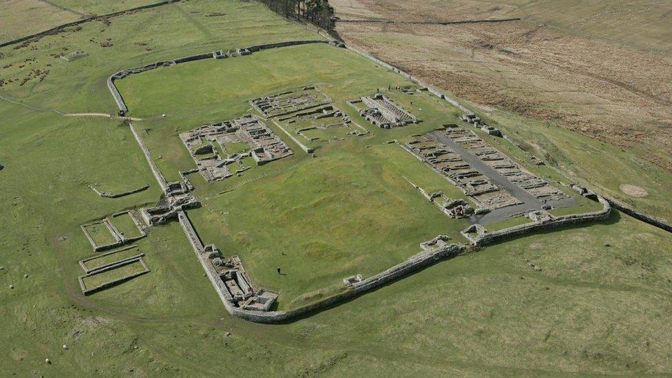
More than 500,000 images, such as this one of Housesteads Roman Fort on Hadrian's Wall, were used for the map
More than half a million aerial images of historical sites in England have been used for a new mapping tool.
Photographs and 3D laser scans have been taken over the past 30 years to uncover "hidden archaeological landscapes", Historic England said.
Sites include 6,000-year-old long barrows, Roman camps such as those on Hadrian's Wall and 20th Century areas linked to the world wars.
The map covers more than half, external of the country.
Duncan Wilson, chief executive of Historic England, said: "This new aerial archaeology mapping tool lets people fly virtually over England and drink in its many layers of history.
"We hope it will give people a springboard to further investigation, whether for research purposes or simply to satisfy curiosity about what archaeological features they may have noticed around their local area."
Historic England has highlighted eight examples of "hidden history" unearthed by aerial mapping.
Iron Age and Roman farms near Doncaster and Rotherham, Yorkshire
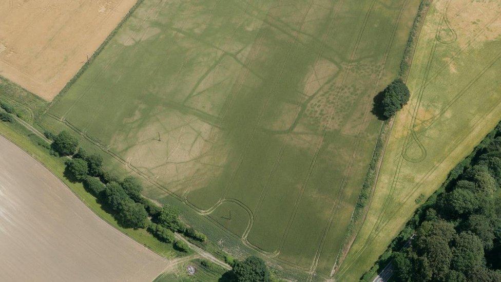
Cropmarks reveal archaeological remains
The landscape today may look like featureless arable fields but when photographed from the air in hot, dry summers patterns begin to emerge.
Known as cropmarks, the patterns are formed when the colour and height of a crop is affected by buried archaeological features.
An aerial survey in 2006 revealed extensive Iron Age and Roman fields and ditches arranged in what is called a "brickwork" system due to its resemblance to the pattern of a brick wall.
Small ditched enclosures have also been spotted, which would have been used for livestock, as have the circular traces of Iron Age houses.
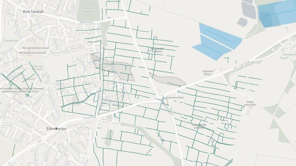
Historic England's map shows where archaeological remains have been covered up by the modern world
Temporary Roman camps at White Moss near Carlisle, Cumbria
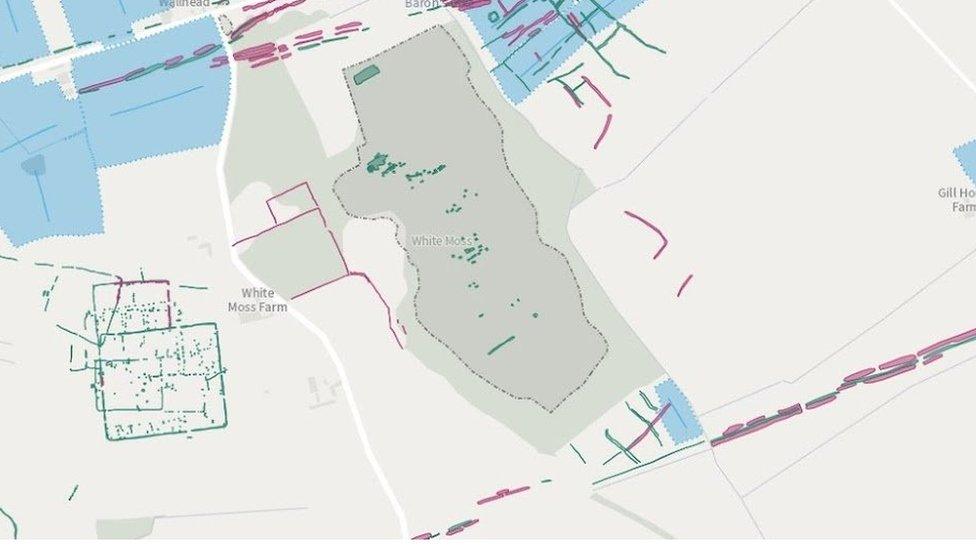
The online map shows two Roman camps (bottom left) at White Moss in Cumbria
The existence of Hadrian's Wall is hardly a secret with much of its 73 miles (118km) having been excavated and explored.
But in 1949, the site of two camps along the 1,800 year-old border were spotted for the first time from the air due to the cropmarks created by the remains.
From aerial mapping, it is also possible to see how medieval and post-medieval fields were laid out either side of the wall after the Roman forces withdrew from Britain around AD410.
Farms and mines in the Yorkshire Dales National Park
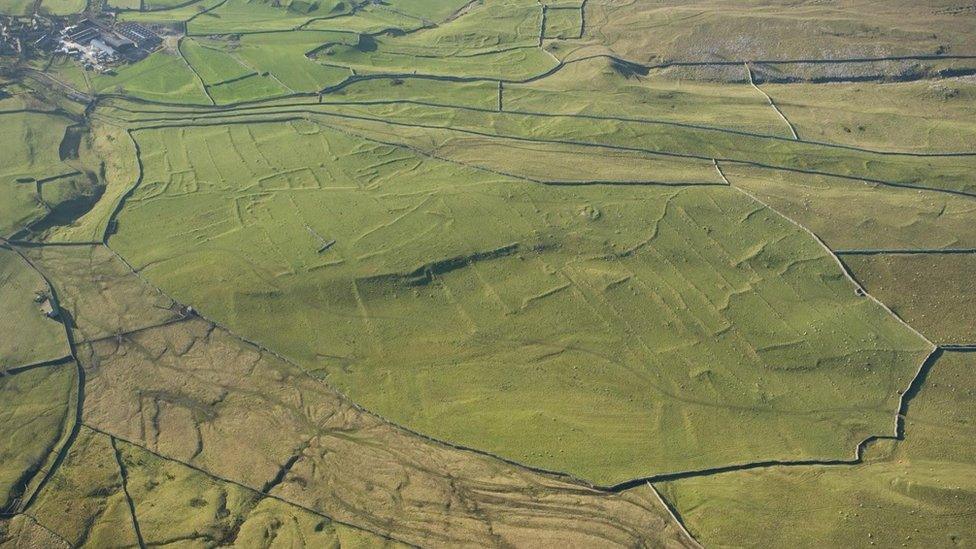
Historic England said the remains that can be seen when the sun is low at Grassington are "spectacular"
The Yorkshire Dales was one of the first areas in the country to be extensively mapped from aerial photographs.
The images show lumps and bumps on the ground which represent the remains of settlements dating back to the prehistoric period, with a "spectacular" example at Grassington where long shadows in winter months pick out the earthworks of fields and enclosures, a spokesman said.
The remains of post-medieval lead mines can also be found.
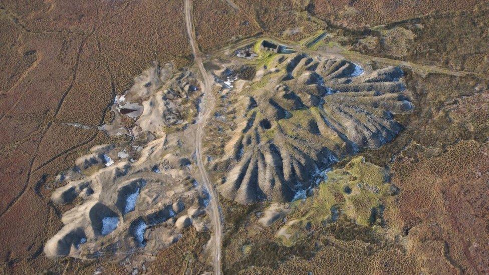
Aerial surveying also captures the remains of mine workings, such as this spoil heap in the Yorkshire Dales
Prehistoric hillfort to World War One training camp at Cannock Chase, Staffordshire
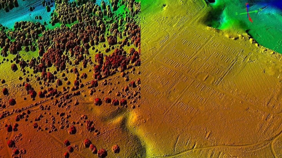
Lidar scanning allows a deeper survey of what lies beneath the surface revealing the remains of a World War One training camp
The maps of this site, which have been completed using light detection and ranging (Lidar) scanning technology, show its extensive use over the centuries.
The aerial survey revealed a "complex history" ranging from a prehistoric hillfort to extensive medieval and later land management, from 18th and 19th Century coal mining to World War One training camps built for 20,000 recruits.
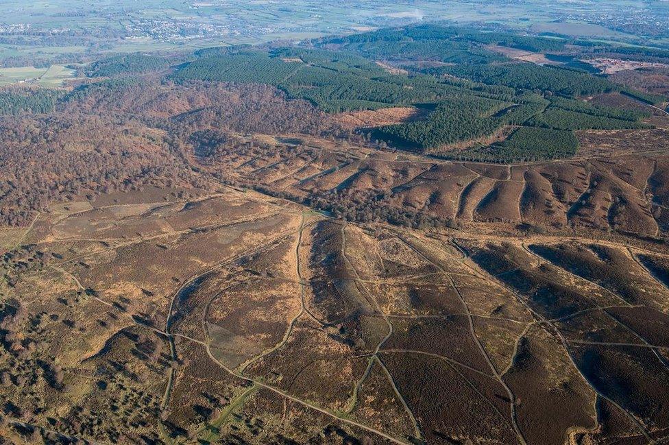
Vegetation masks many of the archaeological remains at Cannock Chase
Whitley Castle Roman fort at Alston, Cumbria
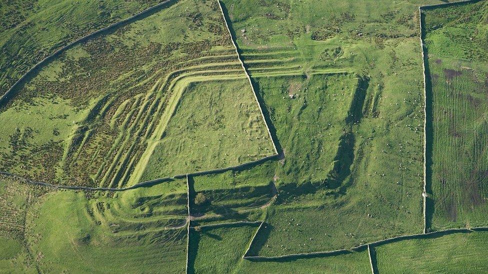
Whitley Castle was built in an unusual shape to fit the terrain
Whitley Castle survives as a series of earthworks and is unusual because of its lozenge shape, which was an attempt to fit into an area of high ground, as opposed to the typical playing-card shape of Roman forts.
Archaeological mapping using aerial photographs and Lidar has revealed traces of a Roman road to the east of the fort.
Iron Age or Roman houses near Comberton, Cambridgeshire
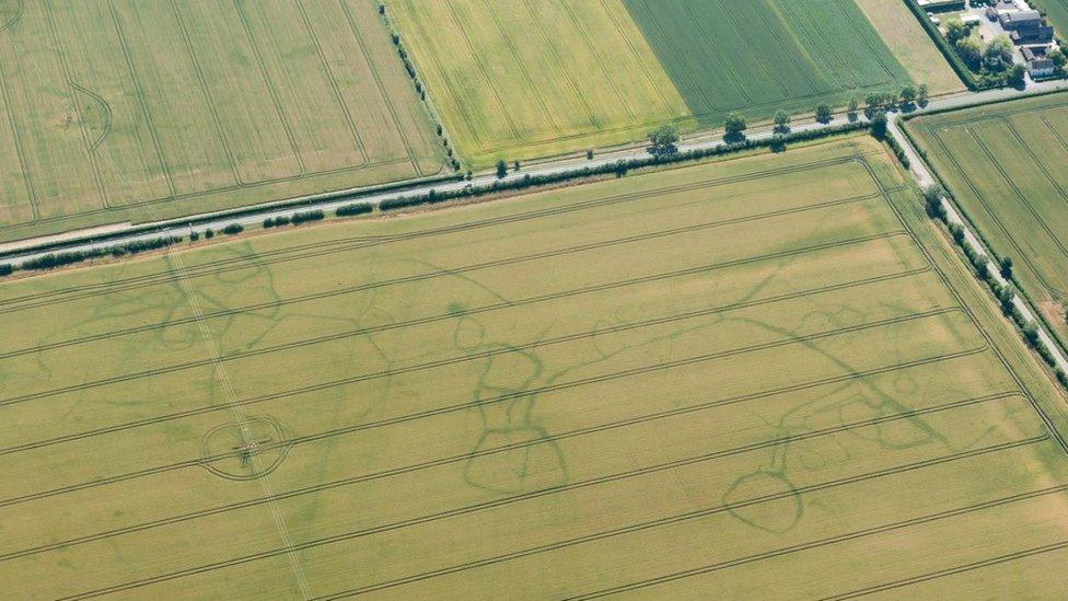
Cropmarks reveal the remains of old settlements at Comberton
Cropmarks form more easily on free draining soils.
As a result, areas rich in clay known as "heavy soils" are less studied leading to the assumption such places were less occupied in history.
However, given the right weather conditions, cropmarks can form and an aerial scan at the right time revealed an Iron Age or Roman settlement including up to six round-houses.
Historic England said it showed the value of "revisiting previously recorded sites where significant new information may be revealed".
Coastal beach defences at Newhaven, East Sussex
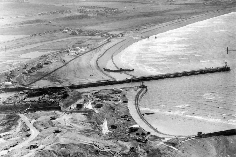
A picture taken in 1940 shows the beach defences in place at Newhaven
During the early years of World War Two, anti-invasion defences were built along Britain's coastline, mostly along the eastern and southern shores.
These included barbed wire, concrete anti-tank blocks, beach scaffolding, gun emplacements, pillboxes and coastal gun batteries.
A 1940 aerial photograph of Newhaven shows a variety of wartime features including lines of barbed wire extending eastwards along the beach into the distance.
Medieval farms in Gloucestershire
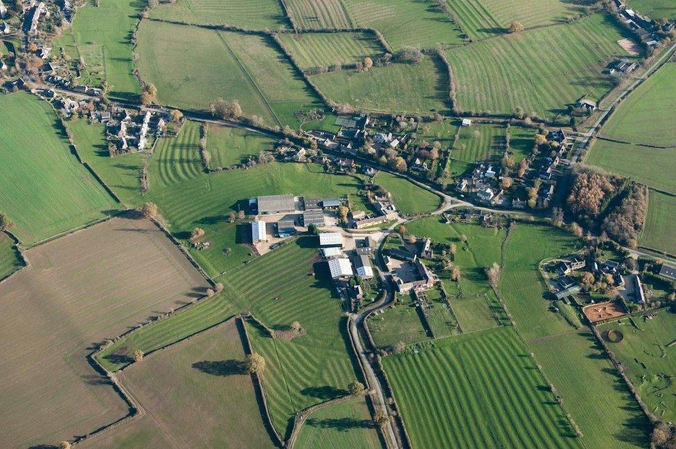
Aerial surveys of Gloucestershire reveal the remains of mediaeval ploughing
Traditional farmlands have undergone many changes over the centuries, but scans of fields in Gloucestershire still show the ridges and furrows made by medieval ploughing.
Some of these earthworks are now covered in grass and used as pasture while others have been ploughed flat and are no longer visible from the ground.
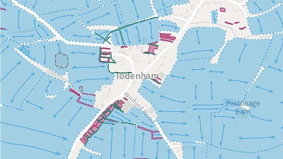
The areas in blue are fields containing medieval ridges and furrows around the village of Todenham
All pictures are subject to copyright.
- Published27 August 2021
- Published19 September 2021
- Published16 December 2020
