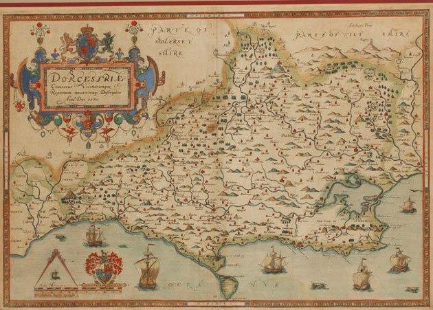
'Earliest' Dorset map sells for £4,000
- Published

The Christopher Saxton map dates from 1575 and has been called a "jewel in the crown" by auctioneers
A map of Dorset, thought to be the earliest known of the county, has sold at auction for £4,200 - about four times its estimate.
The map, by Christopher Saxton, dates from 1575.
Auctioneers said it was the "jewel in the crown" of a 150-plus map collection owned by Edward Gillis from Poole, who started collecting maps of Dorset in the 1970s.
The map had been estimated to sell for between £800 and £1,500.
Duke's Auctioneers in Dorchester, which sold the item, said Mr Gillis' collection included almost every map to have been printed of the county between 1575 and 1875.
'Very good condition'
Auctioneer Matthew Denney said the house was "delighted" with the sale and the final price of the Saxton map was "more than expected."
"This is the earliest map of the county and this example was in very good condition given the age," he added.
"It is fascinating to see how many of the names and features are recorded accurately and the competence with which the map is drawn, from so many years ago, is quite staggering."
Mr Denney said the Saxton map was a "leading light" in the collection - all but three of the 57 lots sold for a total of just more than £21,000 in total.
A folding map by Isaac Taylor also sold for £2,400.
- Published13 February 2014
- Published13 February 2014
- Published11 February 2014
- Published11 February 2014
- Published6 February 2014
- Published4 February 2014