Project to map Dorset's ancient sunken holloways
- Published

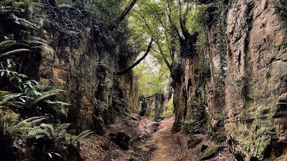
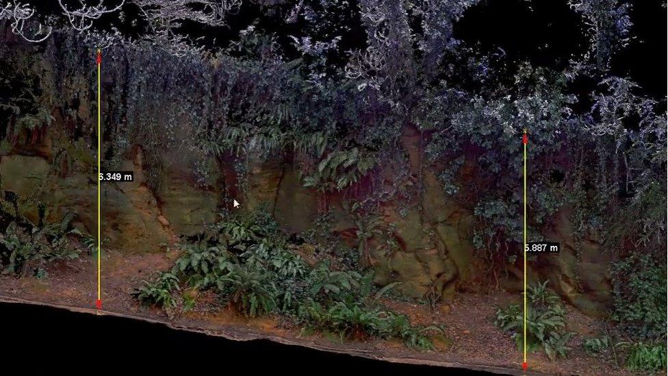
A laser survey is being carried out along Shute's Lane holloway near Bridport as part of the project
A project is under way to survey ancient sunken paths in Dorset.
The Natural England-funded scheme is mapping the paths, called holloways, to assess their ecological, historic and cultural value.
Experts are carrying out 3D surveys at Shute's Lane, a holloway near Bridport, and also studying Hell Lane, which runs between Symondsbury and North Chideock.
Following the study a map will be created to show the locations of sunken lanes across the UK.

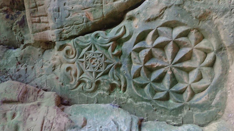
Many holloways feature detailed graffiti carved into their banks
Andy Jefferies of Natural England said: "Often described as sunken lanes, a holloway is a road, a lane, track or path with tall banks that tower over the sides with tree canopies closing over the top.
"They are really quite dark mysterious places... some are at least 10m deep into the ground and formed by the movements of people, animals and carts along routes with soft ground."
The English name holloway, or hollow-way, derives from the Old English "hola weg", a sunken road.
The paths have evolved over hundreds of years, sometimes beginning as trenches or boundaries between fields or estates.
Many feature graffiti carved into their banks, "it isn't just 'I woz here' they are really quite elaborate carvings with ghouls and gargoyles and Celtic patterns, they clearly inspire some sense of mystery", Mr Jefferies said.

Andy Jefferies of Natural England said the 3D survey would give a "ultra detailed measurement" and create a digital visualisation showing the "mystery and the magic of the holloways"
The initial project will be completed by the end of March, and a report of the findings will be published through Natural England.
Mr Jefferies added: "Nobody knows the full extent of them right across the UK - so we are trying to collect them and create this map."
The holloways project is inviting people to share pictures and details of their local ancient paths via twitter using #sunkenlanes.

Follow BBC South on Facebook, external, Twitter, external, or Instagram, external. Send your story ideas to south.newsonline@bbc.co.uk, external.