In pictures: Lightning storms across East Anglia
- Published

The view from the top of "Radar Hill" over-looking South Woodham Ferrers as the lightning storm rolled into Essex on Friday evening.
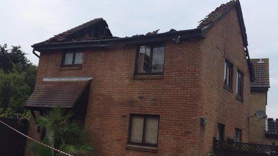
Spectacular storms have once again illuminated the night sky in Essex, resulting in firefighters attending three homes that struck were by lightning.
Peter Sloss, duty forecaster at BBC Weather, said: "The storms were at their heaviest as they arrived from across the English Channel and interacted with the high temperatures we saw yesterday for another explosive burst of energy, resulting in more serve storms.
"Over the period of Friday evening we saw several thousand lighting strikes across the south and east of England."
BBC Look East's viewers have shared their images of Friday night's storms across East Anglia.

Sven Roden captured this image of lightning near Burton Latimer in Northamptonshire. He said: "A few minutes later I got totally drenched as the torrential rain hit, but it was worth it to watch the amazing lightshow."

Steve Bell told BBC Look East: "This was taken at about 04:30 today from just outside Loddon, Norfolk, facing in the direction of Bungay. The wind and rain arrived soon afterwards and it was time to go. Quickly."

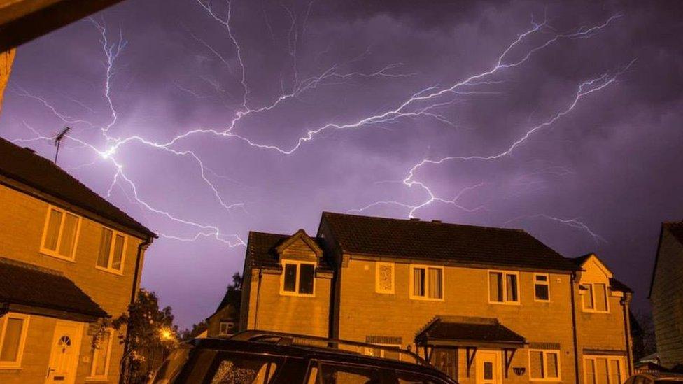
BBC Look East viewer Martin Ward captured this image of lightning in the skies above Wickford, Essex.

Nick Barker, from Braintree, tweeted: "@BBCLookEast the money shot taken in Southend last night in the eye of the storm!"
The Met Office said a very warm and humid air mass across the UK would become "increasingly unstable", leading to more intense thunderstorms.
There are amber weather warnings for rain, external in place for most of England and Wales.
Forecaster Jim Bacon, from Norwich-based Weatherquest, external, added: "Last night's storms were a classic example of what can happen when storms develop in such warm, humid, air.
"Temperatures in excess of 30C meant the storms were potentially severe with frequent lightning and torrential rain in some places. The heaviest rainfall figures in the East were in the order 18mm at Shoeburyness, Essex.
"There's a continued risk of heavy thunder showers developing or other storm moving in from the continent overnight - but next week looks to be feeling cooler and less humid."

As the storm swept across the region on its journey north, Robert Robertson awoke at 04:15 BST to capture ribbons of lightning as it illuminated the skies over Bury St Edmunds from his bedroom window

Brian Tomlinson, a keen 'light artists' and photographer, captured this image of the storm as it arrived over Willen Lake, Milton Keynes
.jpg.webp)
Jeremy Hagon captured this image of lightning in Great Baddow, Essex, as the storm moved northwards throughout the county
- Published19 July 2014
- Published18 July 2014
- Published18 July 2014