Isle of Wight: Military Road erosion plan turned down
- Published

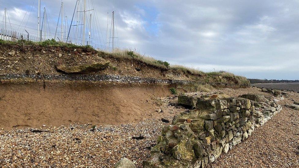
Island Roads proposed the stabilisation work between Brook and Hanover Point
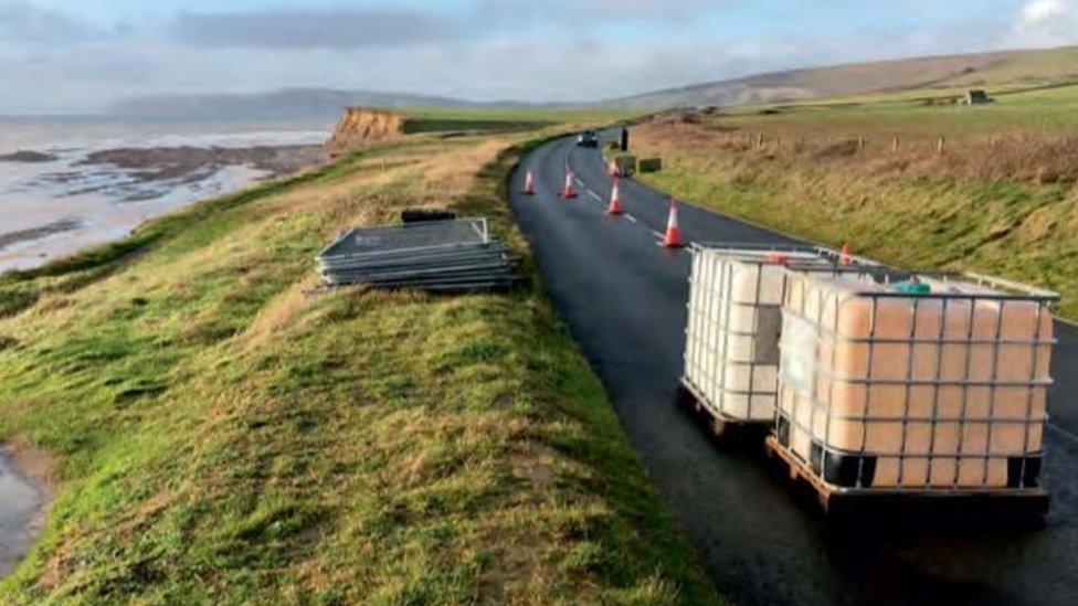
Plans to shore up a coastal road on the Isle of Wight, threatened by erosion, have been turned down.
Island Roads had proposed a 26m-long (85ft) wall to help stabilise Military Road, with piles drilled 26m into the ground.
Isle of Wight Council's planners said it would have a "significant adverse impact" on the landscape and wildlife habitats.
Some councillors supporting the scheme said the road was a "lifeline".
Military Road runs along the island's south-west coast, through protected habitats, including an Area of Outstanding Natural Beauty and Scientific Sites of Special Interest.
It has been dubbed one of the most scenic drives in the country by Visit England.
'Real duty'
However, some parts of the road are less than 5m (16ft) from the cliff edge.
Island Roads said if the current rate of erosion continues the road would be at risk in fewer than seven years.
Its plan - acknowledged as a temporary solution - was to use the wall to stabilise the section between Brook and Hanover Point.
At a meeting of the council's planning committee, councillors Matt Price and Claire Critchison chose to support the scheme.
Ms Critchison told the meeting Military Road was a "lifeline for the south side of the island" and traffic congestion in local villages would increase if it was left to fail.
Mr Price said: "It will be looked at outrageously by the public that anyone would vote against a plan to keep the Military Road in use. We have a real duty to protect Military Road."
He called for "other options" to be brought forward, including re-routing the road.
Isle of Wight Council leader Phil Jordan said there was no preferred, costed alternative option for the route.
He said: "The council will continue to explore potential solutions to preserve and protect this important route, and to secure all the necessary consents in a highly protected and geologically sensitive landscape and that can be implemented as quickly as possible.
"The road remains open while we continue to work with local communities and landowners to assess alternative options."
Speaking before the meeting, a spokesperson for The National Trust, which looks after most of the land on both sides of the route, said: "We're still very much at the discussion stage with the council [about re-routing the road]. It's a complex negotiation."

Follow BBC South on Facebook, external, Twitter, external, or Instagram, external. Send your story ideas to south.newsonline@bbc.co.uk, external.
Related topics
- Published21 December 2022
- Published15 August 2022