East Yorkshire seabed survey to combat coastal erosion
- Published

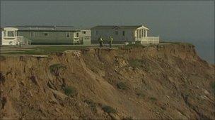
Many homes have been lost to the sea due to coastal erosion
Scientists are carrying out the first ever seabed survey of the East Yorkshire coast.
The latest technology is being used to produce an accurate map of the area between Flamborough and Spurn Point.
Coastal engineers will use the data to help them take more cost-effective, preventative action to combat coastal erosion.
According to government figures the Holderness coastline is one of the fastest eroding areas in Europe.
The Department for Environment, Food and Rural Affairs (Defra) estimate that 2m (6ft) of shoreline is lost every year.
The problem is particularly acute in the region as much of the coast is soft clay.
Defra is funding the £400,000 survey, which uses shipboard sonar equipment to map the seabed up to 2kms (1.2 miles) from the land.
'Complete picture'
The information will be combined with land and air surveys to give a fuller picture of the locations likely to be affected by coastal erosion.
Mike Ball, principal engineer at East Riding of Yorkshire Council, said the information will lead to better decision making and more cost-effective sea defences.
"We can see which areas need the defences building, which areas need their defences strengthening in light of the detail of the information we are getting from the survey.
"The information will complete the picture. At the moment we don't know where the material that is on our beaches goes to exactly.
"It comes offshore and it goes down but we don't know how that process occurs, how that mechanism happens," he said.