Withernsea coastal erosion pictures snapped up by schools
- Published

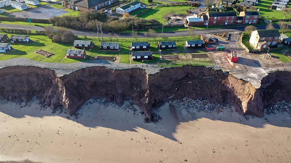
The pictures show severe coastal erosion of the Holderness coast to the south of Withernsea
Dramatic pictures by an amateur photographer of coastal erosion have been snapped up by more than 100 schools to use in geography lessons.
Andy Medcalf, an IT project manager, took the pictures of the East Yorkshire coast near Withernsea.
That coastline is the fastest-eroding in northern Europe with 30ft (10m) in parts between March and December 2019.
Mr Medcalf offered the drone pictures on Twitter and said he was "intrigued" by the interest.
"I hadn't realised the disappearing Holderness coastline was so popular on the geography syllabus," he said.
Schools and colleges from around the UK and as far afield as Kuwait have contacted Mr Medcalf to use his pictures.

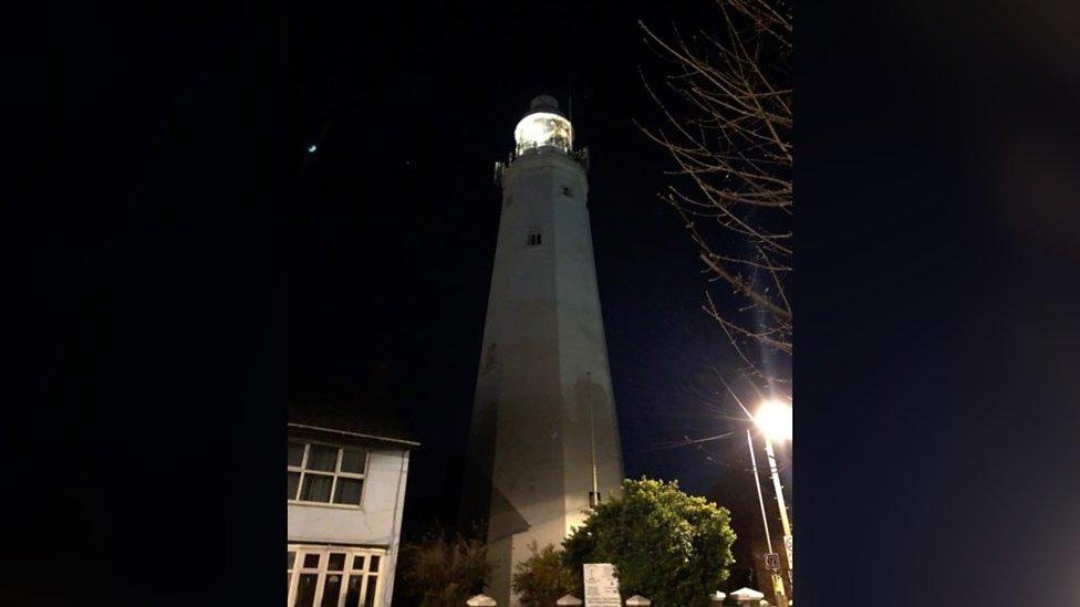
A birds-eye view of Withernsea with its former lighthouse

It is "unsustainable and inappropriate" to defend all the coastline, said East Riding of Yorkshire Council
Mr Medcalf said he was "very aware of the erosion" as he lived close to the sea in Withernsea.
He has a Civil Aviation Authority drone licence and said the height allowed a good view of the shape of the land.
"It is good to record the erosion, if they had had drones hundreds of years ago it would have been fascinating to see", he said.
Since Roman times it is estimated a 3.5-mile (5.6km) strip of land has been washed into the North Sea, taking about 30 villages with it.

The pictures show how land is lost to the sea

Further down the coast near the village of Hollym
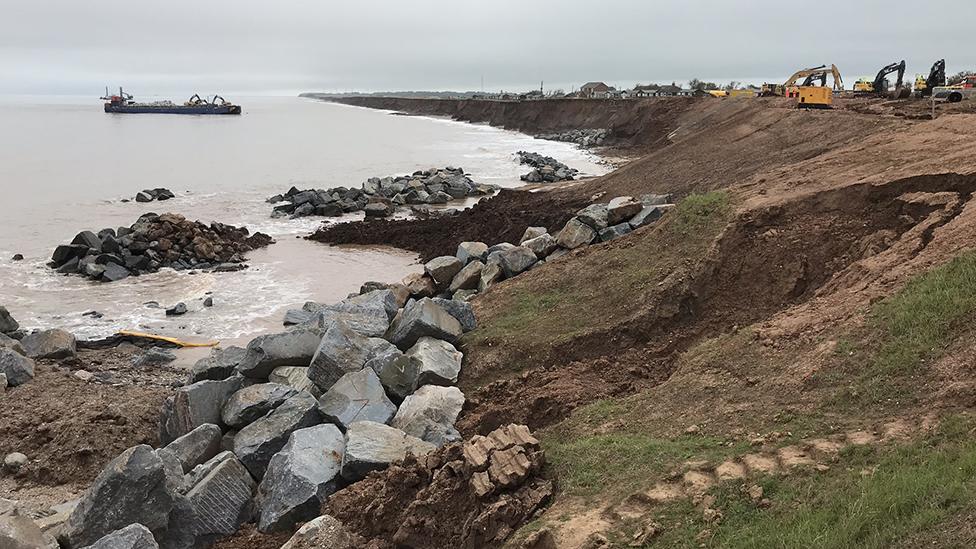
A sea defence scheme to protect some of the coastline near Withernsea, with 63,000 tonnes of interlocking rocks to prevent waves from reaching the cliffs, started in June.
"The tide goes north to south and the defences just move the erosion along to form what is a new bay," said Mr Medcalf.
The two main types of rock along the coast are chalk and boulder clay. The southerly boulder clay cliffs are more at risk of erosion.
Mr Medcalf said he got the pictures with a small "toy drone" that he could afford to lose if it crashed over the sea.

Parts of East Yorkshire lost more than 30ft (10m) of land to the sea in 2019

The coast stretches from Flamborough in the north through Holderness to Spurn

Follow BBC Yorkshire on Facebook, external, Twitter, external and Instagram, external. Send your story ideas to yorkslincs.news@bbc.co.uk or send video here.
- Published15 June 2020
- Published6 April 2020
- Published22 January 2020
- Published11 April 2013


