A chance to leave an historic mark on the Olympic Park
- Published
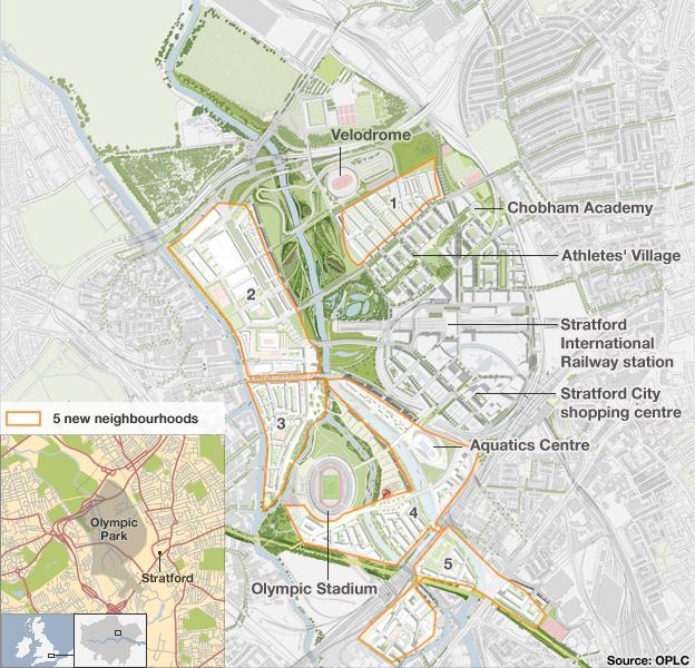
Over the next 20 years, the five Olympic Park neighbourhoods will accommodate up to 8,000 new homes and naming them , externalgives Londoners a chance to help shape the future of the area. To give you inspiration, here is our potted guide to each zone.
Neighbourhood 1
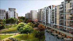
Neighbourhood 1 lies next to the Athletes' Village and the Velopark
This neighbourhood will become the most 'village like' of all the residential areas in the Olympic Park with a modern take on some of London's finest architecture including mews and town houses.
The homes will be near the Chobham Academy campus, in the Athletes' Village, and the Velopark.
The area bears little resemblance to the Lee Valley marshland of prehistoric times. Discoveries of ancient axes show people have lived in the area since the Palaeolithic period (part of the Stone Age) and coins and medals dating from Roman times have also been found.
This area lay within the ancient parish of West Ham, which probably took its name from the manors of Ham (meaning low-lying pasture), and also within part of Leyton (settlement on the Lee). Both places were mentioned in the Domesday Book of AD 1086.
During the Second World War on 7 September 1940 a heavy anti-aircraft gun near Manor Garden Allotments was the first to shoot down an enemy aircraft. The military pillboxes used as part of the defence of London during the war in this area were later used as potting sheds.
Neighbourhood 2
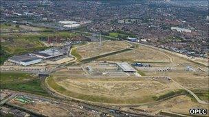
The Broadcast and Press centre area will be replaced by businesses on the Park
This area will offer family homes framing the edge of the parklands with a primary school and a community centre. It will also be the Olympic Park's main employment zone.
During the Games it will house the Broadcast and Press centres and the nearby Handball arena will host handball and fencing for the men's modern pentathlon plus goalball during the Paralympic Games.
The area, close to Hackney Wick, has for centuries been dominated by the River Lee and, more recently, the man-made Hackney Cut canal. During the Great Plague in 1665 barges helped save Londoners from starvation by transporting food into the capital.
The area became home to industry including White Post Lane which was the site of the Hope Chemical Works. In 1948 Clarnico - the country's largest confectioner - moved into Waterden Road due to war damage to its Hackney premises.
Waterden Road was also home to the Hackney Wick stadium, which opened in 1932 for greyhound and motorcycle racing. It was demolished in 2003.
Neighbourhood 3
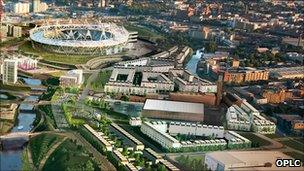
Neighbourhood 3 was the birthplace of plastic and the dry cleaning capital of the UK
This is the highest point of the Olympic Park and a mix of studios, flats and family homes will be built here alongside the Lee Navigation Canal.
There will be a continuous riverside walk along the canal, connecting Hackney Wick, Fish Island and the Olympic Park for the first time.
During the Games, this area will be the main destination for food, information and 2012 Olympic souvenirs and merchandise.
Historically, the area has been a hive of industry as well as mired in controversy. It is situated between the Hackney Cut and River Lee and most of the marshland that had been gradually drained for use as meadows was once again submerged in water when the East London Waterworks Company (ELWC) built a reservoir in the middle of the 19th Century. However, it was filled in by the end of the century when it was hit by scandal.
In 1866 it was claimed that contaminated water was spreading cholera. Locals claimed that putrid eels had been found in their water pipes. ELWC denied supplying unfiltered water, but was eventually found guilty of criminal negligence.
The case was so difficult to prove and the fine so small that no prosecution took place.
In the late 19th to early 20th Century the growth of chemical, confectionery and petroleum-related industries really took off.
Wallis Road in Hackney Wick was crucial in the history of the invention of plastic. This is where Alexander Parkes made the first type of plastic, which he called Parkesine.
White Post Lane was the home of Achille Serre - the company that introduced dry cleaning to the UK in 1876. The French cleaning process used a chemical solvent rather than water.
Neighbourhood 4
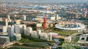
It may be the home of swimming come the Games but the history of this area is all about the railways
This area will be the cultural quarter with residential areas and shops, restaurants and bars. It will be close to the Westfield Stratford City shopping centre and the rail connections at Stratford Regional and Stratford International stations.
During the Games, the Aquatics Centre will adjoin the main entrance to the Olympic Park. Swimming and synchronised swimming, diving and events from the modern pentathlon will be watched by 17,500 spectators.
This area is all about railways - without the development of the railways Stratford would not be the place it is today. Bordered to the east and south by railway lines - like much of the Olympic Park - the area was transformed by the train.
The line to the south was originally the Eastern Counties Railway (ECR) from London to Romford, built in the 1830s. It crossed the Lee Valley on a man-made embankment that included a short viaduct between Pudding Mill Lane and Marshgate Lane.
The ECR was one of London's earliest lines and attracted businesses from the centre of the capital to relocate to the area. Stratford became a major railway intersection and the main ECR depot.
In the early 20th Century the works employed over 6,000 people and the area was dubbed Hudson's Town, after George Hudson, the chairman of the ECR.
The second half of the 19th Century saw commercial development of Carpenter's Road and Warton Road, the bank of the City Mill River and Marshgate Lane along Pudding Mill River - which was filled in to make way for the Olympic Stadium.
Neighbourhood 5
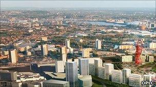
Neighbourhood 5 once had the main crossing over the River Lee - requested by Queen Matilda no less
Here, rivers and canal converge to create a network of waterfronts to the south, east and west. As one of the three prospective employment zones in the Park, the area will be a mix of residential, light-industrial and business uses.
It is the closest neighbourhood to the secondary school that will will be built in the future Queen Elizabeth Olympic Park, adjacent to Stratford High Street.
During the Games, the area will house facilities for the athletes including physiotherapy, doctors and trainers.
The River Lee was a difficult obstacle for our ancestors and this area was once the site of the main crossing across the water, known as Queen Matilda's Causeway.
Built around AD1110, it linked settlements at Bow and Stratford on opposite sides of the valley. It was apparently requested by Matilda, wife of King Henry I, as the old Roman crossing had become unsafe.
The earliest businesses were located on the High Street between Marshgate Lane Lock and Bow Bridge and included Thomas Frye's Bow Porcelain Works, founded in the 1740s, one of the first in Britain to make porcelain.
- Published23 March 2011