Somerset floods: What work has been done?
- Published

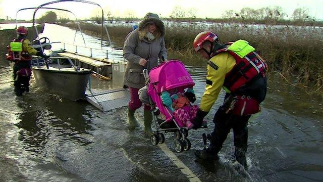
Last January, the then environment secretary Owen Paterson suffered an angry welcome when he waded into a flood-hit Somerset. One year on, how much of the action plan that he ordered has been implemented?

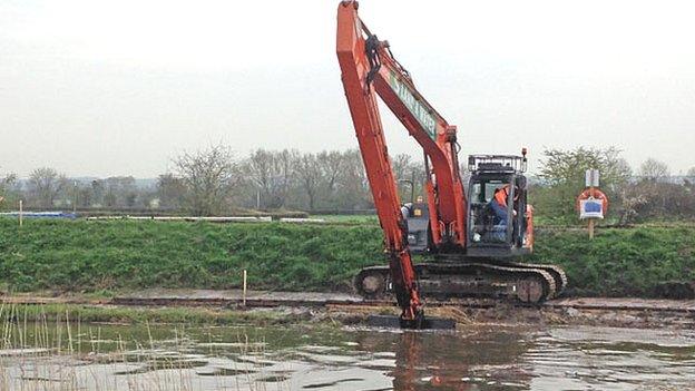
Dredging the rivers

Somerset landowners and farmers blamed a lack of dredging for the flooding, although the Environment Agency has maintained it would not have prevented it.
Dredging, however, formed the first phase of the 20-year, £100m Somerset Levels and Moors Action Plan.
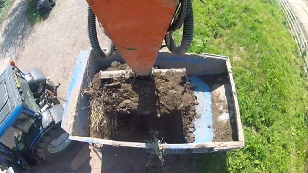
Work to dredge the first five miles (8km) of the River Parrett and River Tone began on 31 March and was completed by the end of October at a cost of £6m.
A total of 130,000 cubic metres of silt were removed.
The Environment Agency said the work would help reduce flooding to properties on Curry Moor and North Moor, on the A361 and the West Coast mainline.
Bank repairs to the River Parrett were also carried out at Langport and Cocklemoor.
Rebecca Horsington, from the Flooding on the Levels Action Group (Flag), said she was pleased with the amount that had been accomplished, but called for "a firm commitment to maintain the dredging".
"I think they've done very well in the short time scale they had to complete things, but there's still quite a lot more needs to be done," Ms Horsington said.
"If they don't maintain it we'll be back to square one in four or five years' time.
The Environment Agency said it was appraising a further 10 sites to determine the effectiveness of additional dredging.
"People can see a big difference on the ground and communities have been positive about our efforts," an agency spokesman said.
Earth bank built at Thorney

The village of Thorney was largely under water for two months last winter but work on an earth embankment to help protect it has now been completed.
The £180,000 project aims to better protect 10 houses and the road into Thorney.
The semi-circular embankment, 300m-long and 20m-wide, was built on private land around the village.
Raising the road into Muchelney

Villagers in Muchelney were cut off by floodwater for two months last winter
A scheme to prevent Muchelney being cut off by flooding was due to be finished by the end of December but is now not expected to be completed until mid February.
A 547 yd-stretch (500m) of Drayton Road, the main road into the village, is in the process of being raised by more than 3.9 ft (120 cm) at its lowest point.
Somerset County Council said the delay was down to bad weather.
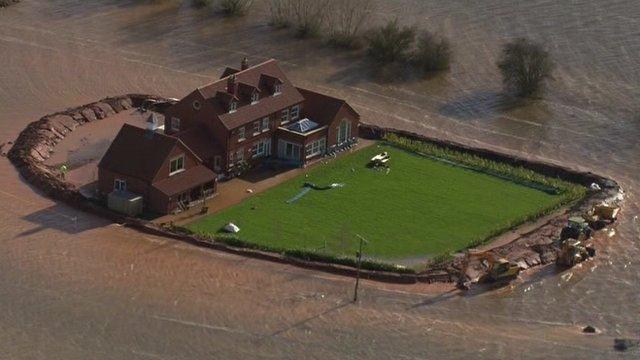
Permanent protection at Westonzoyland

People living near Grays Avenue in Westonzoyland helped build temporary flood defences in January
The original plans for a permanent flood barrier at Westonzoyland came to a standstill in September due to unforeseen ground conditions.
The Environment Agency said the scheme would need to be redesigned as the ground was unsuitable for drilling into.
Residents were consulted on a new scheme and the works, which began in October, are now nearing completion.
Flood protection body set up

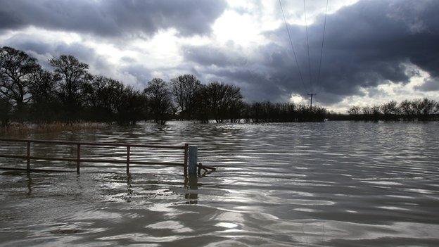
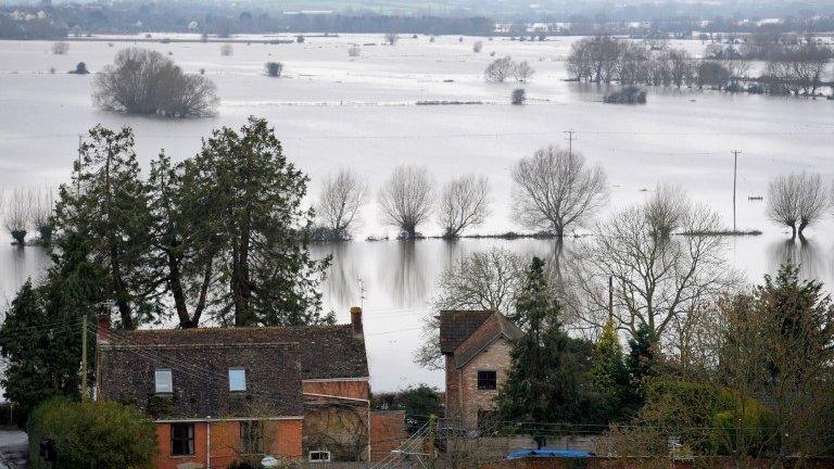
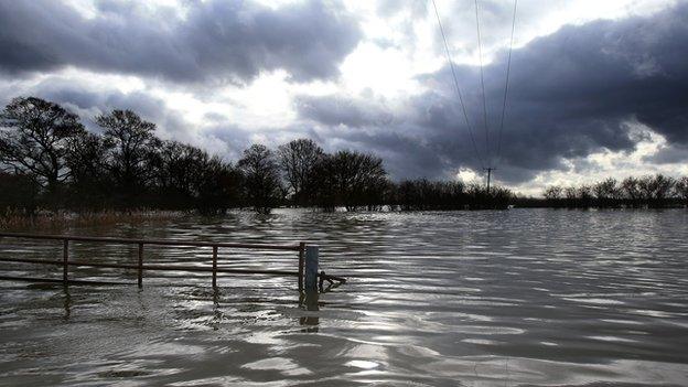
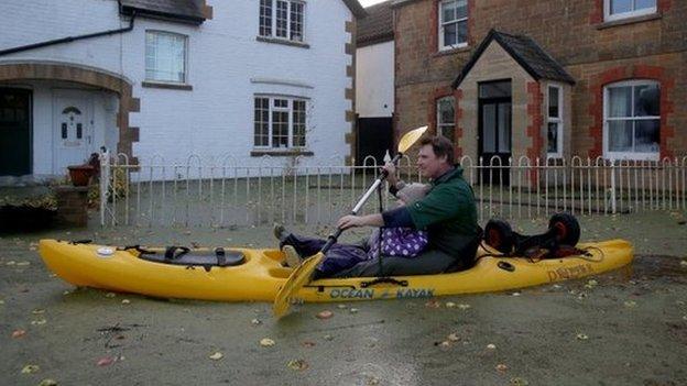
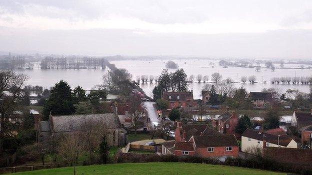
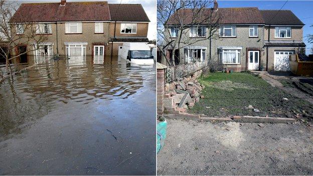
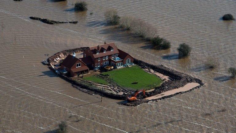
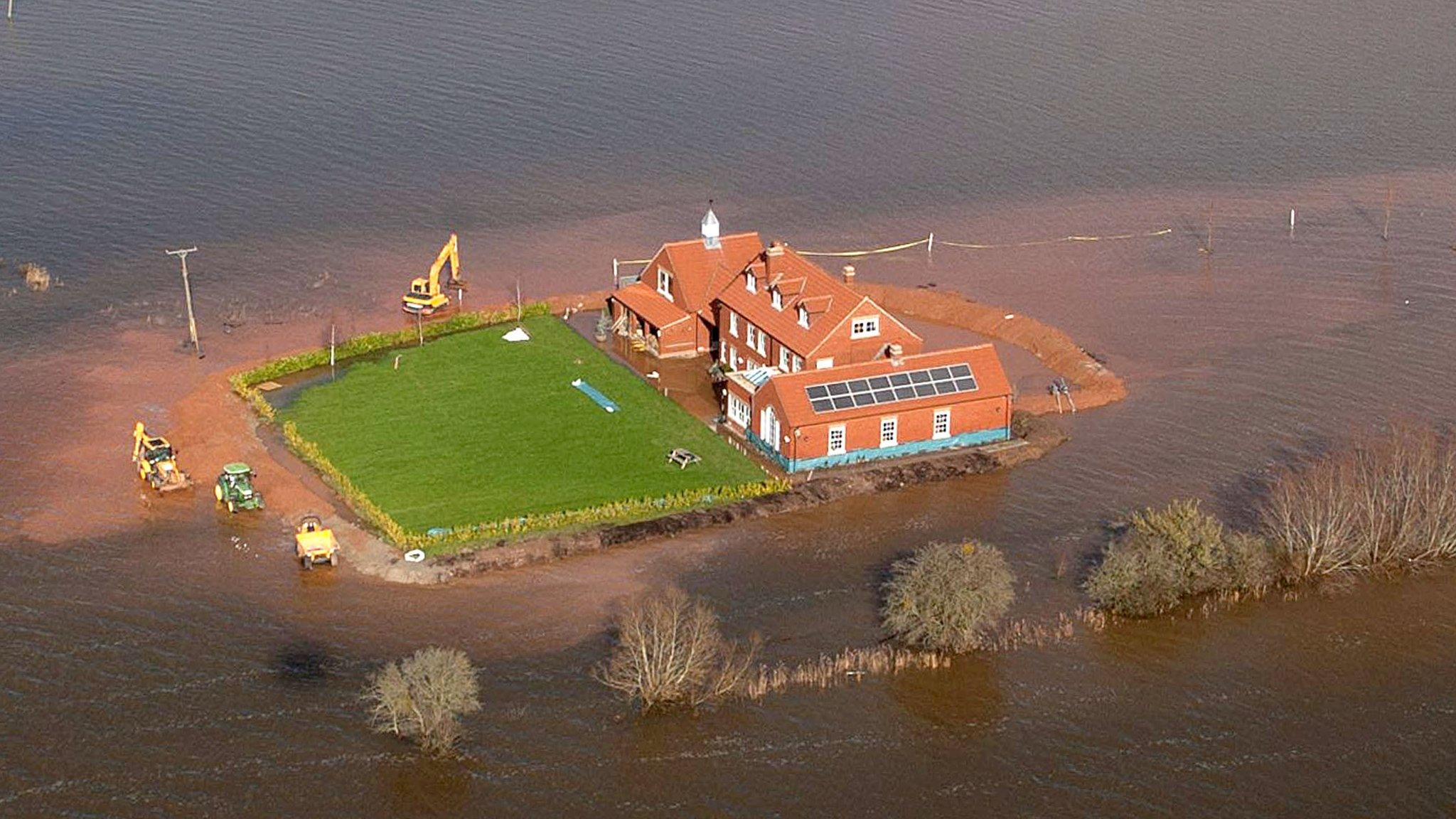
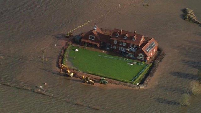
Large parts of the Somerset Levels spent much of the winter of 2013-14 under water after heavy rain
Proposals for a new organisation to oversee flood protection measures in Somerset were approved by the county council in November.
Shortly afterwards, the government agreed to pay about £2m of the cash needed to start up the Somerset Rivers Authority (SRA).
Once up and running, the council plans to fund the authority via a council tax increase of approximately £25 per year.
The SRA will be set up on 31 January and focus on enhanced maintenance of river channels and flood banks along the county's waterways in order to help reduce the risk of flooding.
'Thames Barrier-style' scheme explored

Sedgemoor District Council and the Environment Agency commissioned experts to explore whether a tidal barrier or sluice would work best to protect the tidal River Parrett and River Tone upstream of Bridgwater.
In December, these experts decided a £32m "Thames Barrier-style structure" would be the best way to prevent flooding on the Levels.
Such a scheme would allow tides to enter the river in normal conditions and exclude tidal surges.
However a business case still needs to be made and a feasibility study carried out.
Funding will also need to be secured, along with the necessary planning consent.
Bridge built on A372

The A372 at Beer Wall was shut for three months for the first phase of the flood defence project
In December, a section of the A372 between Aller and Othery, which had been flooded, officially reopened after 11 weeks' of flood prevention work.
The works, including the installation of a temporary bridge, marked the completion of the first phase of flood protection works at Beer Wall.
Somerset County Council said the work meant the road would stay open if there was a repeat of last year's weather.
In the spring, four new culverts will be installed under the A372 which will be followed by Environment agency work to increase the capacity of the Sowy river.
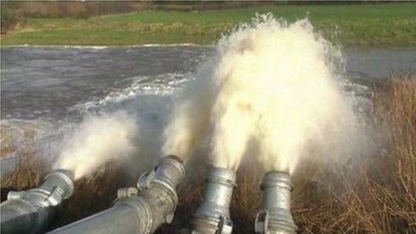
The trigger points

A list of 10 trigger points on the Somerset Levels have been drawn up which allow additional pumps to be switched on to remove water from a given area, once three criteria have been met.
The first is that flood water has covered a specific road identified by the agency.
The second is that rain is forecast for the next three to five days, with a total expected rainfall of 10cm (3in) or more in that time.
The third is that the level of water on the moors is rising at a rate of 5cm per hour.
Community Resilience

Community Resilience Groups have already been set up in six areas of the Levels and Moors, including Moorland/Fordgate and Burrowbridge.
With the help of local authority and Environment Agency staff, the groups are each creating a Community Resilience Plan tailored to their local needs. As part of these plans they can apply for funding for equipment and training.
The plans link into the Environment Agency's water level trigger points and any warnings issued by the Met Office, so that actions take place in advance rather than in response.
Other actions

Deep-cleaning of highways drainage and repair of road surfaces with flood resilient materials
Temporary pump platform and infrastructure at Dunball, Bridgwater
Extensive programme of repairs to river banks, spillways and pumping stations at more than 50 locations
£100k secured to complete survey work and a further £550k to deliver a 2015/16 programme of small scale on-farm schemes
Initial feasibility study for a £16m flood storage upstream from Taunton published and funding bid submitted
- Published5 January 2015
- Published11 December 2014
- Published27 November 2014
- Published31 October 2014
- Published29 September 2014
- Published29 September 2014
- Published28 July 2014
- Published25 July 2014
- Published3 July 2014
- Published31 March 2014
- Published31 March 2014
- Published19 March 2014
- Published5 March 2014
- Published5 March 2014
- Published21 February 2014
- Published10 February 2014
- Published10 February 2014
- Published27 January 2014
- Published24 January 2014