Thorne and Hatfield Moors peatland mapping to save 'waning reserves'
- Published

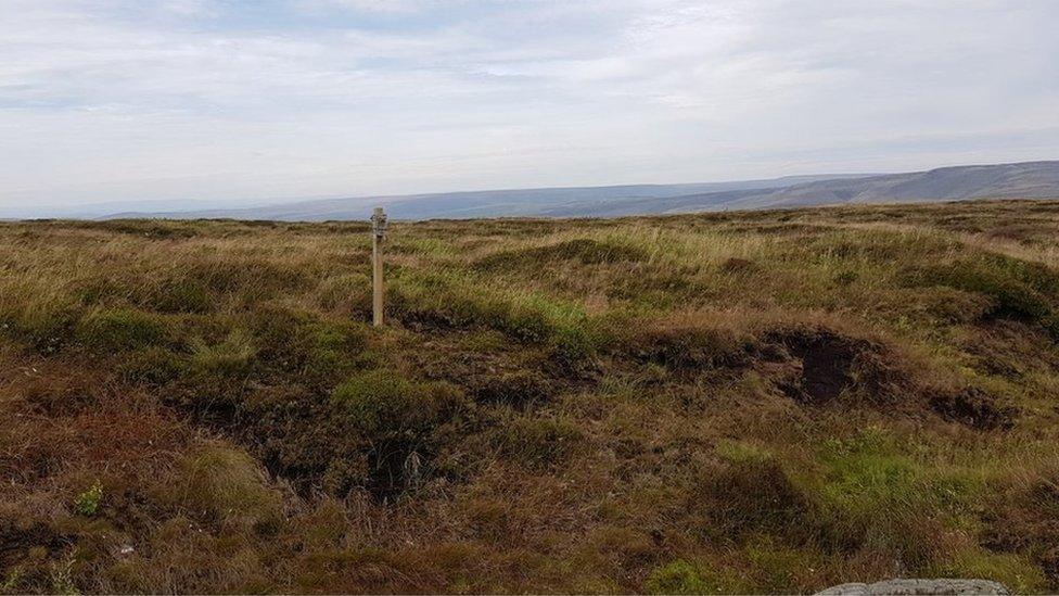
Experts are using GPS to record the vegetation at Thorne and Hatfield Moors
A project mapping peatlands to help preserve and restore them is being piloted in South Yorkshire, ahead of a potential national roll-out.
The Thorne and Hatfield Moors pilot involves a team using data from a satellite to analyse the site's condition.
If successful detailed mapping could be used to help save "all the UK's waning peat reserves", experts have said.
The government believes only 13% of UK peatlands are in a near-natural state.
As a result, a ban on the sale of peat compost to households and amateur gardeners is to come into force next year, external.

It is hoped the pilot project at Thorne and Hatfield Moors will help other peatlands
Peat bogs are a wetland habitat made up of decomposed plants which are seen as crucial in their effect on the climate as they store twice as much carbon dioxide as a rainforest.
They help prevent the release of carbon dioxide, which scientists say warms Earth's atmosphere in a process that leads to climate change.
However, drained or damaged peatlands release carbon dioxide.
The team, involving scientists from Durham University, Natural England and Ordnance Survey (OS), said detailed and highly accurate mapping of the peatlands was needed to monitor its health and "help identify areas for future restoration, or in need of additional protection".
As part of the project, experts will record different types of vegetation species, monitor greenhouse gas emission types and establish the water table at the site, which is part of Humberhead Peatlands National Nature Reserve located between Doncaster and Goole, East Yorkshire.

Thorne and Hatfield Moors is part of Humberhead Peatlands National Nature Reserve, which also includes moorland in Crowle and Goole, in East Yorkshire
At the time of the peat sale ban announcement, the Department for Environment, Food & Rural Affairs (Defra) had said degradation of the UK's peatland arose from agricultural use, overgrazing and burning, as well as "extraction for use in growing media". Peat was also a "frequently misused" product by households and amateur gardeners.
Defra hopes the ban will help efforts to restoring 35,000 hectares of peatlands by 2025.

Follow BBC Yorkshire on Facebook, external, Twitter, external and Instagram, external. Send your story ideas to yorkslincs.news@bbc.co.uk, external.
- Published31 May 2023
- Published11 May 2023
- Published27 March 2023