Storm Brendan: Met Office issue yellow warning for NI
- Published

A yellow warning has been issued for NI from midday on Monday
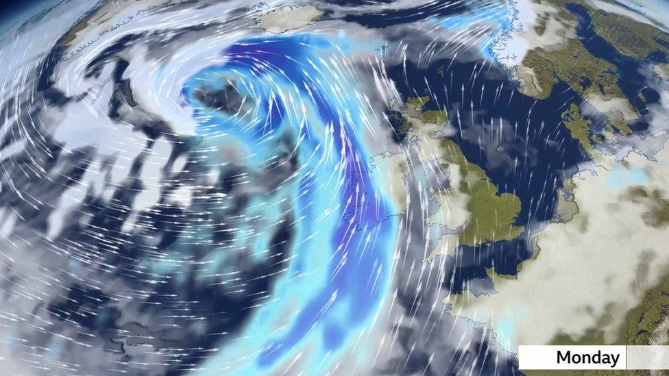
Storm Brendan is set to bring some strong and possibly disruptive winds across Ireland on Monday.
The Met Office has issued a yellow warning for Northern Ireland from 10:00 GMT to midnight.
It warns that travel disruption is likely and coastal areas may be affected by large waves.
Gusts between 80-100km/h (50-60mph) can be expected around the coast, and these could reach up to 130km/h (80mph) in more exposed areas.
The storm was named on Saturday by Irish weather service, Met Éireann, who have issued status orange weather warnings covering all of the Republic of Ireland.
Allow X content?
This article contains content provided by X. We ask for your permission before anything is loaded, as they may be using cookies and other technologies. You may want to read X’s cookie policy, external and privacy policy, external before accepting. To view this content choose ‘accept and continue’.
The Department of Agriculture, Environment and Rural Affairs has advised members of the public not to visit forests, country parks or nature reserves on Monday.
In a statement on twitter, the department said: "The public should expect that access to our sites may be closed to vehicles due to the increased likelihood and risks associated with falling branches and debris."
Allow X content?
This article contains content provided by X. We ask for your permission before anything is loaded, as they may be using cookies and other technologies. You may want to read X’s cookie policy, external and privacy policy, external before accepting. To view this content choose ‘accept and continue’.
A wind warning for counties Connacht, Donegal and Kerry comes into effect from 05:00 GMT and will remain in place until 21:00 GMT on Monday night.
A separate wind warning for counties Leinster, Cavan, Monaghan, Clare, Cork, Limerick, Tipperary and Waterford will also come into effect from 08:00 GMT and will stay in place until 15:00 GMT.
The service is warning of significant risk of coastal flooding due to the combination of high tides and storm surge.
This is the second locally named storm of the winter season following Storm Atiyah in December.
- Published3 October 2019
