Scotland's summer of two halves
- Published

The north west of Scotland was drier than usual whereas other places experienced as much as twice the normal rainfall
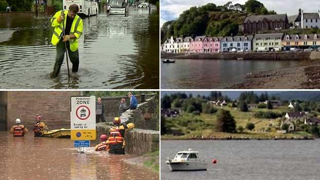
Has this summer been wet, wet, wet or dry as a bone? It depends on where in Scotland you live.
It has been a tale of two summers with some areas experiencing rainfall well below the average and others getting twice the amount of precipitation they would expect over the months of June, July and August.
Figures for the UK suggest it has been the second wettest summer since records began - and the wettest in 100 years.
For Scotland it looks like it has been the seventh wettest since 1910, which is pretty wet, but does not explain the feeling of deluge experienced by some places.
That's because the rainfall has not been evenly distributed.
People in the area around the Met Office weather centre at Charterhall in Berwickshire could be forgiven for asking "Why does it always rain on me?".
They have had 254% of the rainfall they would expect in the summer months, based on the average for the past 30 years.
Charterhall got 422mm of rain over three months, they would normally get 165.9mm.
Staying on the east coast, Edinburgh has had 214% of its average rainfall and Leuchars in Fife 203%.
It was also wet in Glasgow (156%), Auchincruvie in Ayrshire (154.5%), Eskdalemuir in Dumfries and Galloway (154.5%) and Crabistone in Aberdeenshire (150%).

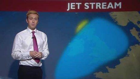
BBC weather presenter Christopher Blanchett said the jet stream led to unsettled weather early in the summer
However, the north west of Scotland mainly escaped the downfalls, especially in the early stages of the summer.
The north west mainland and the Western Isles only got about 65% to 80% of their usual rainfall.
Figures for the weather station at Kinlochewe in the north west Highlands showed it received 70% of the "normal" summer rainfall.
It had 238.6mm of rain and the average is 336mm.
At the beginning of the summer it was even drier, with drought conditions for some of the Outer Hebrides.
The explanation for this lies with the "jet stream" - a ribbon of fast-moving air, up in the atmosphere.
For the first part of Summer 2012 it was positioned much further south than normal.
BBC weather presenter Christopher Blanchett said: "If you think of it as the dividing line between settled weather to the south of it - and changeable weather to the north, its position meant much of the UK was in line for wetter, windier and cooler conditions.
"This is because, the left-hand exit of the jet stream - or its northern edge - is where low-pressure systems develop. It's these low-pressure systems that bring the unsettled weather.
"But, the jet stream was so far south, that whilst the path of the low pressure systems - and the unsettled weather - crossed much of the UK, they actually missed the far north west - which is why it was much drier there."
Later in the summer, the jet stream moved back to its normal position and the usual rainfall service was resumed.
- Published30 August 2012
- Published20 July 2012