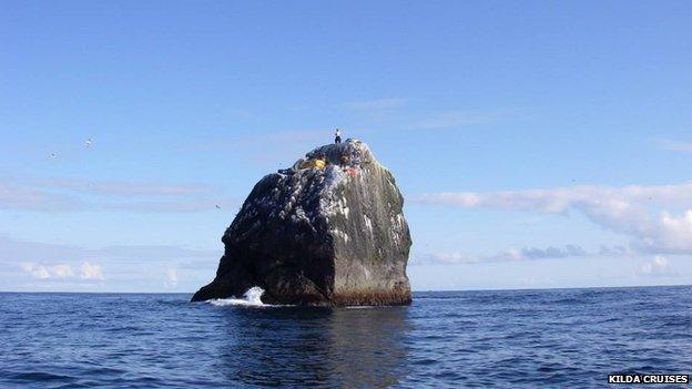
Rockall: Smaller, but in the same place
- Published

Nick Hancock proving Rockall is where it was thought to be
Data gathered during a record-breaking occupation of the remote islet of Rockall has shown it is lower than previously recorded.
The rock was found to have a mean height above sea level of 17.15m - some 0.85m below the previous estimate.
However, the calculations also showed that previous estimates of Rockall's position were accurate.
Adventurer Nick Hancock collected the data while he spent 45 days on the rock in the North Atlantic in June, 2014.
The chartered surveyor connected to satellites and Ordnance Survey (OS) radio stations to try to update United Kingdom Hydrographical Office (UKHO) records relating to the position and height of Rockall.
They were last calculated in 1977, as part of a major survey into the sea bed around the islet.
Following multiple hi-tech tests, the position of Rockall - 230 miles off the Western Isles - was confirmed to be the same as had been calculated almost 40 years ago.
Mark Greaves, OS satellite positioning expert, said: "Nick's occupation of Rockall for such a long time is a fantastic achievement and Ordnance Survey was happy to be involved with advice and data processing facilities.
"The satellite positioning data that Nick recorded on Rockall was of high quality and it enabled the island's position to be determined to just a few centimetres.
"This provided a very useful check on the official chart position of Rockall."
During his occupation in June and July, Mr Hancock, who lives near Edinburgh, installed a fixed permanent survey marker on the summit plateau of the rock.
'Long-term significance'
The latest coordinates are said to have pinpointed its position with an accuracy of within two centimetres.
The difference between the new data and the previous collections is only about 1.3m in an east/west direction and 0.3m in a north/south direction.
It means that Mr Hancock's aim of "relocating" Rockall was not realised.
He said: "I had hoped that my survey results might significantly relocate Rockall.
"But being able to finally establish the true height of the rock means that my time spent there has even greater long-term significance than just breaking the previous occupation records and raising funds for Help for Heroes."
Summit removed
It is estimated his summer exile raised more than £10,000 for the services charity.
The height of Rockall was previously estimated by the Royal Geographical Society in its first map of Rockall as about 18m from sea level to the summit.
It had earlier been estimated at 19.2m, but the summit was removed by the Royal Engineers in 1971 when they installed a light beacon.
The UK claimed Rockall in 1955 when a party of Royal Marines planted the Union Flag on it.
Ireland, which is 270 miles away, disputed its ownership, but this was resolved in March 2014 when exclusive economic zone (EEZ) limits were published following an investigation by the United Nations.