In maps: Scotland's most deprived areas
- Published
The stark contrast of poverty and wealth in Scotland's towns and cities has been illustrated in an interactive map of deprivation.
The Scottish Index of Multiple of Deprivation named Ferguslie Park in Paisley as the most deprived area of the country.
But the maps show that there are pockets of deprivation in most of Scotland's urban areas.
They highlight the most deprived areas in red, while the least deprived are dark blue.
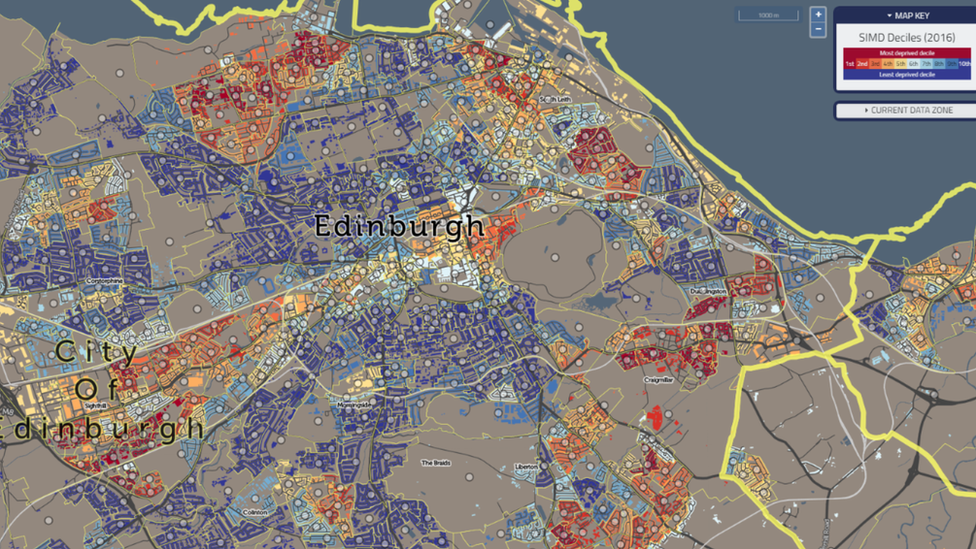
Edinburgh
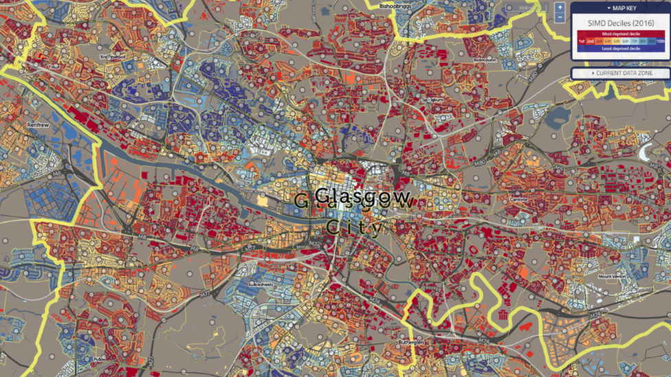
Glasgow
The index found that Glasgow has 56 of the 100 most deprived areas in Scotland.
Meanwhile Edinburgh has six of the most deprived areas - up two on the same survey four years ago.
Outside the central belt, Midstocket, in Aberdeen, and St Andrews south west in Fife were among the least deprived areas.
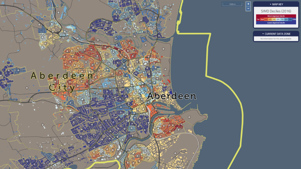
Aberdeen
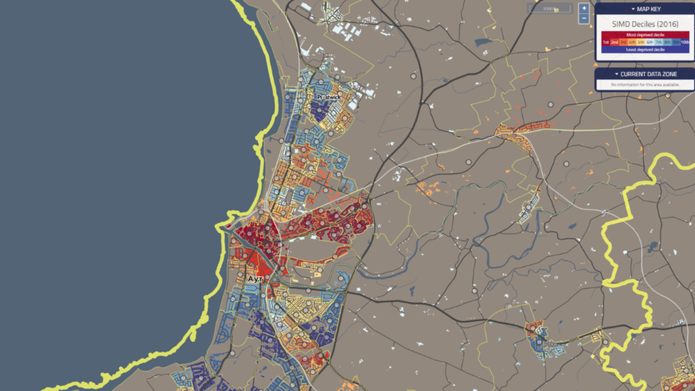
Ayr
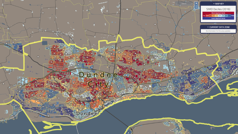
Dundee
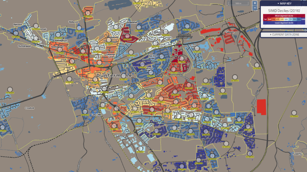
Dunfermline
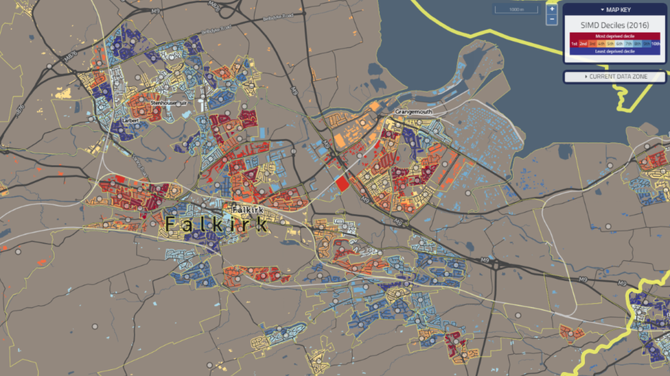
Falkirk
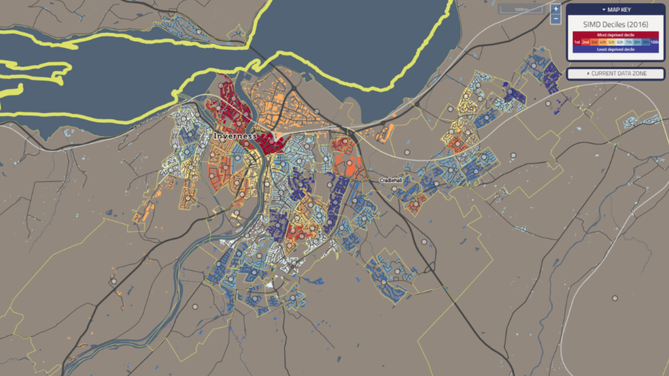
Inverness
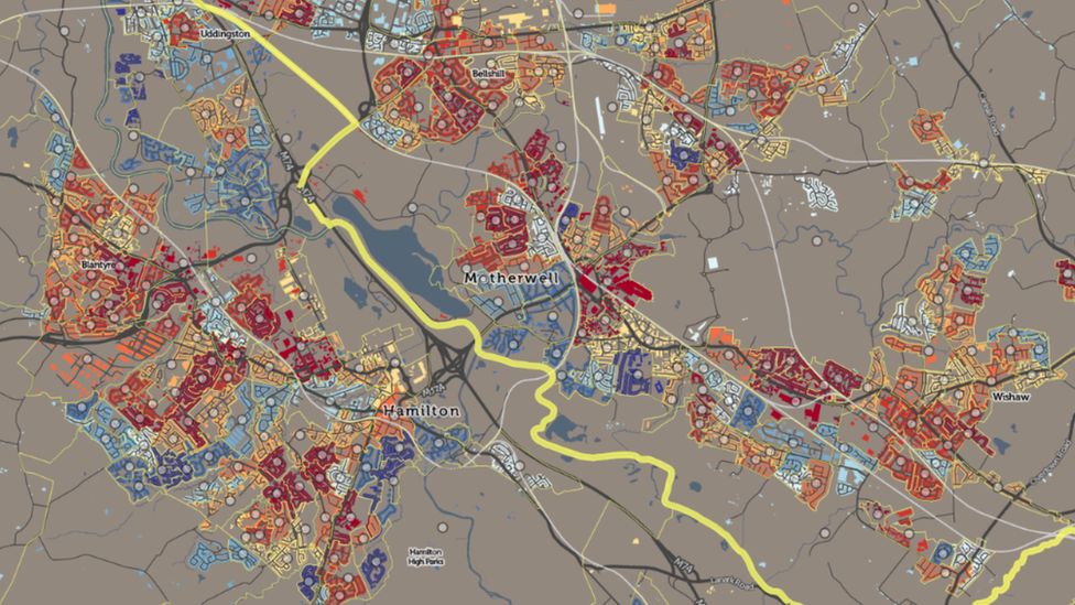
Motherwell and Hamilton
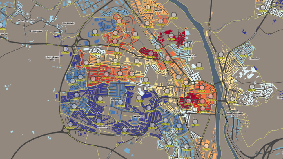
Perth
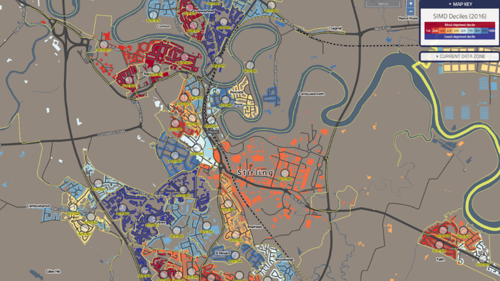
Stirling