Amber alert as Ophelia storm reaches Scotland
- Published
- comments

The Scout hut in Castle Douglas lost its roof in the high winds
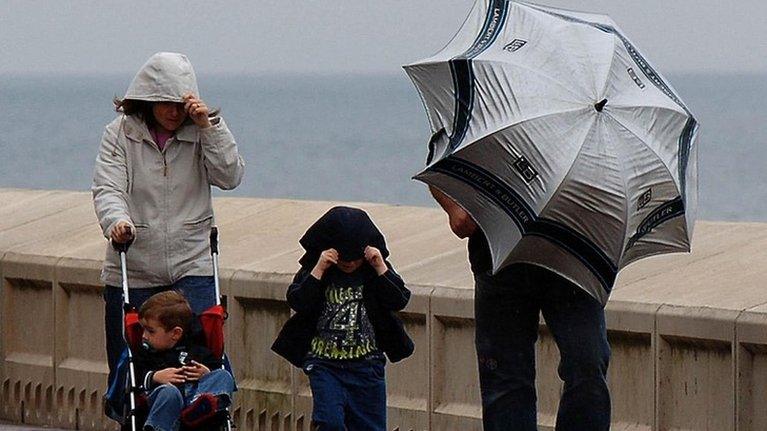
Winds gusting at more than 70mph and heavy rain have hit parts of Scotland as the remnants of Hurricane Ophelia reached the UK and Ireland.
The Met Office has extended an amber "be prepared" warning to cover the south-west of the country. It is valid from 12:00 to 23:00.
A yellow "be aware" warning remains in place across much of southern and central Scotland.
A further alert of strong winds is in place for many areas on Tuesday.
Ophelia reached Ireland early on Monday with gusts of almost 100mph (161km/h) reported on the south coast.
By Monday evening, gusts of 73mph were recorded in south-west Scotland.
Police Scotland said the storm was affecting Dumfries and Galloway with a number of trees being blown down in the region.
In Castle Douglas, high winds blew the roof off a Scout hut. The roof then became stuck on top of a nearby church.
Residents living near the hut in Blackpark Road, Douglas Court Drive and Jubilee Terrace are being asked to remain indoors.
The A74 near to Castle Douglas was earlier closed after a tree came down over the road.
Allow X content?
This article contains content provided by X. We ask for your permission before anything is loaded, as they may be using cookies and other technologies. You may want to read X’s cookie policy, external and privacy policy, external before accepting. To view this content choose ‘accept and continue’.
The Dumfries and Galloway Virtual Operations and Support Team said: "Police Scotland are warning the public that they are currently dealing with a high number of calls from the public in relation to the effects of Storm Ophelia.
"Reports of trees down, roofs blown off buildings and other damage would indicate that the storm is now taking effect. Calls are incoming from Castle Douglas in the east through to Mull of Galloway in the west."
Police Scotland has advised against all but essential travel in the Galloway region.

Images captured by the University of Dundee satellite receiving station show the scale of the storm
Gusts of up to 60mph are expected to hit the Glasgow area in the early hours of Tuesday morning.
Weather experts predict the high winds will then move across eastern parts of the country.
On Sunday, the Met Office issued Northern Ireland with an amber "potential danger to life" warning.
That was subsequently extended to cover Dumfries and Galloway, Lothian and Borders and Strathclyde.
Edinburgh Airport said its flights to Ireland had been cancelled but all others were unaffected.
SP Energy Networks said it had a team of engineers on standby to tackle any power cuts.
The Scottish Environment Protection Agency has issued a series of flood alerts and warnings for the south west of Scotland.
Tidal surge
David Faichney, duty flood manager, said: "The storm this evening is expected to cause significant disruption to some coastal communities in the Solway Coast and Firth of Clyde.
"A combination of tidal surge and large waves will cause overtopping along exposed coastal areas, particularly the Mull of Galloway.
"Impacts are expected to coincide with high tide around 10pm this evening until the early hours of Tuesday."
Transport Minister Humza Yousaf said disruption should be expected during rush hour on Monday evening and on Tuesday morning.
"The impacts will be felt at evening peak today across the west and then in central and southern Scotland the morning peak will probably feel some impact as well," he told BBC Scotland.
"The main message to commuters is when that yellow warning kicks in from 12:00 today, right the way through to effectively 15:00 tomorrow in different parts of Scotland, do check the Traffic Scotland website.
"Expect disruption whether you're on the trunk road network, ferries, whether you're taking a flight and even of course on the trains as well. Do expect some level of disruption so check ahead."

The Met Office warned on Sunday that areas covered by the weather warnings could see longer journey times with possible cancellations to rail, air and ferry services.
The forecaster added: "Some damage to buildings, such as tiles blown from roofs could happen, perhaps leading to injuries and danger to life from flying debris.
"Coastal routes, sea fronts and coastal communities may be affected by spray and/or large waves."
The charity RNLI said the weather conditions could make seas around coastal areas "particularly dangerous and unpredictable".
Meanwhile, Scottish airline Loganair has offered free flight changes to customers who face weather disruption on some of its west coast routes.
- Published15 October 2017
- Published17 October 2017