Storm Ali to bring high winds and rain across much of Scotland
- Published

Storm Ali is expected to bring high winds and heavy rain to central and southern parts of Scotland
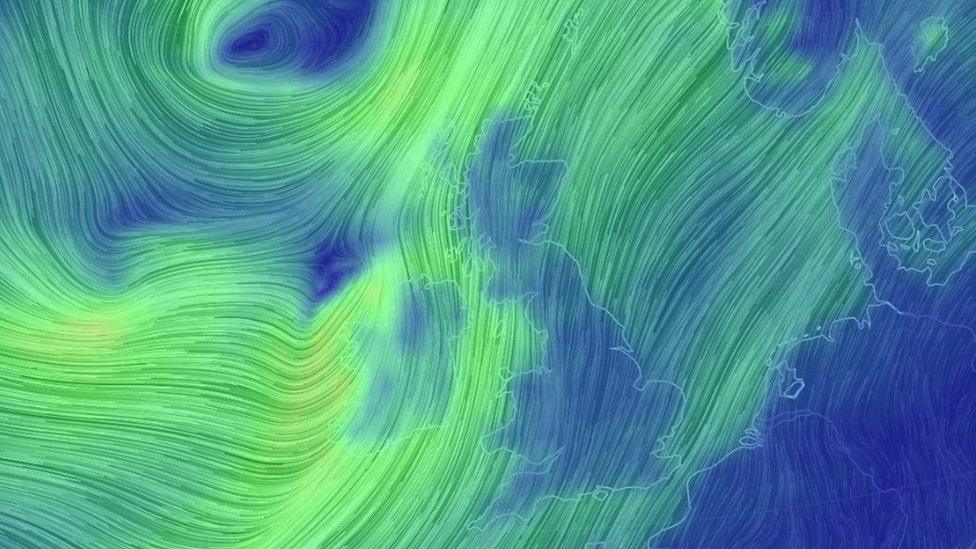
Much of Scotland is due to be battered by high winds and heavy rain as the first named storm of the season sweeps in.
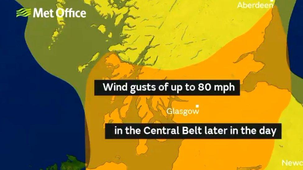
The Met Office has issued weather warnings, external and said Storm Ali could bring winds of 80mph and a danger to life from flying debris.
An amber warning is in place for large parts of the country between 08:00 and 17:00 on Wednesday.
Travel disruption and huge waves in coastal areas are also expected.
'Damage to buildings'
The amber warning covers central, Tayside, Fife, Grampian, south west, Lothian and Borders and the Strathclyde areas.
The Met Office said flying debris was likely as was damage to buildings from falling tiles, trees and branches.
It added: "Large waves could affect coastal roads, sea fronts and properties."
Allow X content?
This article contains content provided by X. We ask for your permission before anything is loaded, as they may be using cookies and other technologies. You may want to read X’s cookie policy, external and privacy policy, external before accepting. To view this content choose ‘accept and continue’.

Gusts of 65-75mph were expected inland, with winds reaching up to 80mph at times on high ground and in coastal areas.
A Scotland-wide yellow "be aware" warning is also in place between 06:00 and 22:00 on Wednesday.
The warning has prompted police to caution drivers of high-sided vehicles to consider whether they are safe to drive.
'Drivers ignoring warnings'
Ch Supt Stewart Carle, head of road policing, said: "Previous incidents have clearly shown the dangers of driving vehicles vulnerable to being blown over in high wind conditions and the subsequent danger created for other road users, emergency services and recovery operatives where incidents have occurred due to drivers ignoring warnings."
He added: "If you are driving a vehicle which may be vulnerable to being blown over in such conditions along exposed routes including bridges, please exercise additional caution and plan your route to avoid exposed areas or consider cancelling your journey until conditions improve."
The Met Office tweeted about naming the storm.
It said: "Very strong winds and heavy rain will reach Northern Ireland and parts of Scotland during Wednesday. @MetEireann and @metoffice have just jointly named this system 'Storm Ali'."

The Met Office issued amber and yellow warnings
Scotland's Transport Secretary Michael Matheson said the Scottish government's resilience room would be active throughout Wednesday to monitor the wider impact of Storm Ali.
He urged motorists to check Traffic Scotland before setting off to make sure that their route was available.
He added: "The conditions are also likely to lead to disruption on other modes of transport, so we are urging people to take the weather into account if they are planning to travel on trains, ferries and flights."
'Emergency bunker'
Stein Connelly from Transport Scotland told the BBC: "We've been doing a lot of planning on this and have been working closely with the Met Office.
"We have called in our operating companies to look at what resources they have available. They have specialised resources - people trained with chainsaws and pumps to clear out drains and make sure there is no flooding.
"The amber warning covers from Dundee to the south. It covers the morning and evening peak, with the disruption expected to increase as the day goes on.
"Our advice is as always, plan your journey, be prepared and drive to the conditions."
ScotRail said it was planning to run a normal service on Wednesday but urged passengers to check their journeys before setting off.
It also urged anyone who lives near the railway to secure any loose garden furniture.
A spokesman said: "We plan to run a normal service tomorrow across all routes. We'll be keeping a close eye on wind speeds in real-time from our integrated control room."
CalMac has cancelled a number of ferry sailings in the Western Isles and has warned of a "high likelihood of major disruption" across all of its routes.
Scottish Borders Council said it was opening its "emergency bunker" from 07:30 "to enable a co-ordinated response with partners" to Storm Ali.
The Dumfries and Galloway Virtual Operations Support Team (DGVOST) - involving council and emergency services - is also being activated. It uses social media and online updates to keep people informed of any major incidents in the area.

What the weather warning colours mean
Yellow: Severe weather expected. Yellow means you should plan ahead thinking about possible travel delays, or the disruption of your day-to-day activities.
Amber: Be prepared for disruption. There is an increased likelihood of bad weather affecting you, which could potentially disrupt your plans and possibly cause travel delays, road and rail closures, interruption to power and the potential risk to life and property.
Red: Extreme weather is expected. Red means you should take action now to keep yourself and others safe from the impact of the weather. Widespread damage, travel and power disruption and risk to life is likely. You must avoid dangerous areas and follow the advice of the emergency services and local authorities.