Why is August the wettest summer month in Scotland?
- Published
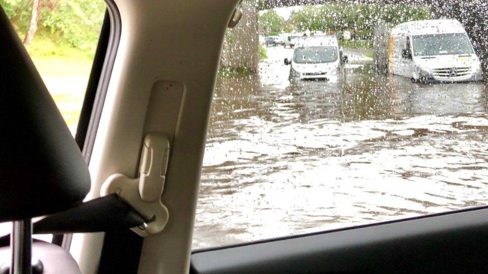
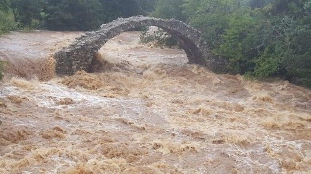
Torrential rain led to flooding at Carrbridge in the Highlands
Scotland may have to wait a while yet before it dries off from the most recent torrential downpours.
On Thursday an entire tunnel in West Lothian was rendered inaccessible after 60% of rainfall predicted for the entire month of August fell in the space of just three hours. In some areas in Moray the figure was closer to a full month's worth.
Emergency services have been out in force with firefighters called to pump water from flooded homes in Inverness and from the Winchburgh tunnel in West Lothian.
And roads across the country were brought to a standstill with abandoned vehicles left in two feet of water.
Allow X content?
This article contains content provided by X. We ask for your permission before anything is loaded, as they may be using cookies and other technologies. You may want to read X’s cookie policy, external and privacy policy, external before accepting. To view this content choose ‘accept and continue’.
So why has this August been so dreich?
August may not be the wettest month of the year, but in the past 10 years it has consistently remained the wettest summer month going by the meteorological seasons.
Rainfall is most frequent in January - about 18 days' worth - with late spring and early summer the driest in western Scotland.
Unsurprisingly, the wettest parts of Scotland in the summer are in the north-west Highlands and Argyll, with drier conditions in lower lying areas to the east.
Commuters in Dunfermline, Fife, may have disputed that point this week though with two feet of rainfall causing havoc on the roads.

Flooding in Dunfermline saw vehicles stranded on Admiralty Road
But in the past two years, the gap between August and January rainfall has been closing - and in fact in 2017, August had 147.1mm when January had 100.8mm.
BBC Weather meteorologist Billy Payne said the country is more prone to active thunderstorms from June to August because there tends to be more heat and moisture around.
"We can get thunderstorms in the winter too," he said. "But these tend to form over the sea when winds are from the north or west, as the sea is warmer than the overlying air.
"In summer, thunderstorms break out over the land."
The science bit
One way of looking at temperature and rainfall distribution in the UK - as well as the abnormalities - is by looking at the North Atlantic Oscillation.
This is a climate index which meteorologists use to refer to variations in the surface pressure gradient over the North Atlantic.
A negative NAO is characterised by higher than normal pressure over Greenland and Iceland, with lower pressure over the Azores - and this can lead to significant rainfall events.
A determined cyclist makes it through flood water in Edinburgh
Since the weekend a slow moving area of low pressure has been heading in off the Atlantic, crossing the UK and moving out into the North Sea - which has taken a more southward track than usual for August.
Billy explains: "This year we saw the lengthiest negative NAO on record at 83 days from 26 April to 17 July. After briefly recovering, it has fallen negative again.
"This tends to result in wetter than normal conditions over eastern Scotland, relative to normal, as compared with the west. When the NAO is positive, north-west Scotland receives the wettest weather with frequent westerly winds.
"Troughs of low pressure stalling to the south-west of the UK can draw up significant heat from Iberia and Africa, like those seen in late July when we broke the UK's record temperature.
"Ex-hurricanes and tropical storms can occasionally become influential in our weather through the summer and into the autumn - two examples of these in August include ex-hurricane Bertha in 2014 and Charley in 1986."
What about climate change?
A key finding from the State of the UK Climate Report over the past decade, summers have been 13% wetter, and winters have been 12% wetter than the period 1961-1990.
And six of the 10 wettest years in the UK since 1862 have occurred since 1998.
So it is possible that Scotland is being more adversely affected by a trend of torrential downpours in recent years.
Billy added: "We can't attribute a few recent rainfall events to climate change, but since warmer air can 'hold' more moisture, a warming climate could lead to more extreme rainfall events."
- Published8 August 2019

- Published9 August 2019
