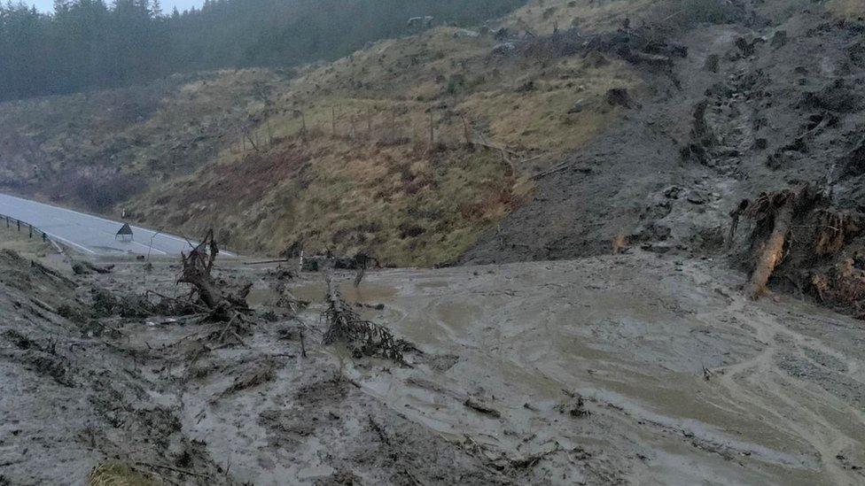
Flooding risk remains high in parts of Scotland despite rain easing
- Published
Heavy rainfall has caused flooding across parts of Scotland
Parts of Scotland remain at risk of flooding despite the rain easing off.
River levels are continuing to rise and the ground is saturated, increasing the risk.
All Met Office yellow warnings have now been lifted but a further yellow warning for rain has been issued for parts of western Scotland for Tuesday.
Two severe flood warnings were still in place at 06:00 on Monday for parts of Perth and Aviemore.
The warning covered the North Inch area of Perth and the Dalfaber area of Aviemore.
The Scottish Environment Protection Agency (Sepa) said basements and properties in low-lying areas of North Inch were at risk of flooding.
The Aviemore warning covers Dalfaber Road, Inverdruie, The Old Bridge Inn, Speyside Leisure Park and the sewage treatment works.
ScotRail said it was expecting to run a full service across most of the network on Monday morning including the central belt.
But service delivery manager David Simpson said routes from Stirling to Perth and from Perth to Inverness were still affected by floodwater.
The Stonehaven to Arbroath route is also awaiting the completion of safety inspections, he added.
Apart from the two severe weather warnings, Sepa had more than 30 flood warnings and several flood alerts still in place, external at 10:00 on Monday.
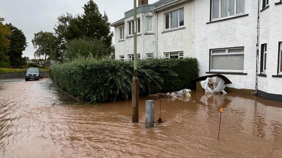
The Craigie area of Perth was flooded after the Craigie burn burst its banks
Hours of heavy and persistent rain on Friday and Saturday caused major disruption around the country with some areas continuing to experience problems on Sunday.
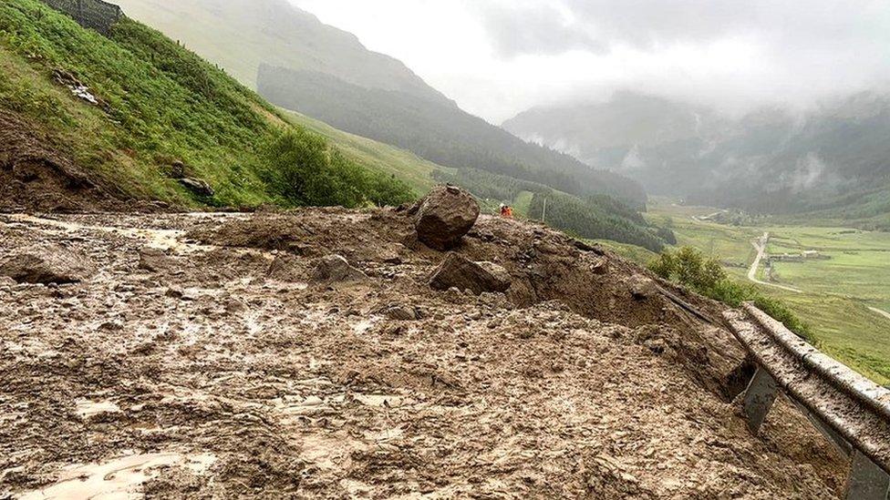
Work has begun to clear the A83 after seven landslips blocked the vital road to Argyll and the Inner Hebrides on Saturday.
About 2,000 tonnes of debris fell on the road.
Ten people had to be airlifted from their vehicles on the A83 at the height of the bad weather.
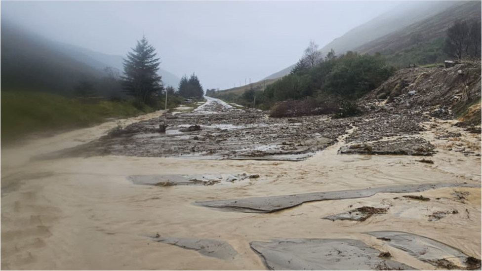
Saturday's rain has brought floods and landslips along the A83
HM Coastguard helicopter rescue stranded people
The area around the Rest and Be Thankful saw a month's worth of rainfall, about 160mm (6in) fall over 36 hours. Bear Scotland said the catch pits and fences it installed had ensured that only a small amount of debris reached the road itself.
Road closures are in place between Inveraray and Tarbet due to landslides both sides of Dunoon junction. The diversion via A819/A85/A82 at A85 Dalmally is open.
The Western Ferries route from Gourock to Dunoon is running.
The Met Office said Tyndrum, west Perthshire, experienced the most rainfall on Saturday, with 112.6mm (4.4in) falling on the small village.
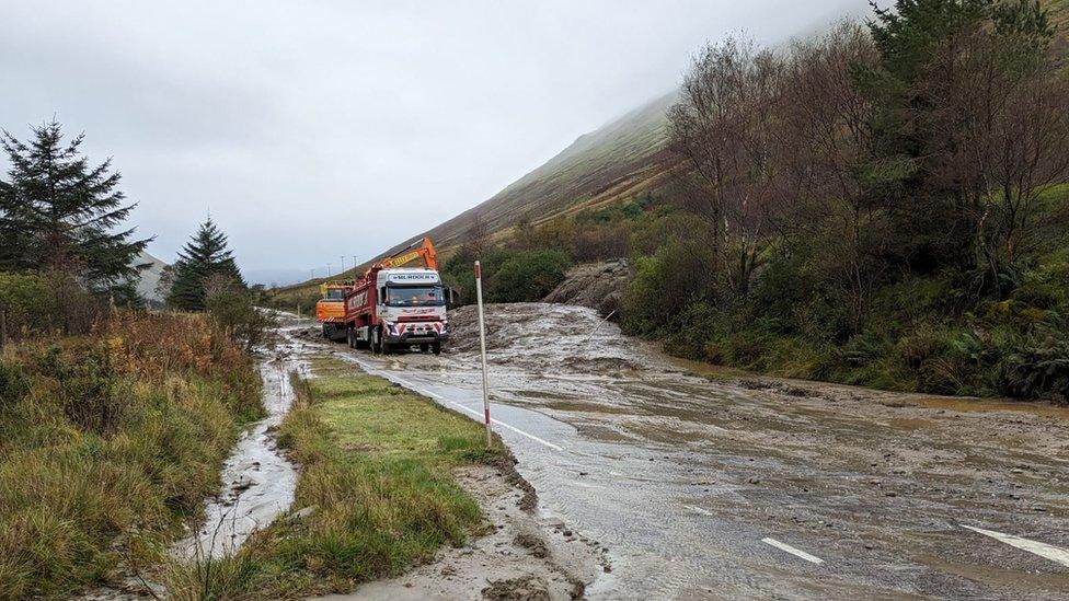
The clear-up has begun on the A83 after it suffered seven landslips
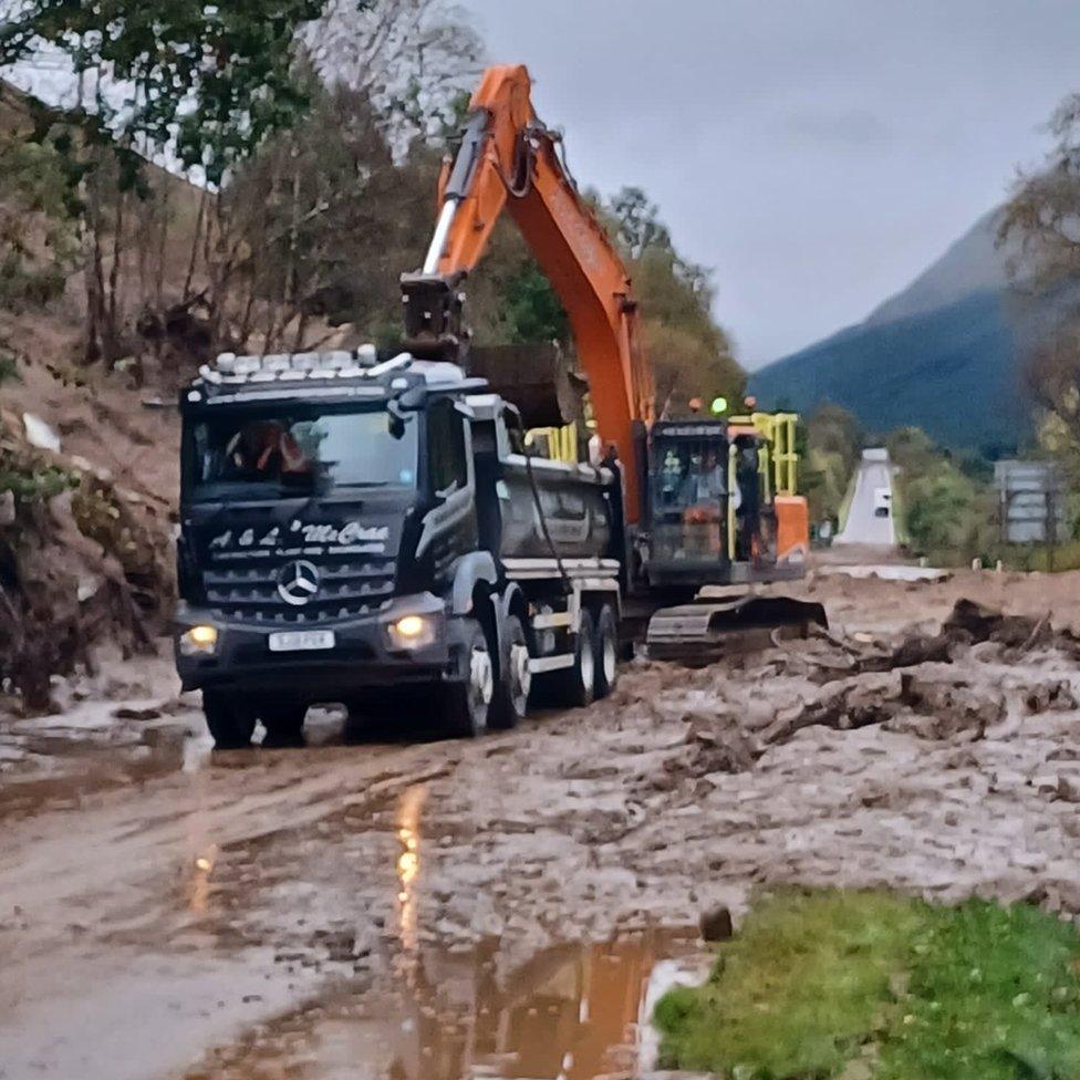
Police said on Saturday there had been no reports of injuries but they were treating the persistent heavy rain in parts of the west of Scotland as a "major incident".
In Aberfoyle, a warning was issued by NHS Forth Valley after a lorry overturned, spilling kerosene/diesel into the watercourse. It said kerosene had also leaked into the general floodwater which poses a potential threat to public health.
Health protection experts urged people to be extra careful if floodwater had entered their homes as there could be "significant health risks" to certain groups such as pregnant women, children, the elderly and those living with heart and lung conditions.
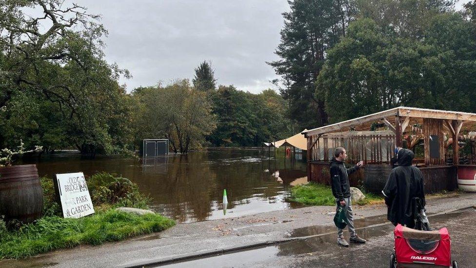
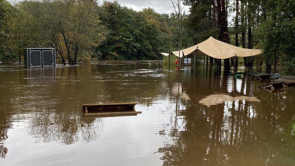
The River Spey burst its banks at the Old Bridge Inn at Aviemore
There following trunk roads are closed:
The A84 between Kilmahog and Strathyre
A92 at Letham
A83 between Tarbet and Inveraray
A828 between Connel and Ballachulish
A85 at Loch Awe
ScotRail said disruption was continuing on Sunday with the following routes completely closed:
West Highland Line between Glasgow and Oban/Fort William
All services between Edinburgh and Perth, Dundee, Aberdeen, and Inverness
All services between Glasgow and Perth, Dundee, Aberdeen, and Inverness
All services between Kyle of Lochalsh and Inverness
ScotRail is advising customers not to travel as no rail replacement travel is available. Some other routes remain affected by speed restrictions as a safety precaution, meaning services may be subject to delay or cancellation.
The rail operator said the greatest risk to a normal restart on Monday was on the Highland Main Line and the Perthshire areas where floodwaters remain high. Passengers whose Monday journey runs between Perth and Inverness or Perth and Stirling are urged check before leaving home.
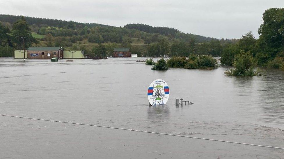
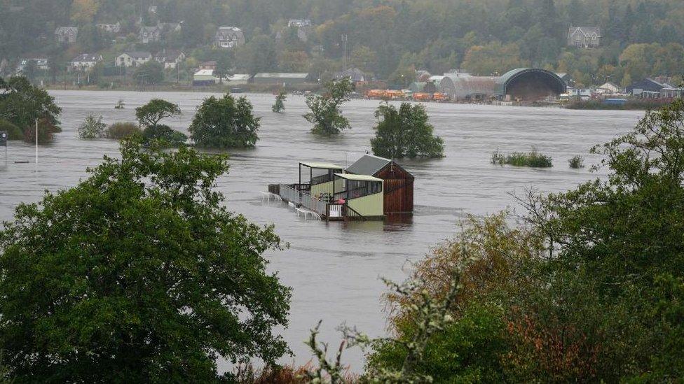
This flooded sports field is in Kingussie
David Simpson, ScotRail service delivery director, said: "The weather we have seen over the weekend has been extreme and in some parts of the country we are continuing to see dangerous levels of rainfall and flooding.
"We appreciate that weather-related disruption like this can be frustrating, but our first priority has to be the safety of the public and our colleagues.
"Our staff across the country, alongside colleagues at Network Rail, are working hard to get services back to normal as quickly and safely as possible, with the priority being getting things back to normal for Monday morning.
"Customers are advised that they should check their journey before travelling, and keep an eye on our website, app, or social media feeds for live updates."
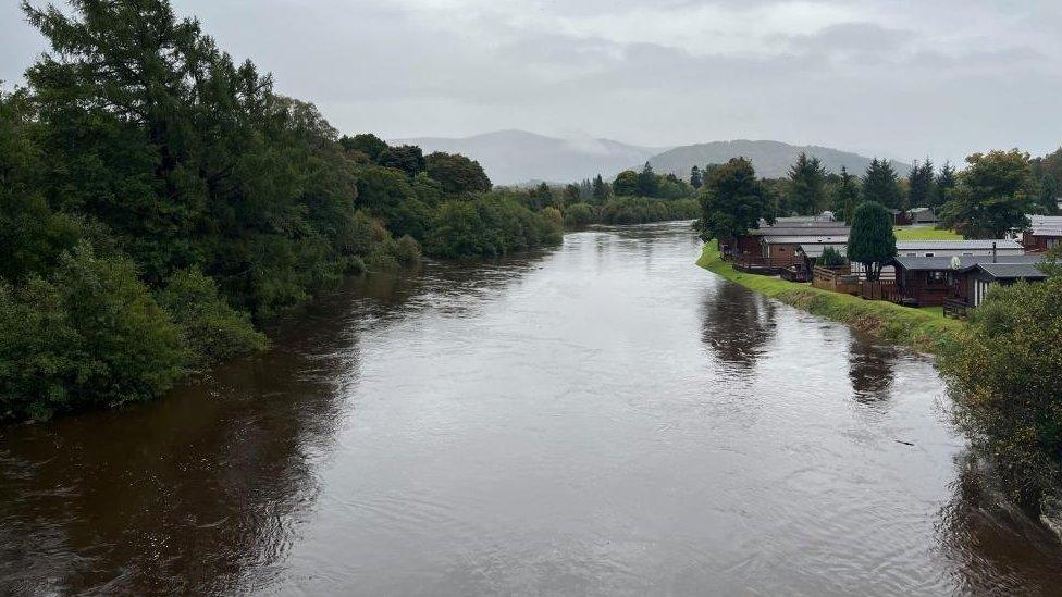
The River Spey levels were very high in Aviemore
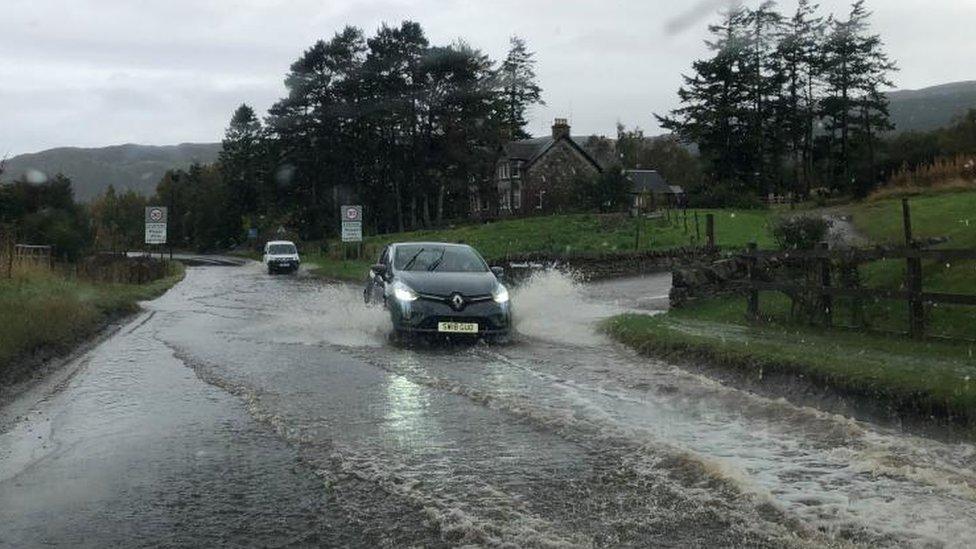
Roads in Aviemore were covered in water
Ruth Ellis, Sepa's flood duty manager, said: "Today the focus turned to communities across the north, with a particular concern for severe flood impacts to communities along the Spey and Tay rivers.
"I want to be clear that communities in these areas should stay alert over the evening as some rivers will continue to rise over the course of the evening. The risk to life remains.
"It's been a difficult weekend across Scotland, with severe weather causing widespread travel disruption to road and rail networks and impacts in communities all over Scotland. Across many areas of the country there is still some deep standing water and it's really important people understand the danger.
"Hazards can be hidden, so please don't walk or drive into flood water. Remember that not only is flood water likely to be dirty, 30cm of fast flowing water can move an average family sized car, and just 15cm of fast-flowing water could be enough to knock you off your feet.
"We'll be continuing to issue further updates across the evening to communities across northern Scotland and our advice remains for people to keep up to date with information from sepa.org.uk and follow guidance from emergency services."
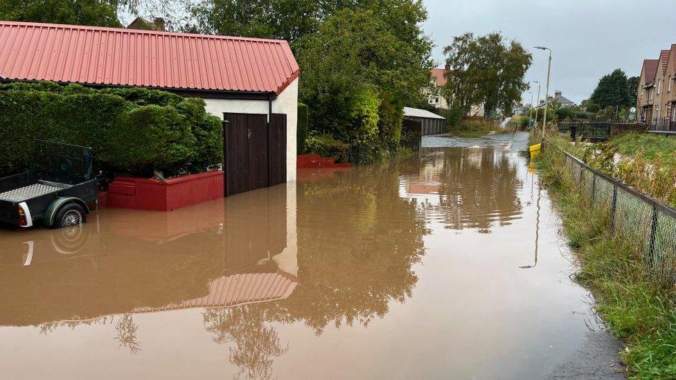
Flooding in the Craigie area of Perth
Following a meeting of the Scottish government's Resilience Room on Sunday, Home Affairs Secretary Angela Constance said: "The rainfall we have seen over Scotland this weekend has been extreme, causing significant disruption -particularly in the west and north of the country.
"These impacts are ongoing, and I want to put on record my thanks to all the staff and volunteers responding across the country.
"The flooding risk remains a key concern over the next few hours and days, with extremely high river levels and saturated ground."
She added: "Our multi-agency response teams stand ready and prepared to respond to any flooding incidents. Some local councils have also set up rest centres in their areas.
"The priority is now to restore normality as far as possible by Monday morning. I would, however, urge anyone planning to travel over the next few days to do so with caution."
On Saturday no cross border trains ran and ScotRail cancelled dozens of services and also cut short its scheduled timetable.
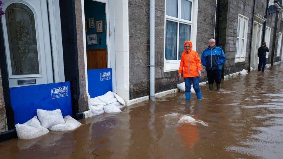
Flooding has affected numerous areas, including Dumbarton
Ian Stewart, Bear Scotland's north west representative, said: "This extreme weather has caused widespread disruption, with Argyll significantly affected.
"Our teams are beginning clear-up operations to return full access to residents of Argyll, but conditions are still difficult, and we need to ensure that those on site are safe. As such, it is unlikely the A83 will reopen today.
"We are also continuing to work as part of the Argyll and Bute Resilience Partnership to assess road closures and incidents in the area."
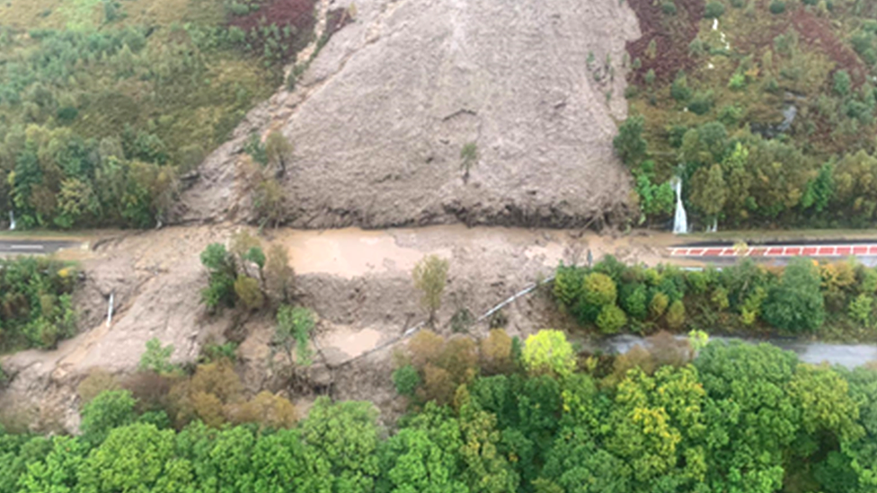
The A83 is often closed by landslips like this one on Saturday
The A83 has proved to be especially vulnerable to landslips and closures and in recent years calls have grown for a permanent solution to make the road more resilient to bad weather.
At almost 100 miles (161km) long, the road connects the Mull of Kintyre and southern Argyll to the shores of Loch Lomond. About 1.3 million vehicles use the route every year.
The closures can leave motorists facing long detours while the route is cleared.
Transport Scotland is planning to build a mile-long open-sided tunnel on the road, on the mountain pass known as the Rest and Be Thankful. The project is expected to cost up to £470m.
Posting on X, the social media site formerly known as Twitter, the former Argyll MSP Michael Russell said: "The amount and rate of rainfall here in Argyll & Bute in the last 24 hours has been astonishing.
"However, that aside it is concerning that slips are on this stretch which is not the area where most of the major problems have previously occurred."
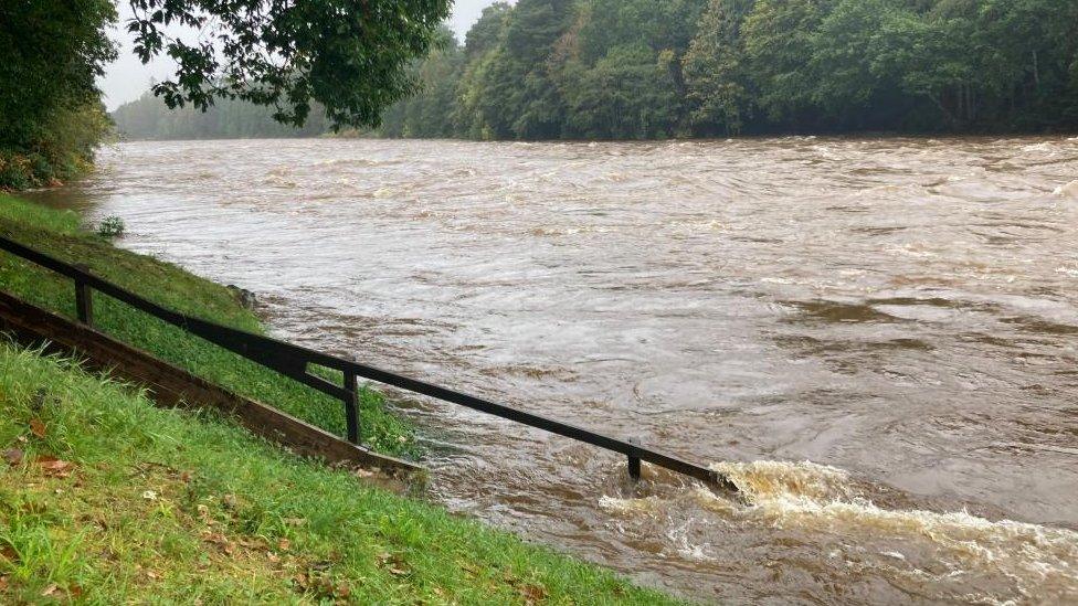
Steps under water at the River Dee at Banchory
An Argyll and Bute Council spokeswoman said: "We are working with our partner agencies, including Police Scotland, the HSCP (Health and Social Care Partnership) and others, to respond to the impact of this weekend's weather in Argyll and Bute.
"We have well established partnership arrangements for supporting vulnerable people and have put them into action. Actions have included for example preparing a rest centre yesterday in Lochgilphead for people potentially stranded because of road closures, although this ultimately was not needed.
"There are road closures across the area because of landslips, flooding or other impacts, and advice remains to not travel in Argyll and Bute.
"We have road crews out across the area to continue work today to clear debris on the road network where possible and to assess the impact of weather conditions, and the recovery work needed.
"Many people in our communities also took action to help and we would like to thank everyone involved for their efforts."
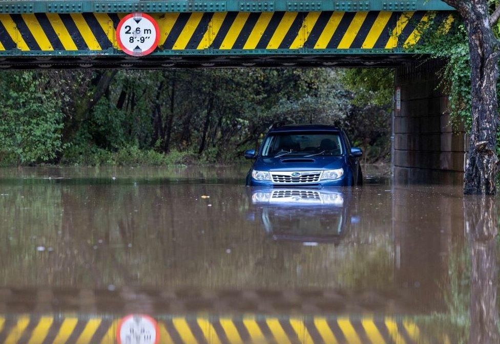
An abandoned car under a flooded railway bridge in Dumbarton, West Dunbartonshire
In the south of the UK, sunshine and highs of about 25C (77F) were forecast by the Met Office for Sunday.
Tom Morgan, a Met Office meteorologist, said the contrasting weather was caused by warm weather travelling up from France meeting cold weather coming from the north with the temperature contrast leading to the heavy rain in Scotland.
The warm weather in southern parts was expected to last until Tuesday.
- Published7 October 2023

- Published7 October 2023

- Published2 June 2023

- Published5 August 2020
- Published30 January 2020
