Rare antique map used as draught excluder is restored
- Published

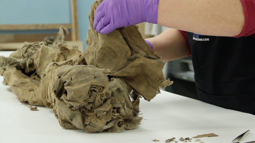
The map arrived at the National Library of Scotland like a "bundle of rags"
A rare antique map found stuffed up a chimney in Aberdeen has been saved by conservation experts.
The document, which dates back to the late 17th Century, was destined for the skip when it was discovered during a house renovation.
Used as a draught excluder, it was encrusted with dirt and had been attacked by vermin and insects.
But it has now been meticulously cleaned and restored by the National Library of Scotland (NLS).
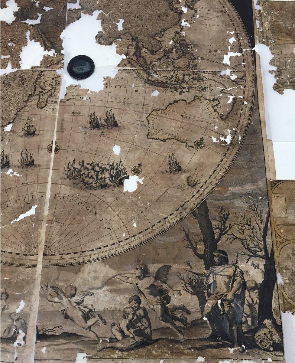
The map of the world was produced by the Dutch engraver Gerald Valck and there are thought to be only two other copies in existence.
In its heyday, the map, which measures 2.2m by 1.6m (7x5ft) would have been hung on a wall to be admired by visitors.

The map has been restored to reveal its "detailed splendour"
Despite its impressive history, the map was rolled up in a plastic bag and looked like a "bundle of rags" when it arrived at the Edinburgh library.
It was so delicate that every time it was moved, fragments of the map fell off "like confetti".
National librarian Dr John Scally said: "This is one of the most challenging tasks our conservation team has faced and they have done a terrific job.
"Although significant sections of the map have been lost, the remainder has been cleaned and stabilised for future study and enjoyment.
"It would have been very easy for this map to end up at the bottom of a skip but thankfully it can now take its place among the magnificent maps held within our collection."
The conservation process by the NLS involved:
opening and flattening the map;
separating it into its original eight sections;
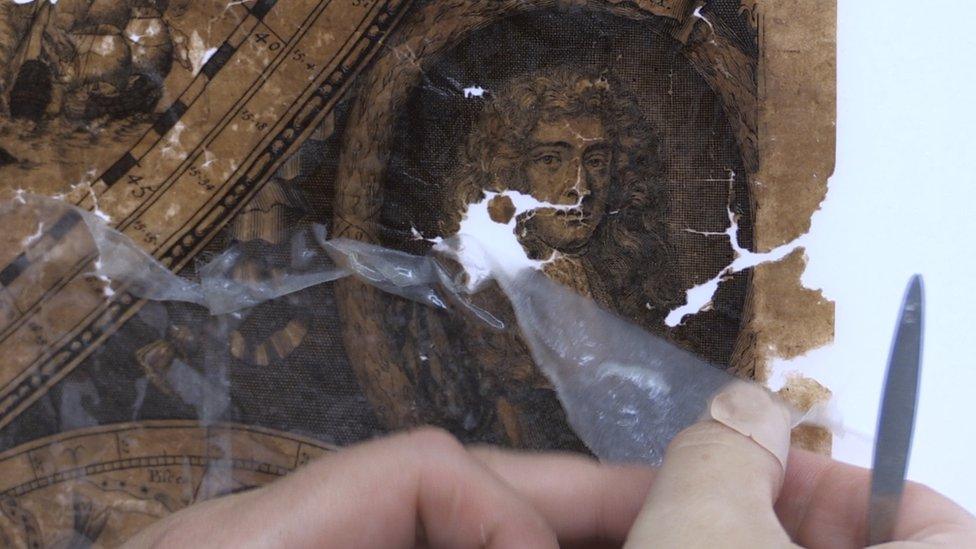
removing the linen backing;
dry cleaning and washing the paper;
re-assembling the cleaned sections onto a new paper lining.

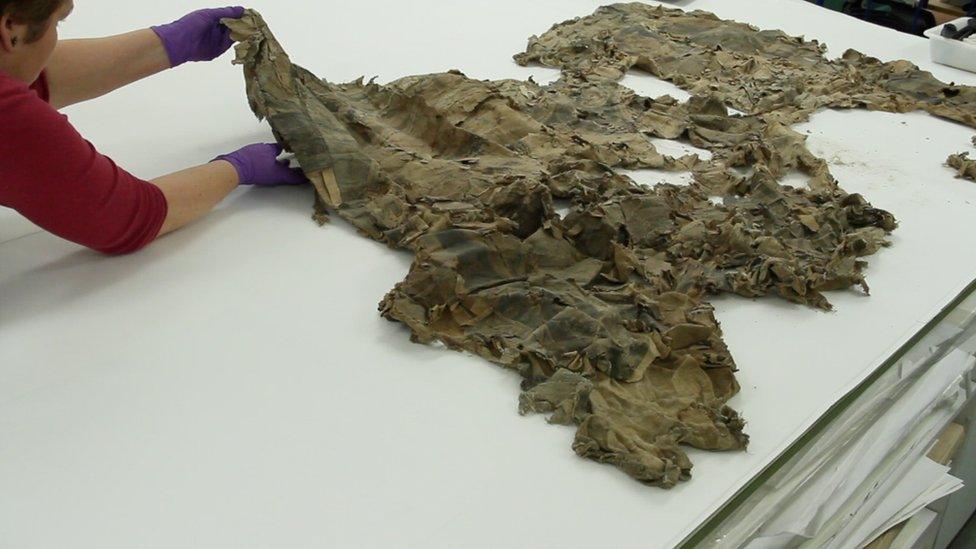
The delicate map had to be carefully unrolled

Much of the paper of the map was lost, and what remained was hard and brittle in places, soft and thin in others
Claire Thomson, the library's book and paper conservator, said: "Once the map was unfurled I was able to assess its condition, which I must admit filled me with dread.
"Much of the paper had been lost, and the remainder was hard and brittle in places and soft and thin in others.
"We needed to stabilise it to prevent any further deterioration, make it robust and easier to handle to get to a point where it could be studied by researchers."
The NLS said the map, which was donated to the library, will be available to view and study once the conservation work is completely finished.