Warm weather reveals previously unknown archaeology
- Published
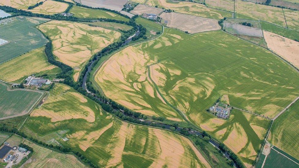
The dry weather has revealed ancient water courses buried under cultivated fields
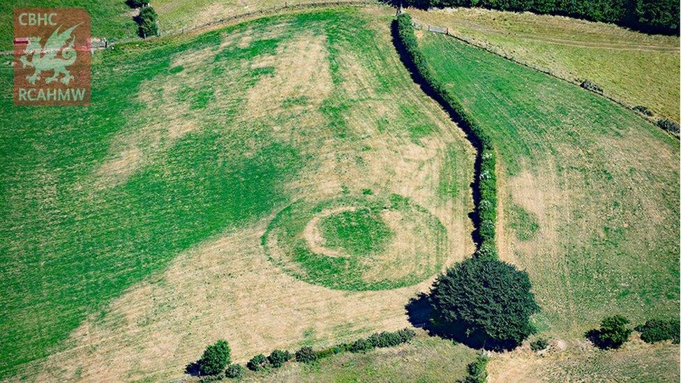
Archaeologists say recent dry weather has given them the best chance since 1976 to detect new sites from the air.
Marks in crop fields across central and southern Scotland have revealed new Iron Age structures in the Borders, and a temporary Roman camp near Peebles.
Dave Cowley from Historic Environment Scotland (HES) said: "We depend on dry years to bring out the buried remains in the crops."
He added that newly revealed sites "add to our ability to see into the past."
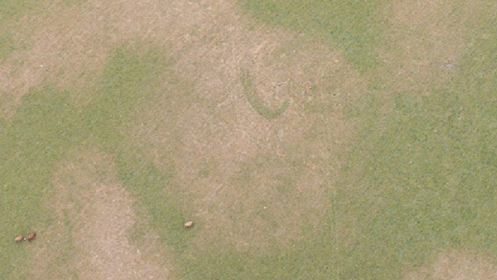
Parched grass shows up the banana shaped outline of what is probably a souterrain or Iron Age passage
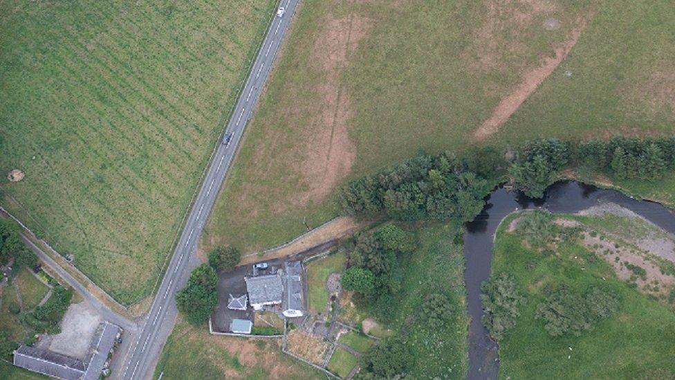
A newly discovered Roman Temporary Camp at Lyne revealed by lines in the landscape
Aerial surveys have been carried out across much of the Scottish mainland since the 1930s, and some of the new discoveries have been made by comparing photographs taken over the decades as different details show up in succeeding years.
Dave Cowley explains that the process is one that would be familiar to any gardener, who might see the contrast in their lawn between a path that has been recently turfed over, and an old flower bed that is now covered by the lawn.
He said: "The area of grass over the old path, for example, will start to burn out sooner, while the former flower beds will stay greener. That's basically because the plant has different amounts of water and nutrients and so on.
"In either grass or arable crops, what we see from the air is the response of the crop to changes in the underlying soil depth and the moisture at that depth."

The straight lines of the Roman temporary camp in Strathearn contrast with the patterns made by ancient dried up river beds
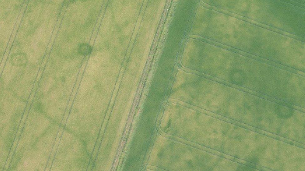
Three small round ditches and one square ditch reveal the sites of probable Iron Age burials
Crops growing over ancient ditches will have access to more moisture and nutrients, and will grow taller and lusher than other crops in the same field - especially in dry or drought conditions.
But interpreting those marks from the sky needs a depth of archaeological understanding.
"From the point of view of the crops," Dave Cowley says, "a ditch is a ditch, whether it was dug five years ago, by a Roman legionary, or five thousand years ago around a large ritual monument."
But how does he tell the difference from the air?
"I've built up a knowledge of excavated sites," Dave said. "Me and my predecessors have been doing aerial surveys in Scotland since the '30s. And that means that we've built up a picture of the landscape."
'An over-view'
That allows him to read the signs - where things may be, and what they might look like.
"But at the end of the day, sometimes you see something and you don't actually know what it is.
"So it's a big detective game, built around what we know of Scotland's archaeology already, exploring for things that we haven't necessarily seen, and trying to build up an overall picture which gives us greater reliability in the individual interpretation (of sites)."
Dave Cowley believes surveys from the air give an over-view of "where people have been doing what, in the landscape ... where people have lived, where they've cultivated and where they've buried their dead."
- Published7 July 2018
- Published22 June 2017
- Published28 July 2016
