Ferries cancelled and flood warnings as Storm Brendan hits
- Published
Footage from Bel Hawson shows waves crashing onto the A83 in Ardrishaig as cars drive along
Parts of Scotland have been hit by severe gales and flooding as Storm Brendan sweeps in from the Atlantic.
Ferry routes covering much of the west coast as well as the Northern Isles have been cancelled or disrupted.
A large tree has fallen at Maybole in South Ayrshire, partially blocking the A77, and may take several hours to clear.
The Scottish Environment Protection Agency, external (Sepa) has also issued 32 flood warnings and 16 flood alerts.
The yellow warning issued by the Met Office covers a 14-hour period from 10:00 until midnight.
A further warning for snow and ice across Scotland is in place from 01:00 until 13:00 on Tuesday, with up to 6cm (2in) on higher ground.
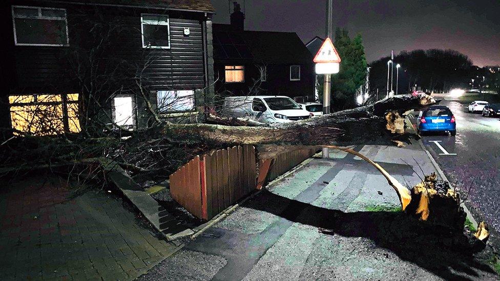
A tree crashed into the garden of a house in the Garthdee area of Aberdeen
Caledonian MacBrayne, external has cancelled ferries on all 28 of its routes for the rest of the day.
CalMac operations director Robert Morrison told BBC Scotland it was unusual for a storm to be large enough to affect the whole network, but that it was not unprecedented.
He said: "We are in the worst of winter weather conditions and will be probably for a few days more.
"The Met Office forecast was for Storm Brendan to blow through within 14 hours, but the forecast for the coming days is also quite significant and we will have to keep a close eye on that.
"Our main aim will be to try and offer our services where it's safe to do so, but only where it's safe to do so."
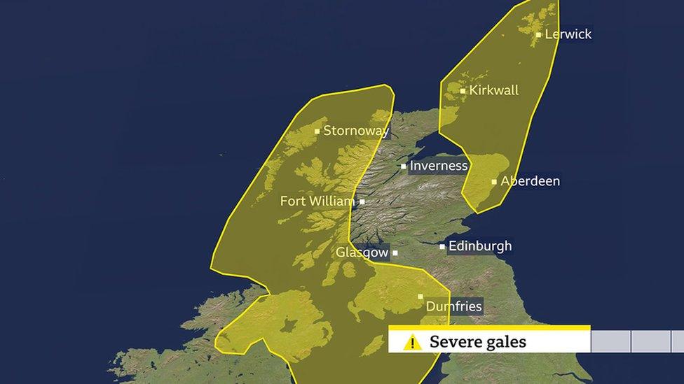
Northlink Ferries, external also told passengers there may be disruption on services to Orkney and Shetland.
The Aberdeen to Lerwick sailing scheduled for 19:00 has also been cancelled.
The Met Office has warned, external of a "very windy period" beginning at about 10:00 on Monday.
In the Garthdee area of Aberdeen one resident thought a branch had blown down when he received a mobile phone alert, triggered by his home CCTV system, at 16:34.
But when Greg Paluch returned from work he was shocked to discovered a tree had fallen into his garden and landed just short of his front door.
Mr Paluch, 35, said: "It could have been worse considering the height of the tree. But no one was at home and no one was hurt - that is the main thing."
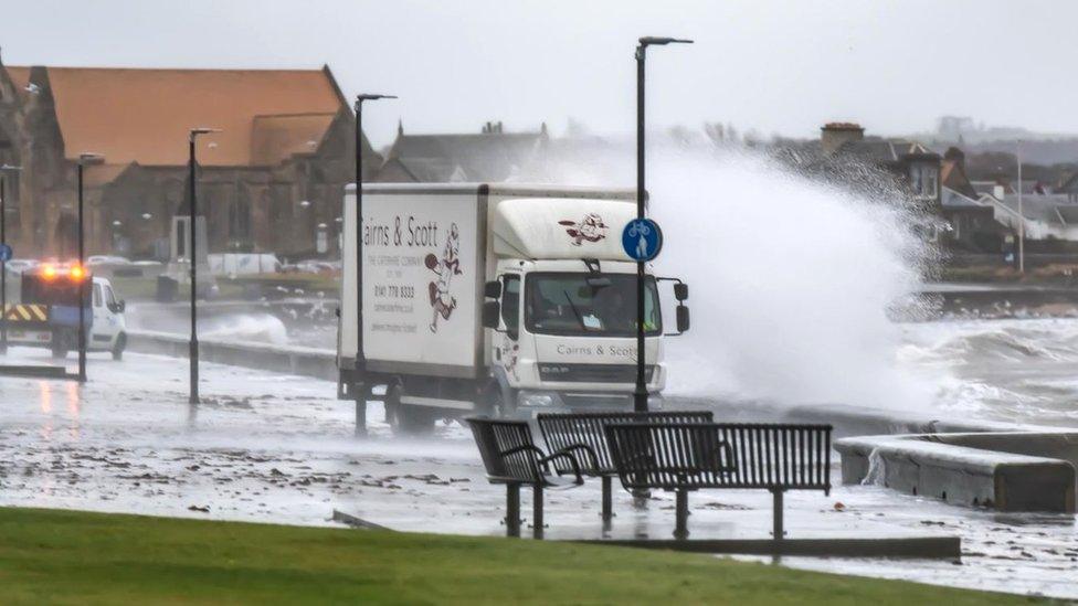
Waves have been crashing onto the shoreline in Troon
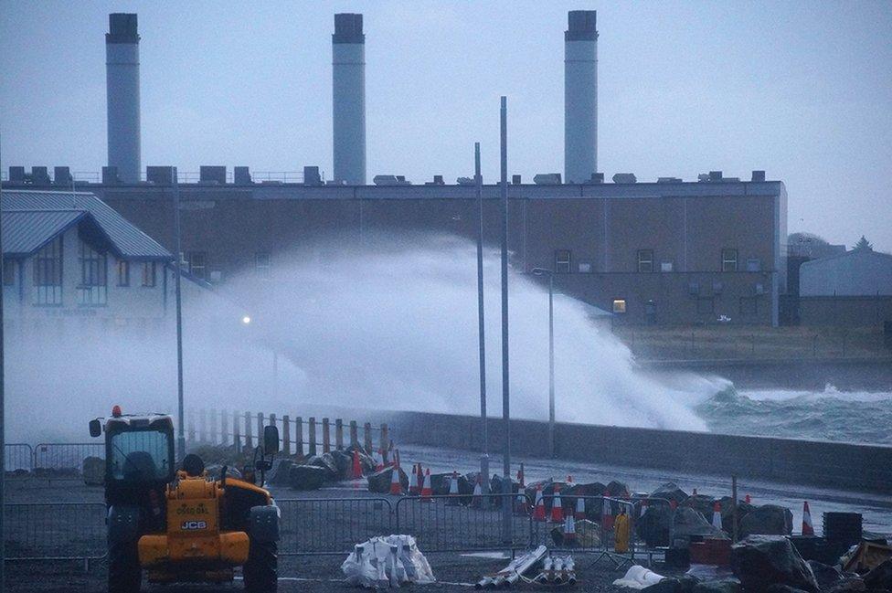
The wild weather has also hit Stornoway
The Met Office said people should expect:
Some delays to road, rail, air and ferry transport, particularly for high-sided vehicles on exposed routes and bridges
Some bus and train services affected, with some journeys taking longer
Coastal routes, sea fronts and coastal communities affected by spray and/or large waves
Some short-term loss of power and other services
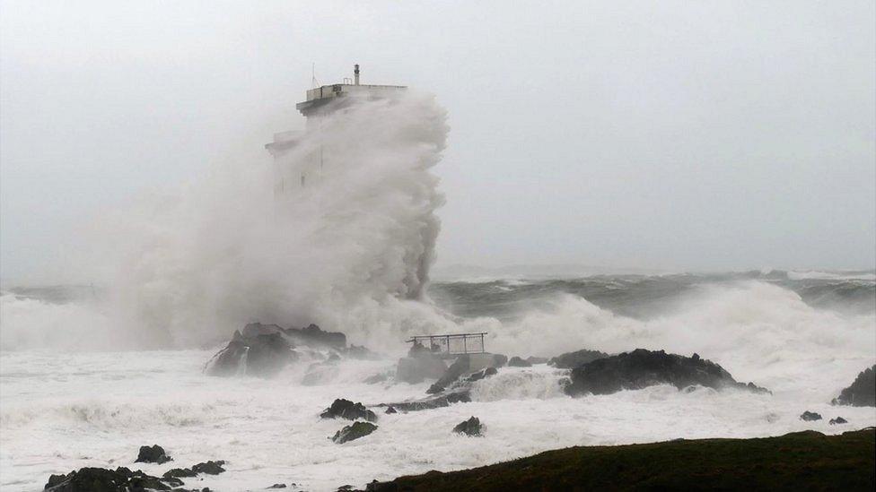
The lighthouse at Port Ellen in Islay was enveloped by waves

Stormy seas have been whipped up at Ardrossan in North Ayrshire
"The strongest winds are expected around exposed coasts and hills," the Met Office said.
"Here gusts of 60-70mph are likely, with a few sites perhaps seeing gusts to 80mph - especially around Irish Sea coasts and around the west coast of Scotland where the strongest winds are most likely.
"Gusts will be lower inland with 45-55mph likely. A narrow band of squally, heavy rain moving east, accompanying the strongest winds, may be an additional hazard."
Allow X content?
This article contains content provided by X. We ask for your permission before anything is loaded, as they may be using cookies and other technologies. You may want to read X’s cookie policy, external and privacy policy, external before accepting. To view this content choose ‘accept and continue’.

Restrictions have been placed on several bridges because of high winds, with the Cromarty, Dornoch, Skye and Kessock bridges among those closed to high-sided vehicles.
As part of preparations for the storm, Comhairle nan Eilean Siar (the Western Isles council) closed all its schools to pupils for the day.
Sepa issued its flood warnings and alerts amid concerns about disruption in coastal areas.
Allow X content?
This article contains content provided by X. We ask for your permission before anything is loaded, as they may be using cookies and other technologies. You may want to read X’s cookie policy, external and privacy policy, external before accepting. To view this content choose ‘accept and continue’.

An agency spokesman said: "The Met Office has forecast strong and sustained winds from Monday morning, January 13, through much of the week.
"Combined with naturally high tides next week, the sustained winds will create an unusual and dangerous combination of tide, storm surge and inshore waves.
"There is therefore a risk of coastal flooding to all Scotland's coastal areas. The highest risk is around high tides from midday Monday through to Tuesday afternoon.
"There is a flooding risk to coastal road and rail routes and coastal communities right around Scotland's coastline."
Allow X content?
This article contains content provided by X. We ask for your permission before anything is loaded, as they may be using cookies and other technologies. You may want to read X’s cookie policy, external and privacy policy, external before accepting. To view this content choose ‘accept and continue’.

Floodgates are being delivered to homes and businesses in Stonehaven, Aberdeenshire, ahead of expected localised flooding.
Doors and windows have been blocked off in the town's High Street as a precaution.
In Orkney, Kirkwall's harbour front flood gates will be put in place in response to the latest weather forecasts.
No trains are running through Saltcoats in North Ayrshire, with replacement buses in operation between Kilwinning and Largs via Ardrossan Princes St.
Storm Brendan's name was picked by the Irish meteorological service Met Éireann.
In December, Storm Atiyah swept into the UK, leading to power cuts and travel disruption in Wales and the south west of England.
This year's storm names, external have already been chosen with Ciara the name for the next storm.

Have you been affected by Storm Brendan? You can get in touch by emailing haveyoursay@bbc.co.uk, external.
Please include a contact number if you are willing to speak to a BBC journalist. You can also contact us in the following ways:
WhatsApp: +44 7756 165803, external
Send pictures/video to yourpics@bbc.co.uk, external
Tweet: @BBC_HaveYourSay, external
Send an SMS or MMS to 61124 (UK) or +44 7624 800 100 (international)
Please read our terms & conditions and privacy policy