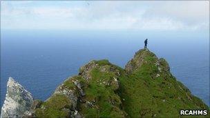
St Kilda digitally laser scanned to create 3D images
- Published

St Kilda's human occupation is also being mapped
The remote St Kilda archipelago is being digitally laser scanned to create 3D images to aid in the conservation of the group of small islands.
New Lanark in Lanarkshire and Neolithic sites on Orkney have already been scanned.
Historic Scotland and Glasgow School of Art are carrying out the work for a project called Scottish Ten, which is recording Unesco World Heritage sites.
St Kilda lies 41 miles (66km) west of the Western Isles.
In a separate project, survey work in a five-year project to produce the most complete mapping record of human occupation of St Kilda is nearing completion.
The Royal Commission on the Ancient and Historical Monuments of Scotland (RCAHMS) and National Trust for Scotland (NTS) have been working on the maps.
- Published17 June 2011
- Published16 November 2010
- Published15 November 2010
- Published29 August 2010