Geographer draws London Tube-style map of Scotland's Munros
- Published

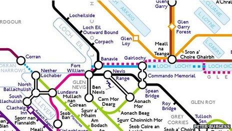
A section of the new map inspired by the London Underground guide
A new map of Scotland's highest mountains has been inspired by the layout of the guide to the London Underground.
Peter Burgess, a former geography teacher living in East Ham in London, created the MunrOverground.
It shows Munros - mountains higher than 3,000ft - and landscapes such as Linn of Dee in Aberdeenshire.
The geographer previously created Tubular Fells, a topological map of England's Lakeland Fells.
The new map groups Scotland's mountains into a number of lines, including the Skye Line, the Knoydart, Skye and Affric Line and the Southern Hills.
These are "blended" with the national rail network and long distance paths such as the West Highland Way, Sutherland Trail and Great Glen Way.
The John Muir Trust and Scottish Mountain Rescue will receive a donation from every map sold.
Mr Burgess said he had enjoyed mapping Scotland.
He said: "I've not climbed many Munros, but a tally approaching 40 isn't too bad.
"I've climbed lots of the lesser hills, with Suilven being one of my favourites."